
T Light Rail Route Map
View the T route map and see all T stops along the route. The map of T shows where the light rail travels and the location of each stop, making it easy to understand the entire route at a glance.
Explore Muni Metro routes on the map and see where Muni Metro light rail services operate. Use the T map to find light rail stations and see how the T connects different areas along its trip.
All T stops on the map are displayed in route order, helping you follow the T light rail from the first station to the last.
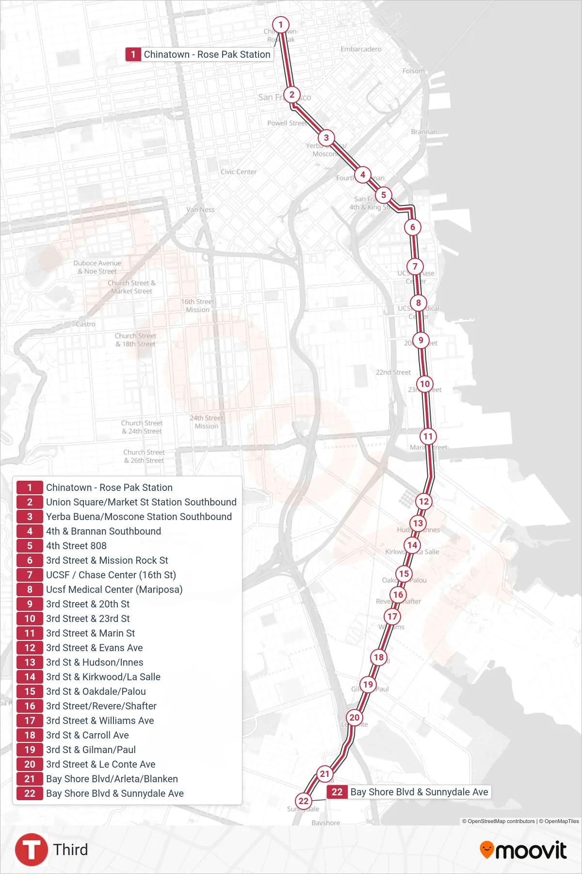
Stops list (T - Sunnydale)
- Chinatown - Rose Pak Station
- Union Square/Market St Station Southbound
- Yerba Buena/Moscone Station Southbound
- 4th & Brannan Southbound
- 4th Street 808
- 3rd Street & Mission Rock St
- UCSF / Chase Center (16th St)
- Ucsf Medical Center (Mariposa)
- 3rd Street & 20th St
- 3rd Street & 23rd St
- 3rd Street & Marin St
- 3rd Street & Evans Ave
- 3rd St & Hudson/Innes
- 3rd St & Kirkwood/La Salle
- 3rd St & Oakdale/Palou
- 3rd Street/Revere/Shafter
- 3rd Street & Williams Ave
- 3rd St & Carroll Ave
- 3rd St & Gilman/Paul
- 3rd Street & Le Conte Ave
- Bay Shore Blvd/Arleta/Blanken
- Bay Shore Blvd & Sunnydale Ave