
T4 Bus Route Map
View the T4 route map and see all T4 stops along the route. The map of T4 shows where the bus travels and the location of each stop, making it easy to understand the entire route at a glance.
Explore Astuce (Métropole Rouen Normandie) routes on the map and see where Astuce (Métropole Rouen Normandie) bus services operate. Use the T4 map to find bus stops and see how the T4 connects different areas along its trip.
All T4 stops on the map are displayed in route order, helping you follow the T4 bus from the first stop to the last.
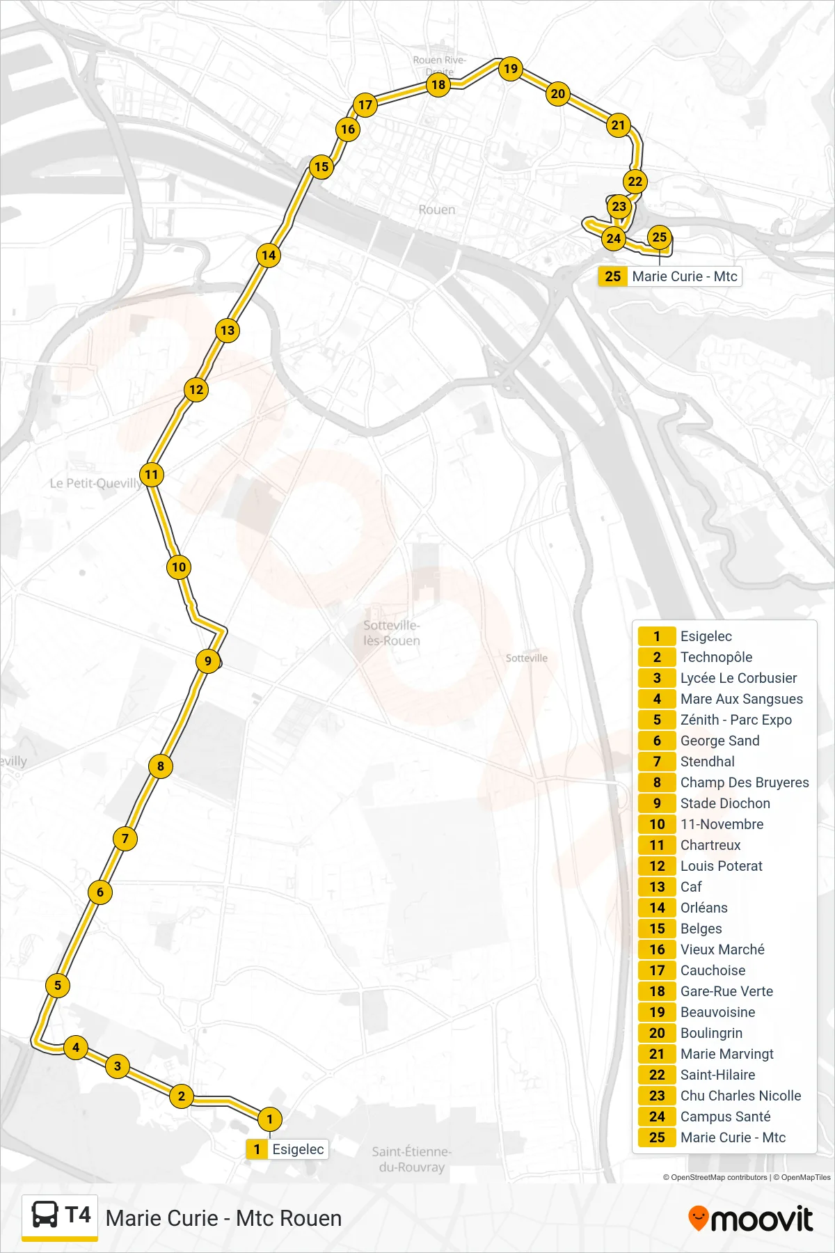
Stops list (T4 - Marie Curie - Mtc Rouen)
- Esigelec
- Technopôle
- Lycée Le Corbusier
- Mare Aux Sangsues
- Zénith - Parc Expo
- George Sand
- Stendhal
- Champ Des Bruyeres
- Stade Diochon
- 11-Novembre
- Chartreux
- Louis Poterat
- Caf
- Orléans
- Belges
- Vieux Marché
- Cauchoise
- Gare-Rue Verte
- Beauvoisine
- Boulingrin
- Marie Marvingt
- Saint-Hilaire
- Chu Charles Nicolle
- Campus Santé
- Marie Curie - Mtc