
T5 Bus Route Map
View the T5 route map and see all T5 stops along the route. The map of T5 shows where the bus travels and the location of each stop, making it easy to understand the entire route at a glance.
Explore Transurbain (Evreux Portes de Normandie) routes on the map and see where Transurbain (Evreux Portes de Normandie) bus services operate. Use the T5 map to find bus stops and see how the T5 connects different areas along its trip.
All T5 stops on the map are displayed in route order, helping you follow the T5 bus from the first stop to the last.
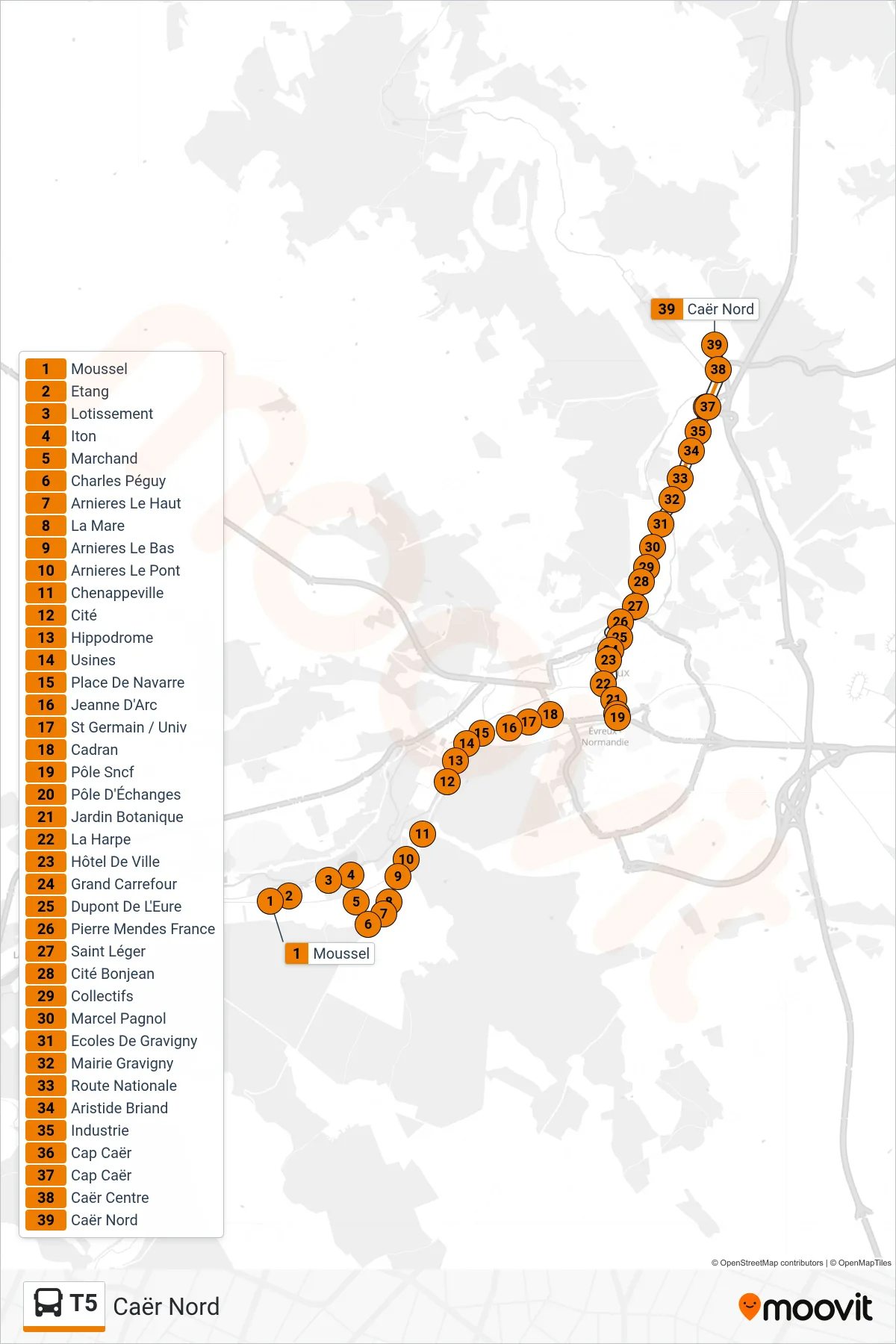
Stops list (T5 - Caër Nord)
- Moussel
- Etang
- Lotissement
- Iton
- Marchand
- Charles Péguy
- Arnieres Le Haut
- La Mare
- Arnieres Le Bas
- Arnieres Le Pont
- Chenappeville
- Cité
- Hippodrome
- Usines
- Place De Navarre
- Jeanne D'Arc
- St Germain / Univ
- Cadran
- Pôle Sncf
- Pôle D'Échanges
- Jardin Botanique
- La Harpe
- Hôtel De Ville
- Grand Carrefour
- Dupont De L'Eure
- Pierre Mendes France
- Saint Léger
- Cité Bonjean
- Collectifs
- Marcel Pagnol
- Ecoles De Gravigny
- Mairie Gravigny
- Route Nationale
- Aristide Briand
- Industrie
- Cap Caër
- Cap Caër
- Caër Centre
- Caër Nord