
THE DALLES DEVIATED FIXED (BLUE) Bus Route Map
View the THE DALLES DEVIATED FIXED (BLUE) route map and see all THE DALLES DEVIATED FIXED (BLUE) stops along the route. The map of THE DALLES DEVIATED FIXED (BLUE) shows where the bus travels and the location of each stop, making it easy to understand the entire route at a glance.
Explore The LINK routes on the map and see where The LINK bus services operate. Use the THE DALLES DEVIATED FIXED (BLUE) map to find bus stops and see how the THE DALLES DEVIATED FIXED (BLUE) connects different areas along its trip.
All THE DALLES DEVIATED FIXED (BLUE) stops on the map are displayed in route order, helping you follow the THE DALLES DEVIATED FIXED (BLUE) bus from the first stop to the last.
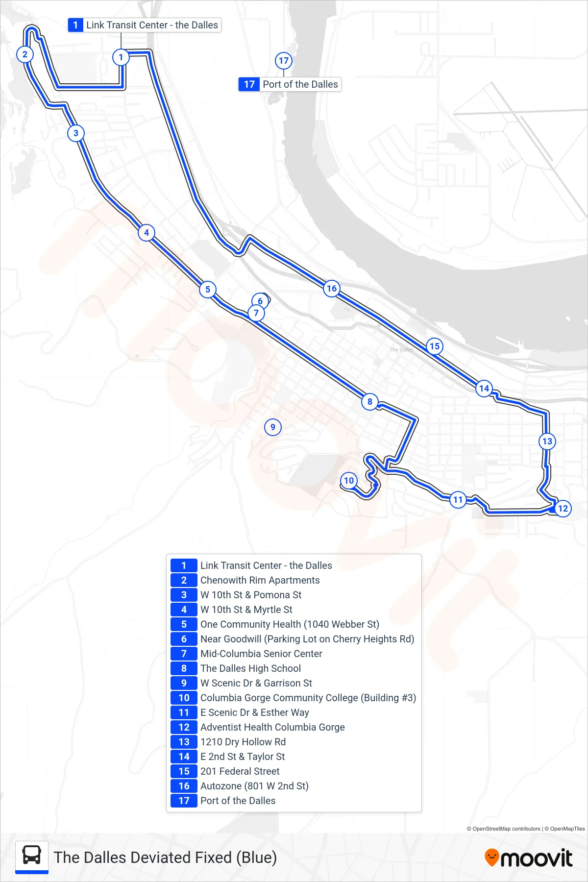
Stops list (THE DALLES DEVIATED FIXED (BLUE) - Loop)
- Link Transit Center - the Dalles
- Chenowith Rim Apartments
- W 10th St & Pomona St
- W 10th St & Myrtle St
- One Community Health (1040 Webber St)
- Near Goodwill (Parking Lot on Cherry Heights Rd)
- Mid-Columbia Senior Center
- The Dalles High School
- W Scenic Dr & Garrison St
- Columbia Gorge Community College (Building #3)
- E Scenic Dr & Esther Way
- Adventist Health Columbia Gorge
- 1210 Dry Hollow Rd
- E 2nd St & Taylor St
- 201 Federal Street
- Autozone (801 W 2nd St)
- Port of the Dalles