
TLR Bus Route Map
View the TLR route map and see all TLR stops along the route. The map of TLR shows where the bus travels and the location of each stop, making it easy to understand the entire route at a glance.
Explore Tahoe Truckee Area Regional Transit routes on the map and see where Tahoe Truckee Area Regional Transit bus services operate. Use the TLR map to find bus stops and see how the TLR connects different areas along its trip.
All TLR stops on the map are displayed in route order, helping you follow the TLR bus from the first stop to the last.
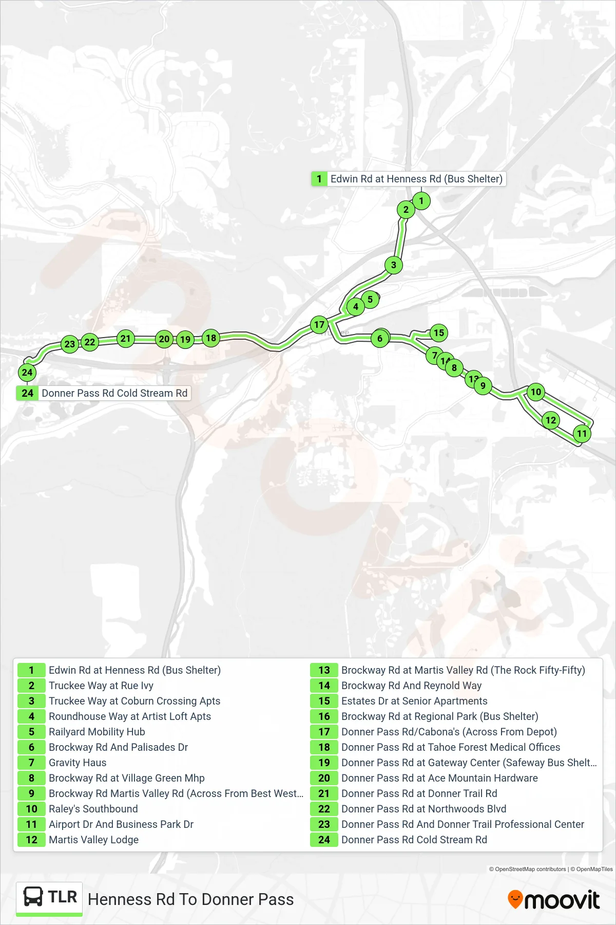
Stops list (TLR - Henness Rd To Donner Pass)
- Edwin Rd at Henness Rd (Bus Shelter)
- Truckee Way at Rue Ivy
- Truckee Way at Coburn Crossing Apts
- Roundhouse Way at Artist Loft Apts
- Railyard Mobility Hub
- Brockway Rd And Palisades Dr
- Gravity Haus
- Brockway Rd at Village Green Mhp
- Brockway Rd Martis Valley Rd (Across From Best Western)
- Raley's Southbound
- Airport Dr And Business Park Dr
- Martis Valley Lodge
- Brockway Rd at Martis Valley Rd (The Rock Fifty-Fifty)
- Brockway Rd And Reynold Way
- Estates Dr at Senior Apartments
- Brockway Rd at Regional Park (Bus Shelter)
- Donner Pass Rd/Cabona's (Across From Depot)
- Donner Pass Rd at Tahoe Forest Medical Offices
- Donner Pass Rd at Gateway Center (Safeway Bus Shelter)
- Donner Pass Rd at Ace Mountain Hardware
- Donner Pass Rd at Donner Trail Rd
- Donner Pass Rd at Northwoods Blvd
- Donner Pass Rd And Donner Trail Professional Center
- Donner Pass Rd Cold Stream Rd