
TPL-B Bus Route Map
View the TPL-B route map and see all TPL-B stops along the route. The map of TPL-B shows where the bus travels and the location of each stop, making it easy to understand the entire route at a glance.
Explore Sabato Travel Bus Lines routes on the map and see where Sabato Travel Bus Lines bus services operate. Use the TPL-B map to find bus stops and see how the TPL-B connects different areas along its trip.
All TPL-B stops on the map are displayed in route order, helping you follow the TPL-B bus from the first stop to the last.
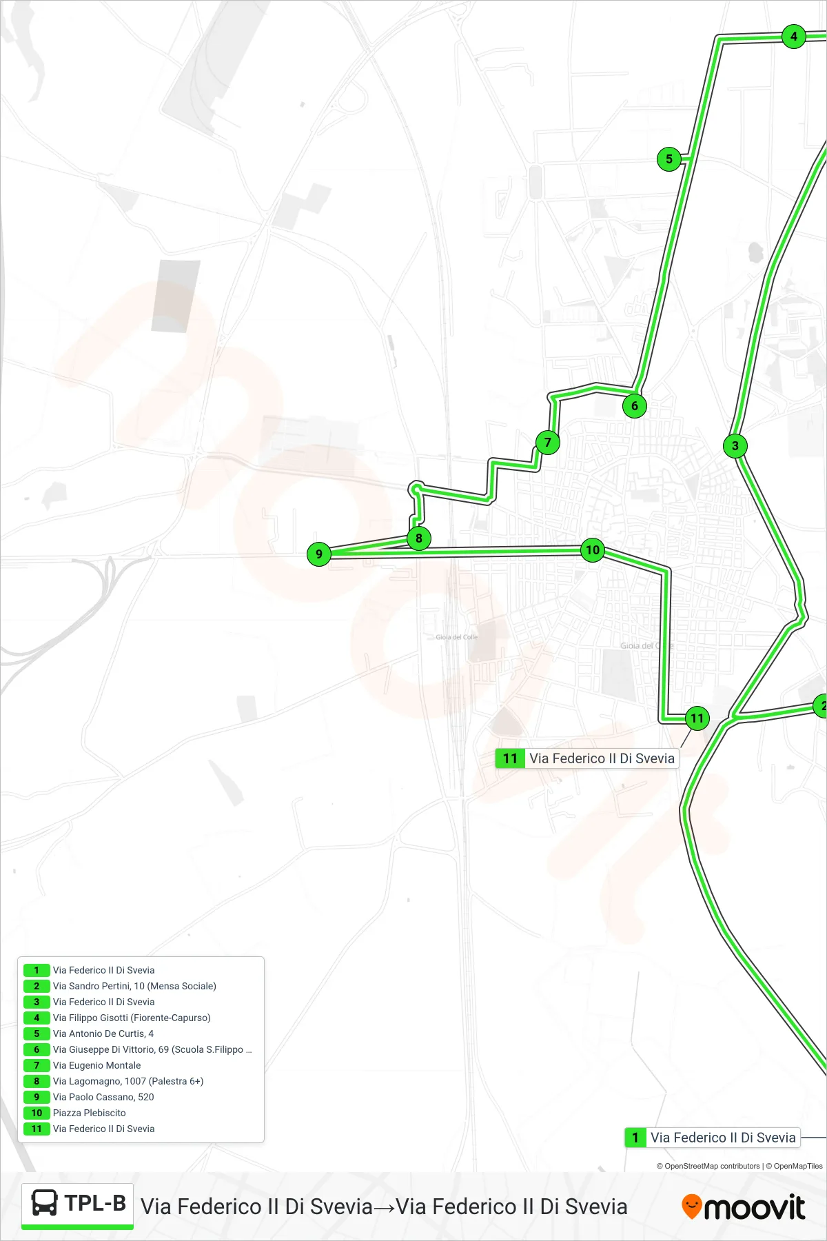
Stops list (TPL-B - Frederick II of Swabia Street→Frederick II of Swabia Street)
- Frederick II of Swabia Street
- Via Sandro Pertini, 10 (Social Canteen)
- Frederick II of Swabia Street
- Filippo Gisotti Street (Fiorente-Capurso)
- Antonio De Curtis Street, 4
- 69 Giuseppe Di Vittorio Street (S.Filippo Neri School)
- Eugenio Montale Street
- Lagomagno Street, 1007 (Gym 6+)
- Paolo Cassano Street, 520
- Plebiscito Square
- Frederick II of Swabia Street