
TRANSFER Bus Route Map
View the TRANSFER route map and see all TRANSFER stops along the route. The map of TRANSFER shows where the bus travels and the location of each stop, making it easy to understand the entire route at a glance.
Explore Transfer Soc. Cons. a.r.l. routes on the map and see where Transfer Soc. Cons. a.r.l. bus services operate. Use the TRANSFER map to find bus stops and see how the TRANSFER connects different areas along its trip.
All TRANSFER stops on the map are displayed in route order, helping you follow the TRANSFER bus from the first stop to the last.
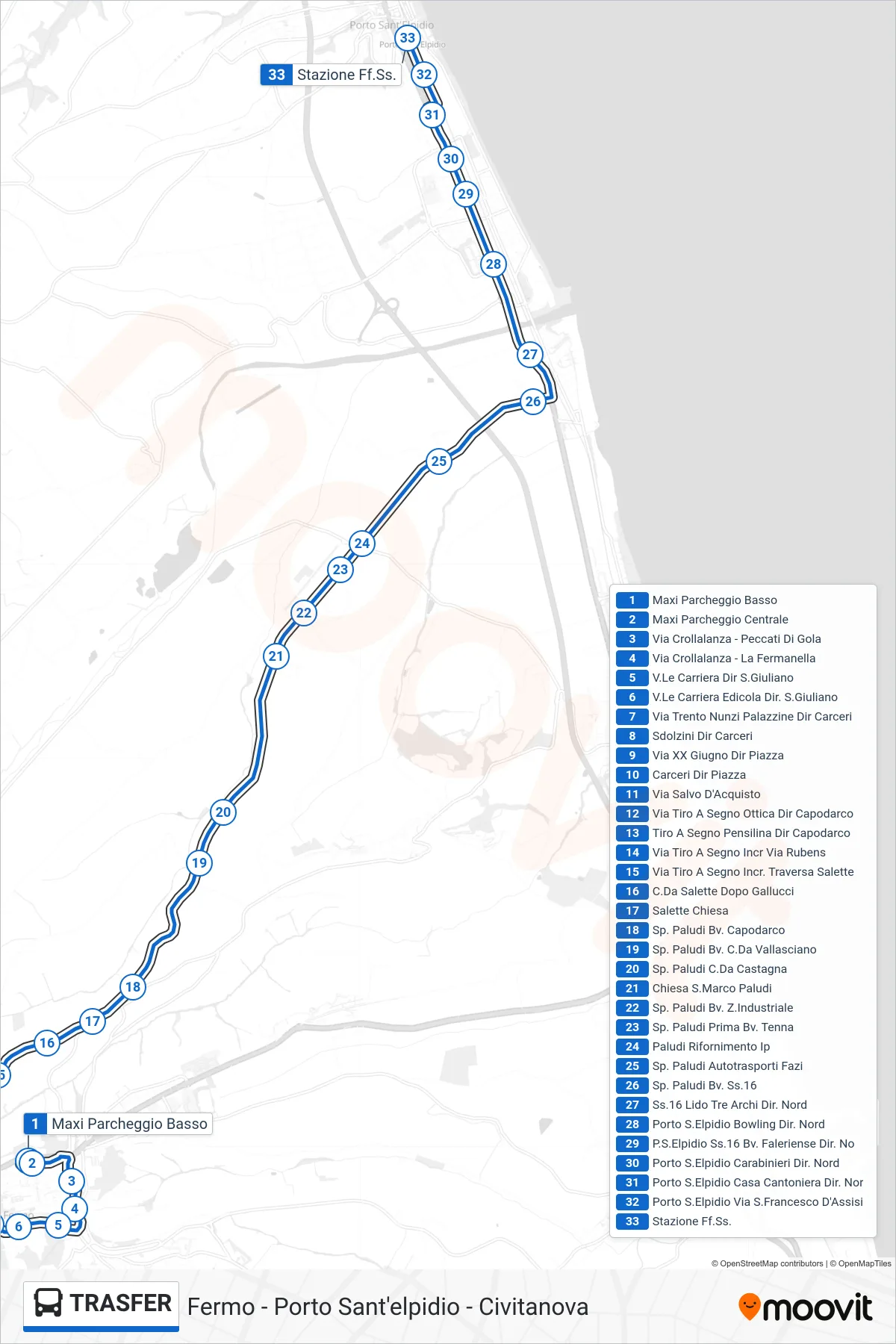
Stops list (TRANSFER - Railway Station)
- Lower Maximum Parking
- Central Maxi Parking
- Crollalanza Street - Peccati Di Gola
- Via Crollalanza - La Fermanella
- Carriera Avenue Towards San Giuliano
- Carriera Avenue Newsstand San Giuliano Direction
- Via Trento Nunzi Buildings Dir Prison
- Sdolzini Prison Direction
- XX June Street Towards Square
- Prison to Square
- Salvo D'Acquisto Street
- Via Tiro A Segno Optical Store Capodarco Direction
- Shooting Range Shelter Direction Capodarco
- Shooting Range Street - Rubens Junction
- Via Tiro A Segno at Traversa Salette
- Salette District After Gallucci
- Salette Church
- Paludi Provincial Rd Capodarco Junction
- Paludi Junction - Vallasciano District
- Paludi Rd Castagna District
- St. Mark Church Paludi
- Paludi Junction Industrial Zone
- SP Paludi First Tenna Junction
- Paludi IP Gas Station
- Paludi Provincial Road Fazi Transport
- SP Paludi Junction SS16
- State Road 16 Lido Tre Archi North Direction
- Porto S.Elpidio Bowling Northbound
- Porto Sant'Elpidio SS16 Faleriense Junction North
- Porto Sant'Elpidio Carabinieri North Direction
- Porto S.Elpidio Railroad House North Direction
- Porto Sant'Elpidio - St. Francis of Assisi Street
- Railway Station