
U Bus Route Map
View the U route map and see all U stops along the route. The map of U shows where the bus travels and the location of each stop, making it easy to understand the entire route at a glance.
Explore Chapel Hill Transit routes on the map and see where Chapel Hill Transit bus services operate. Use the U map to find bus stops and see how the U connects different areas along its trip.
All U stops on the map are displayed in route order, helping you follow the U bus from the first stop to the last.
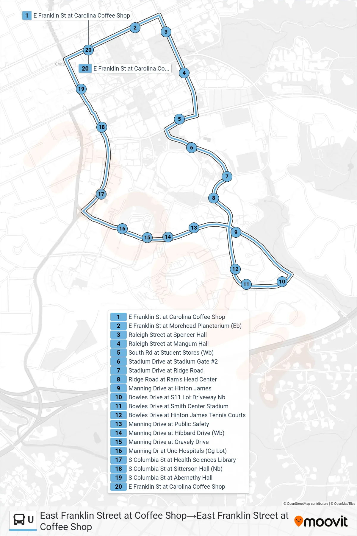
Stops list (U - East Franklin Street at Coffee Shop→East Franklin Street at Coffee Shop)
- E Franklin St at Carolina Coffee Shop
- E Franklin St at Morehead Planetarium (Eb)
- Raleigh Street at Spencer Hall
- Raleigh Street at Mangum Hall
- South Rd at Student Stores (Wb)
- Stadium Drive at Stadium Gate #2
- Stadium Drive at Ridge Road
- Ridge Road at Ram's Head Center
- Manning Drive at Hinton James
- Bowles Drive at S11 Lot Driveway Nb
- Bowles Drive at Smith Center Stadium
- Bowles Drive at Hinton James Tennis Courts
- Manning Drive at Public Safety
- Manning Drive at Hibbard Drive (Wb)
- Manning Drive at Gravely Drive
- Manning Dr at Unc Hospitals (Cg Lot)
- S Columbia St at Health Sciences Library
- S Columbia St at Sitterson Hall (Nb)
- S Columbia St at Abernethy Hall
- E Franklin St at Carolina Coffee Shop