
U2 Bus Route Map
View the U2 route map and see all U2 stops along the route. The map of U2 shows where the bus travels and the location of each stop, making it easy to understand the entire route at a glance.
Explore RodoAmarante routes on the map and see where RodoAmarante bus services operate. Use the U2 map to find bus stops and see how the U2 connects different areas along its trip.
All U2 stops on the map are displayed in route order, helping you follow the U2 bus from the first stop to the last.
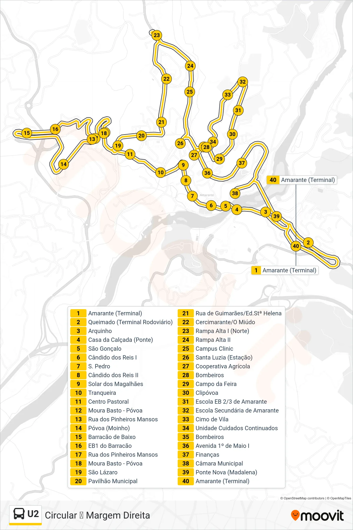
Stops list (U2 - Circular ⟳ Margem Direita)
- Amarante (Terminal)
- Queimado (Terminal Rodoviário)
- Arquinho
- Casa da Calçada (Ponte)
- São Gonçalo
- Cândido dos Reis I
- S. Pedro
- Cândido dos Reis II
- Solar dos Magalhães
- Tranqueira
- Centro Pastoral
- Moura Basto - Póvoa
- Rua dos Pinheiros Mansos
- Póvoa (Moinho)
- Barracão de Baixo
- EB1 do Barracão
- Rua dos Pinheiros Mansos
- Moura Basto - Póvoa
- São Lázaro
- Pavilhão Municipal
- Rua de Guimarães/Ed.Stª Helena
- Cercimarante/O Miúdo
- Rampa Alta I (Norte)
- Rampa Alta II
- Campus Clinic
- Santa Luzia (Estação)
- Cooperativa Agrícola
- Bombeiros
- Campo da Feira
- Clipóvoa
- Escola EB 2/3 de Amarante
- Escola Secundária de Amarante
- Cimo de Vila
- Unidade Cuidados Continuados
- Bombeiros
- Avenida 1º de Maio I
- Finanças
- Câmara Municipal
- Ponte Nova (Madalena)
- Amarante (Terminal)