
U79 Subway Route Map
View the U79 route map and see all U79 stops along the route. The map of U79 shows where the subway travels and the location of each stop, making it easy to understand the entire route at a glance.
Explore Rheinbahn routes on the map and see where Rheinbahn subway services operate. Use the U79 map to find subway stations and see how the U79 connects different areas along its trip.
All U79 stops on the map are displayed in route order, helping you follow the U79 subway from the first station to the last.
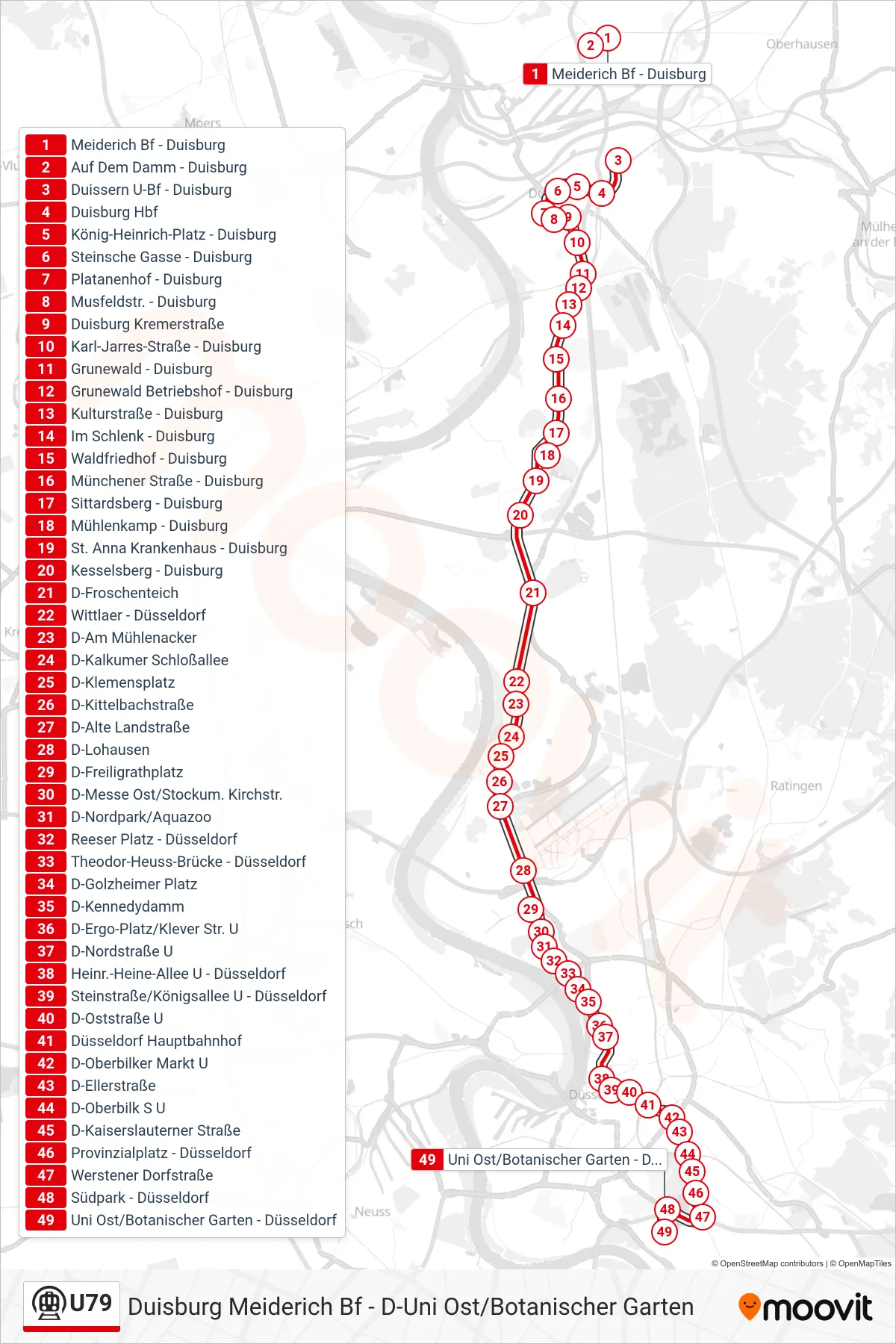
Stops list (U79 - D-Uni Ost/Botanischer Garten)
- Meiderich Bf - Duisburg
- Auf Dem Damm - Duisburg
- Duissern U-Bf - Duisburg
- Duisburg Hbf
- König-Heinrich-Platz - Duisburg
- Steinsche Gasse - Duisburg
- Platanenhof - Duisburg
- Musfeldstr. - Duisburg
- Duisburg Kremerstraße
- Karl-Jarres-Straße - Duisburg
- Grunewald - Duisburg
- Grunewald Betriebshof - Duisburg
- Kulturstraße - Duisburg
- Im Schlenk - Duisburg
- Waldfriedhof - Duisburg
- Münchener Straße - Duisburg
- Sittardsberg - Duisburg
- Mühlenkamp - Duisburg
- St. Anna Krankenhaus - Duisburg
- Kesselsberg - Duisburg
- D-Froschenteich
- Wittlaer - Düsseldorf
- D-Am Mühlenacker
- D-Kalkumer Schloßallee
- D-Klemensplatz
- D-Kittelbachstraße
- D-Alte Landstraße
- D-Lohausen
- D-Freiligrathplatz
- D-Messe Ost/Stockum. Kirchstr.
- D-Nordpark/Aquazoo
- Reeser Platz - Düsseldorf
- Theodor-Heuss-Brücke - Düsseldorf
- D-Golzheimer Platz
- D-Kennedydamm
- D-Ergo-Platz/Klever Str. U
- D-Nordstraße U
- Heinr.-Heine-Allee U - Düsseldorf
- Steinstraße/Königsallee U - Düsseldorf
- D-Oststraße U
- Düsseldorf Hauptbahnhof
- D-Oberbilker Markt U
- D-Ellerstraße
- D-Oberbilk S U
- D-Kaiserslauterner Straße
- Provinzialplatz - Düsseldorf
- Werstener Dorfstraße
- Südpark - Düsseldorf
- Uni Ost/Botanischer Garten - Düsseldorf