
V Bus Route Map
View the V route map and see all V stops along the route. The map of V shows where the bus travels and the location of each stop, making it easy to understand the entire route at a glance.
Explore AC Transit routes on the map and see where AC Transit bus services operate. Use the V map to find bus stops and see how the V connects different areas along its trip.
All V stops on the map are displayed in route order, helping you follow the V bus from the first stop to the last.
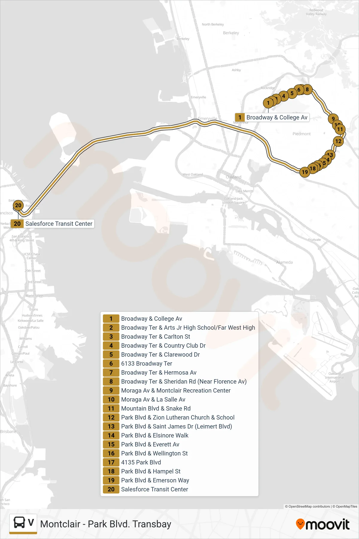
Stops list (V - San Francisco)
- Broadway & College Av
- Broadway Ter & Arts Jr High School/Far West High
- Broadway Ter & Carlton St
- Broadway Ter & Country Club Dr
- Broadway Ter & Clarewood Dr
- 6133 Broadway Ter
- Broadway Ter & Hermosa Av
- Broadway Ter & Sheridan Rd (Near Florence Av)
- Moraga Av & Montclair Recreation Center
- Moraga Av & La Salle Av
- Mountain Blvd & Snake Rd
- Park Blvd & Zion Lutheran Church & School
- Park Blvd & Saint James Dr (Leimert Blvd)
- Park Blvd & Elsinore Walk
- Park Blvd & Everett Av
- Park Blvd & Wellington St
- 4135 Park Blvd
- Park Blvd & Hampel St
- Park Blvd & Emerson Way
- Salesforce Transit Center