
V45 Bus Route Map
View the V45 route map and see all V45 stops along the route. The map of V45 shows where the bus travels and the location of each stop, making it easy to understand the entire route at a glance.
Explore RhönEnergie Bus GmbH routes on the map and see where RhönEnergie Bus GmbH bus services operate. Use the V45 map to find bus stops and see how the V45 connects different areas along its trip.
All V45 stops on the map are displayed in route order, helping you follow the V45 bus from the first stop to the last.
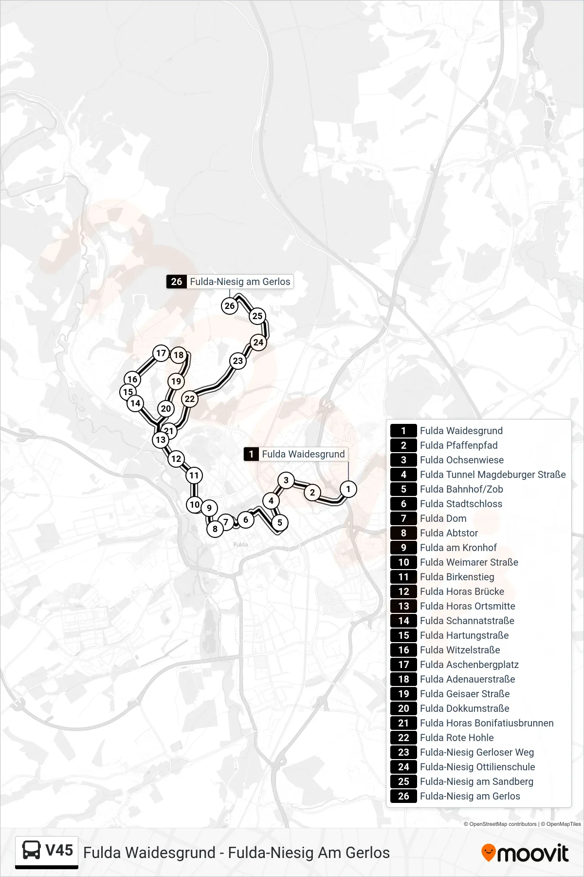
Stops list (V45 - Fulda-Niesig am Gerlos)
- Fulda Waidesgrund
- Fulda Pfaffenpfad
- Fulda Ochsenwiese
- Fulda Tunnel Magdeburger Straße
- Fulda Bahnhof/Zob
- Fulda Stadtschloss
- Fulda Dom
- Fulda Abtstor
- Fulda am Kronhof
- Fulda Weimarer Straße
- Fulda Birkenstieg
- Fulda Horas Brücke
- Fulda Horas Ortsmitte
- Fulda Schannatstraße
- Fulda Hartungstraße
- Fulda Witzelstraße
- Fulda Aschenbergplatz
- Fulda Adenauerstraße
- Fulda Geisaer Straße
- Fulda Dokkumstraße
- Fulda Horas Bonifatiusbrunnen
- Fulda Rote Hohle
- Fulda-Niesig Gerloser Weg
- Fulda-Niesig Ottilienschule
- Fulda-Niesig am Sandberg
- Fulda-Niesig am Gerlos