
VAN Bus Route Map
View the VAN route map and see all VAN stops along the route. The map of VAN shows where the bus travels and the location of each stop, making it easy to understand the entire route at a glance.
Explore Cooperativa Los Vanegas routes on the map and see where Cooperativa Los Vanegas bus services operate. Use the VAN map to find bus stops and see how the VAN connects different areas along its trip.
All VAN stops on the map are displayed in route order, helping you follow the VAN bus from the first stop to the last.
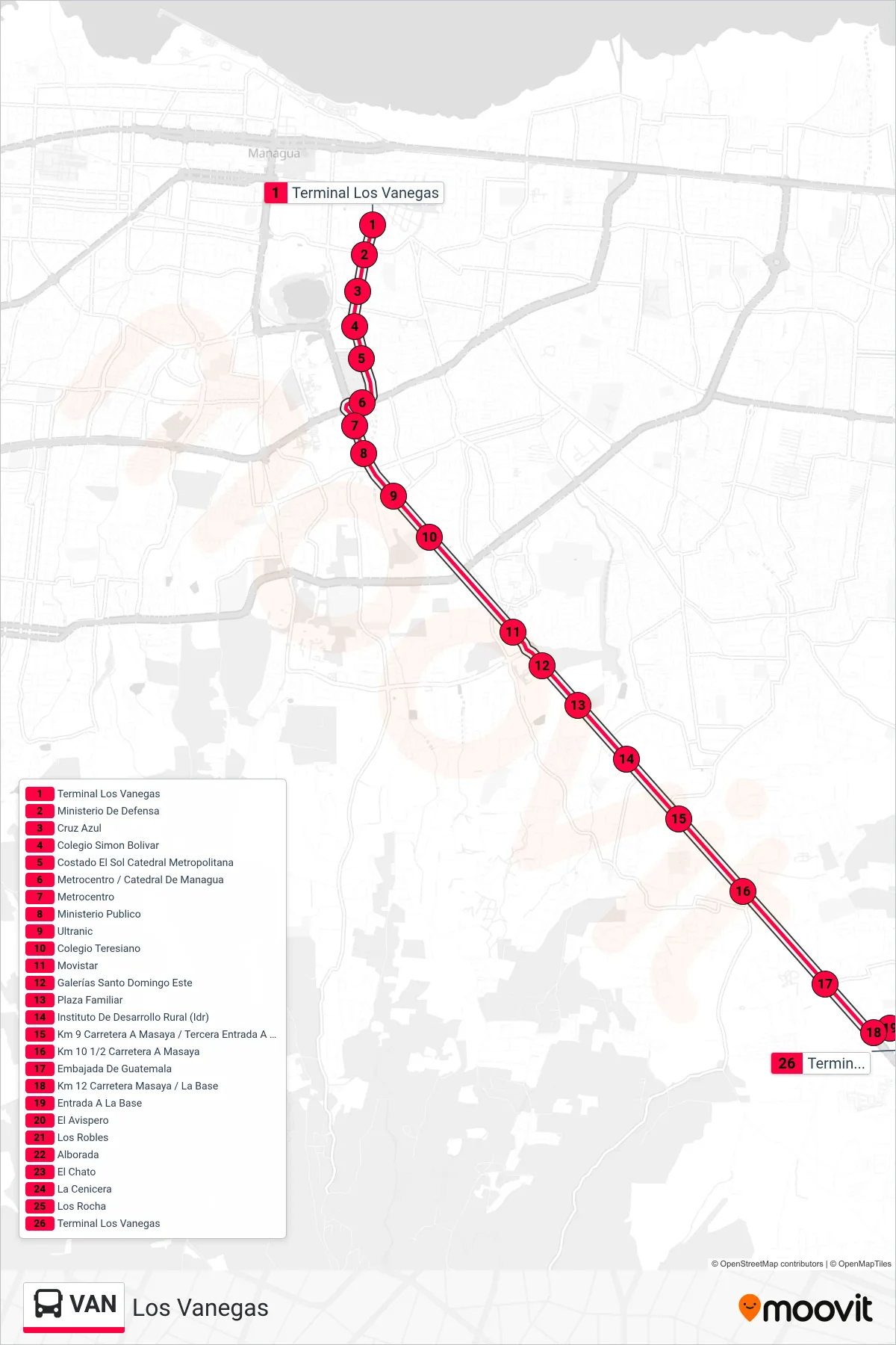
Stops list (VAN - Los Vanegas)
- Terminal Los Vanegas
- Ministerio De Defensa
- Cruz Azul
- Colegio Simon Bolivar
- Costado El Sol Catedral Metropolitana
- Metrocentro / Catedral De Managua
- Metrocentro
- Ministerio Publico
- Ultranic
- Colegio Teresiano
- Movistar
- Galerías Santo Domingo Este
- Plaza Familiar
- Instituto De Desarrollo Rural (Idr)
- Km 9 Carretera A Masaya / Tercera Entrada A Santo Domingo
- Km 10 1/2 Carretera A Masaya
- Embajada De Guatemala
- Km 12 Carretera Masaya / La Base
- Entrada A La Base
- El Avispero
- Los Robles
- Alborada
- El Chato
- La Cenicera
- Los Rocha
- Terminal Los Vanegas