
VB-15 Bus Route Map
View the VB-15 route map and see all VB-15 stops along the route. The map of VB-15 shows where the bus travels and the location of each stop, making it easy to understand the entire route at a glance.
Explore VGO Alsfeld routes on the map and see where VGO Alsfeld bus services operate. Use the VB-15 map to find bus stops and see how the VB-15 connects different areas along its trip.
All VB-15 stops on the map are displayed in route order, helping you follow the VB-15 bus from the first stop to the last.
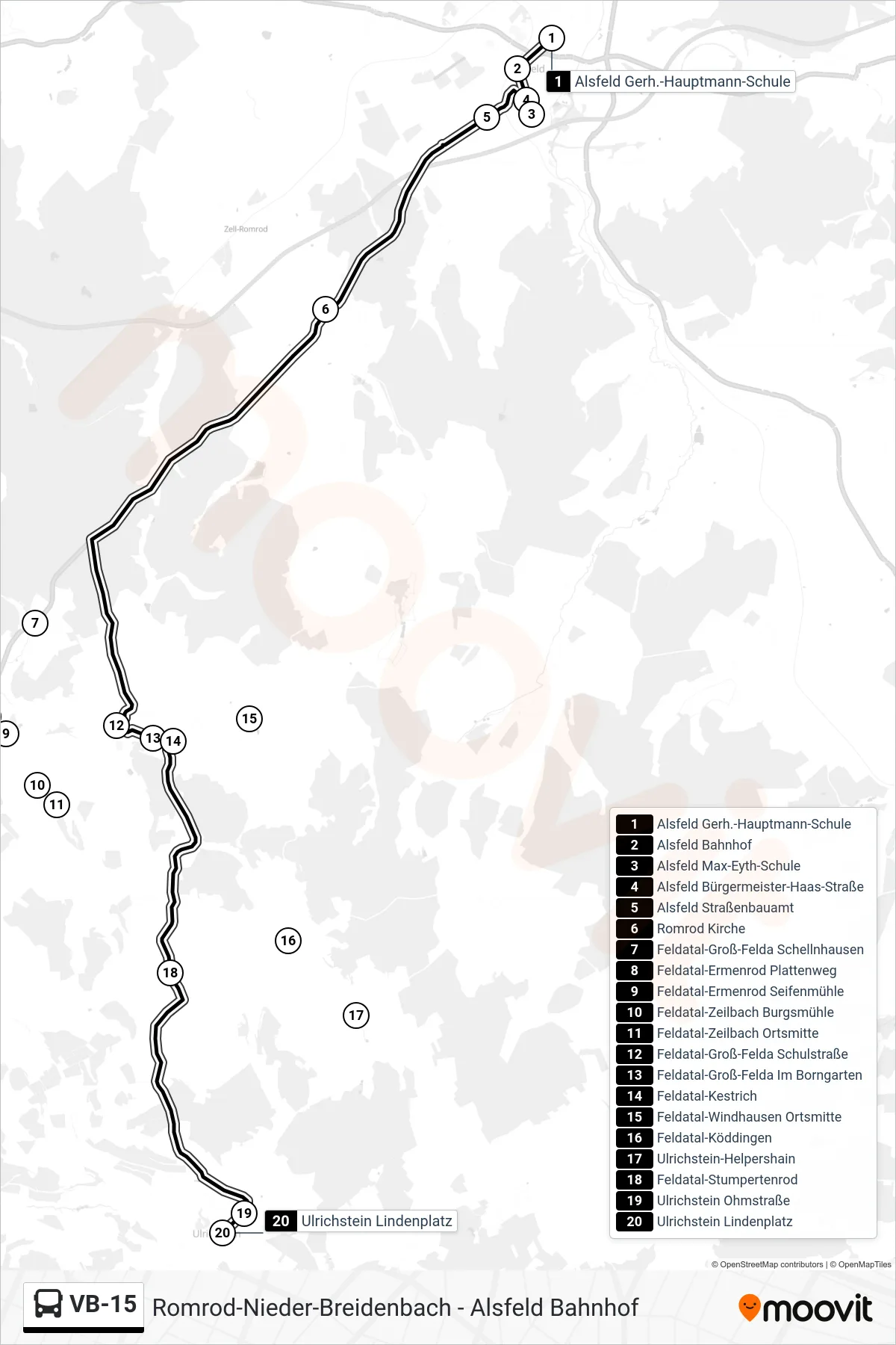
Stops list (VB-15 - Ulrichstein Lindenplatz)
- Alsfeld Gerh.-Hauptmann-Schule
- Alsfeld Bahnhof
- Alsfeld Max-Eyth-Schule
- Alsfeld Bürgermeister-Haas-Straße
- Alsfeld Straßenbauamt
- Romrod Kirche
- Feldatal-Groß-Felda Schellnhausen
- Feldatal-Ermenrod Plattenweg
- Feldatal-Ermenrod Seifenmühle
- Feldatal-Zeilbach Burgsmühle
- Feldatal-Zeilbach Ortsmitte
- Feldatal-Groß-Felda Schulstraße
- Feldatal-Groß-Felda Im Borngarten
- Feldatal-Kestrich
- Feldatal-Windhausen Ortsmitte
- Feldatal-Köddingen
- Ulrichstein-Helpershain
- Feldatal-Stumpertenrod
- Ulrichstein Ohmstraße
- Ulrichstein Lindenplatz
Change direction
- Route Map - VB-15 - Alsfeld In Der Krebsbach
- Route Map - VB-15 - Alsfeld Stadtschule
- Route Map - VB-15 - Alsfeld-Liederbach
- Route Map - VB-15 - Feldatal-Groß-Felda Schulstraße
- Route Map - VB-15 - Romrod-Nieder-Breidenbach
- Route Map - VB-15 - Romrod-Ober-Breidenbach Ortsmitte
- Route Map - VB-15 - Alsfeld Gerh.-Hauptmann-Schule
- Route Map - VB-15 - Alsfeld Bahnhof
- Route Map - VB-15 - Feldatal-Stumpertenrod