
VERDE Bus Route Map
View the VERDE route map and see all VERDE stops along the route. The map of VERDE shows where the bus travels and the location of each stop, making it easy to understand the entire route at a glance.
Explore Arezzo, Siena and Provinces - Tuscan Bus Lines routes on the map and see where Arezzo, Siena and Provinces - Tuscan Bus Lines bus services operate. Use the VERDE map to find bus stops and see how the VERDE connects different areas along its trip.
All VERDE stops on the map are displayed in route order, helping you follow the VERDE bus from the first stop to the last.
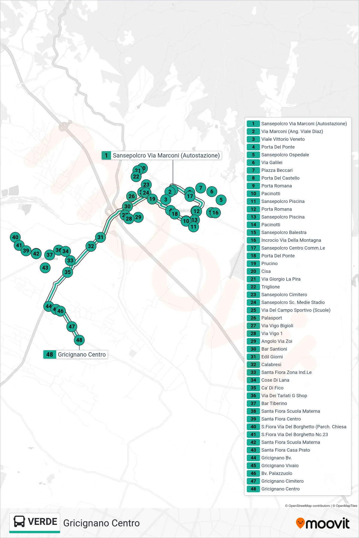
Stops list (VERDE - Gricignano Center)
- Sansepolcro Marconi Street (Bus Station)
- Marconi Street (Corner of Diaz Avenue)
- Vittorio Veneto Avenue
- Sansepolcro Shopping Center
- Roman Gate
- Bridge Gate
- Pacinotti
- Sansepolcro Swimming Pool
- Roman Gate
- Sansepolcro Swimming Pool
- Pacinotti
- Sansepolcro Balestra
- Mountain Road Junction
- Bridge Gate
- Sansepolcro Hospital
- Galilei Street
- Prucino
- Beccari Square
- Castle Gate
- Cisa
- Giorgio La Pira Street
- Triglione
- Sansepolcro Cemetery
- Sansepolcro Middle School Stadium
- Sports Field Street (Schools)
- Sports Hall
- Via Vigo Bigioli
- Via Vigo 1
- Via Zoi Corner
- Santioni Bar
- Edil Giorni
- Calabresi
- Santa Fiora Industrial Zone
- Cose Di Lana
- Ca' Di Fico
- Via Dei Tarlati G Shop
- Tiberino Bar
- Santa Fiora Kindergarten
- Santa Fiora Center
- San Fiora Via Del Borghetto (Church Parking)
- Via Del Borghetto 23 - Santa Fiora
- Santa Fiora Kindergarten
- Santa Fiora House Meadow
- Gricignano Junction
- Gricignano Nursery
- Palazzuolo Junction
- Gricignano Cemetery
- Gricignano Center