
VIOLA Bus Route Map
View the VIOLA route map and see all VIOLA stops along the route. The map of VIOLA shows where the bus travels and the location of each stop, making it easy to understand the entire route at a glance.
Explore Arezzo, Florence and Provinces - Tuscan Bus Lines routes on the map and see where Arezzo, Florence and Provinces - Tuscan Bus Lines bus services operate. Use the VIOLA map to find bus stops and see how the VIOLA connects different areas along its trip.
All VIOLA stops on the map are displayed in route order, helping you follow the VIOLA bus from the first stop to the last.
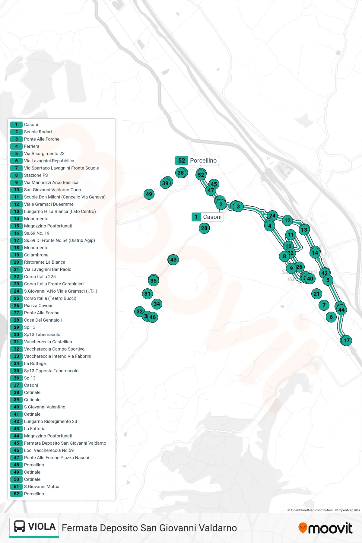
Stops list (VIOLA - San Giovanni Valdarno Depot Stop)
- Casoni
- Rodari Schools
- Bridge at Forche
- Steelworks
- Via Risorgimento 23
- Via Lavagnini Repubblica
- Via Spartaco Lavagnini Opposite Schools
- Railway Station
- Mannozzi Street Basilica Arch
- San Giovanni Valdarno Coop
- Don Milani Schools (Genova Gate)
- Gramsci Avenue Dueemme
- Lungarno H.La Bianca (Center Side)
- Monument
- Posfortunati Warehouse
- State Road 69 #19
- State Road 69 Opposite #54 (Agip Station)
- Monument
- Calambrone
- La Bianca Restaurant
- Via Lavagnini Bar Paolo
- Corso Italia 225
- Carabinieri Station - Corso Italia
- San Giovanni Valdarno Viale Gramsci (Technical Institute)
- Corso Italia (Bucci Theater)
- Cavour Square
- Bridge at Forche
- Gennaioli House
- Route 13
- Sp13 Tabernacle
- Vacchereccia Castellina
- Vacchereccia Sports Field
- Vacchereccia Inside Fabbrini Street
- The Shop
- SP13 Opposite Tabernacle
- Route 13
- Casoni
- Cetinale
- Cetinale
- San Giovanni Valentino
- Cetinale
- 23 Risorgimento Riverfront
- The Farm
- Posfortunati Warehouse
- San Giovanni Valdarno Depot Stop
- Vacchereccia #59
- Ponte Alle Forche Piazza Nasoni
- Porcellino
- Cetinale
- Cetinale
- San Giovanni Mutual
- Porcellino