
W Bus Route Map
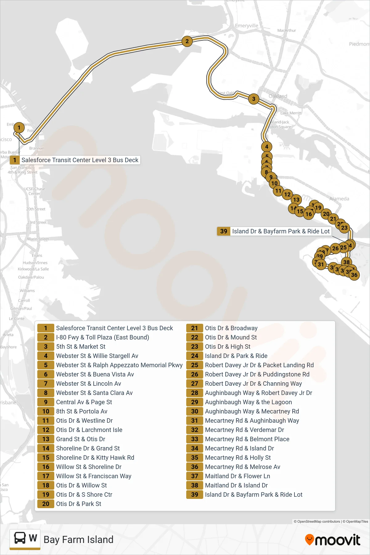
View the W route map and see all W stops along the route. The map of W shows where the bus travels and the location of each stop, making it easy to understand the entire route at a glance.
Explore AC Transit routes on the map and see where AC Transit bus services operate. Use the W map to find bus stops and see how the W connects different areas along its trip.
All W stops on the map are displayed in route order, helping you follow the W bus from the first stop to the last.
Stops list (W - Bay Farm Island)
- Salesforce Transit Center Level 3 Bus Deck
- I-80 Fwy & Toll Plaza (East Bound)
- 5th St & Market St
- Webster St & Willie Stargell Av
- Webster St & Ralph Appezzato Memorial Pkwy
- Webster St & Buena Vista Av
- Webster St & Lincoln Av
- Webster St & Santa Clara Av
- Central Av & Page St
- 8th St & Portola Av
- Otis Dr & Westline Dr
- Otis Dr & Larchmont Isle
- Grand St & Otis Dr
- Shoreline Dr & Grand St
- Shoreline Dr & Kitty Hawk Rd
- Willow St & Shoreline Dr
- Willow St & Franciscan Way
- Otis Dr & Willow St
- Otis Dr & S Shore Ctr
- Otis Dr & Park St
- Otis Dr & Broadway
- Otis Dr & Mound St
- Otis Dr & High St
- Island Dr & Park & Ride
- Robert Davey Jr Dr & Packet Landing Rd
- Robert Davey Jr Dr & Puddingstone Rd
- Robert Davey Jr Dr & Channing Way
- Aughinbaugh Way & Robert Davey Jr Dr
- Aughinbaugh Way & the Lagoon
- Aughinbaugh Way & Mecartney Rd
- Mecartney Rd & Aughinbaugh Way
- Mecartney Rd & Verdemar Dr
- Mecartney Rd & Belmont Place
- Mecartney Rd & Island Dr
- Mecartney Rd & Holly St
- Mecartney Rd & Melrose Av
- Maitland Dr & Flower Ln
- Maitland Dr & Island Dr
- Island Dr & Bayfarm Park & Ride Lot