
WESTLINK Bus Route Map
View the WESTLINK route map and see all WESTLINK stops along the route. The map of WESTLINK shows where the bus travels and the location of each stop, making it easy to understand the entire route at a glance.
Explore Ride Connection routes on the map and see where Ride Connection bus services operate. Use the WESTLINK map to find bus stops and see how the WESTLINK connects different areas along its trip.
All WESTLINK stops on the map are displayed in route order, helping you follow the WESTLINK bus from the first stop to the last.
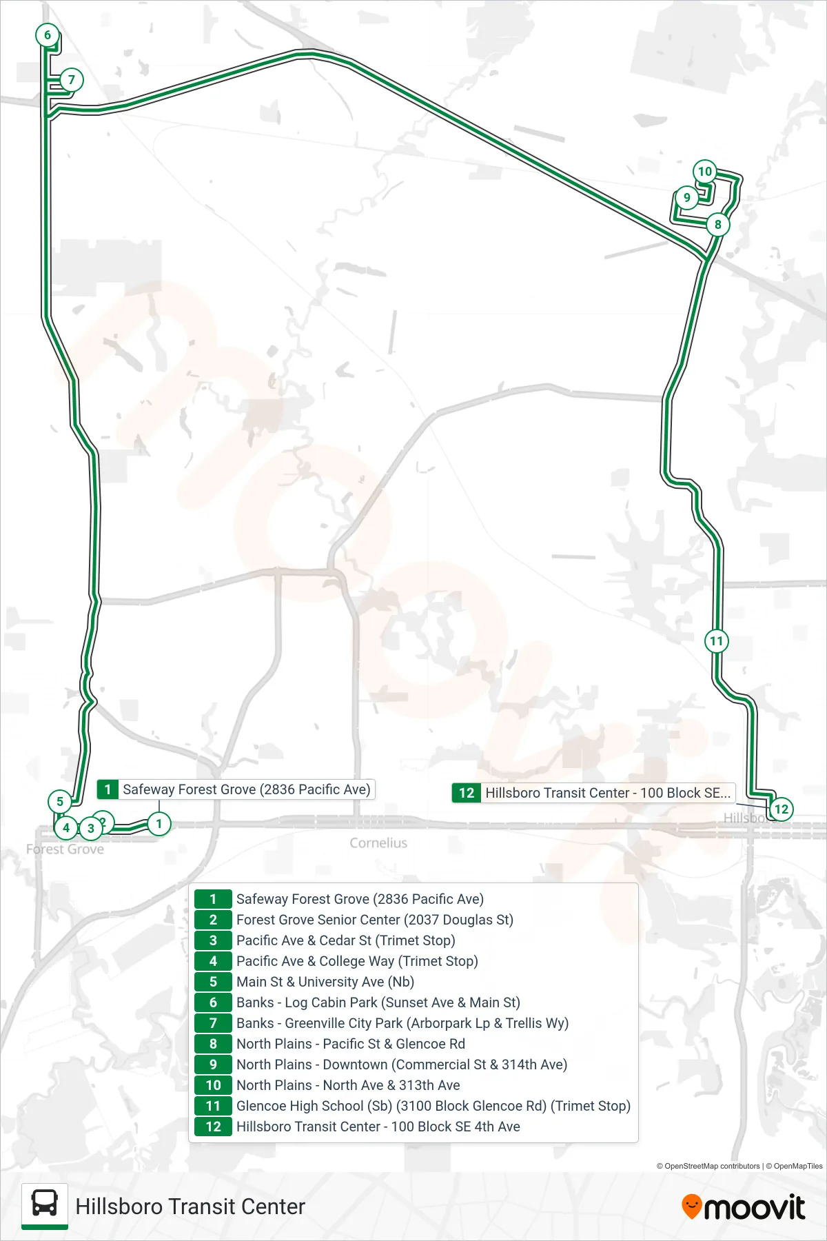
Stops list (WESTLINK - Hillsboro Transit Center)
- Safeway Forest Grove (2836 Pacific Ave)
- Forest Grove Senior Center (2037 Douglas St)
- Pacific Ave & Cedar St (Trimet Stop)
- Pacific Ave & College Way (Trimet Stop)
- Main St & University Ave (Nb)
- Banks - Log Cabin Park (Sunset Ave & Main St)
- Banks - Greenville City Park (Arborpark Lp & Trellis Wy)
- North Plains - Pacific St & Glencoe Rd
- North Plains - Downtown (Commercial St & 314th Ave)
- North Plains - North Ave & 313th Ave
- Glencoe High School (Sb) (3100 Block Glencoe Rd) (Trimet Stop)
- Hillsboro Transit Center - 100 Block SE 4th Ave