
X2 Bus Route Map
View the X2 route map and see all X2 stops along the route. The map of X2 shows where the bus travels and the location of each stop, making it easy to understand the entire route at a glance.
Explore Bus Átha Cliath – Dublin Bus routes on the map and see where Bus Átha Cliath – Dublin Bus bus services operate. Use the X2 map to find bus stops and see how the X2 connects different areas along its trip.
All X2 stops on the map are displayed in route order, helping you follow the X2 bus from the first stop to the last.
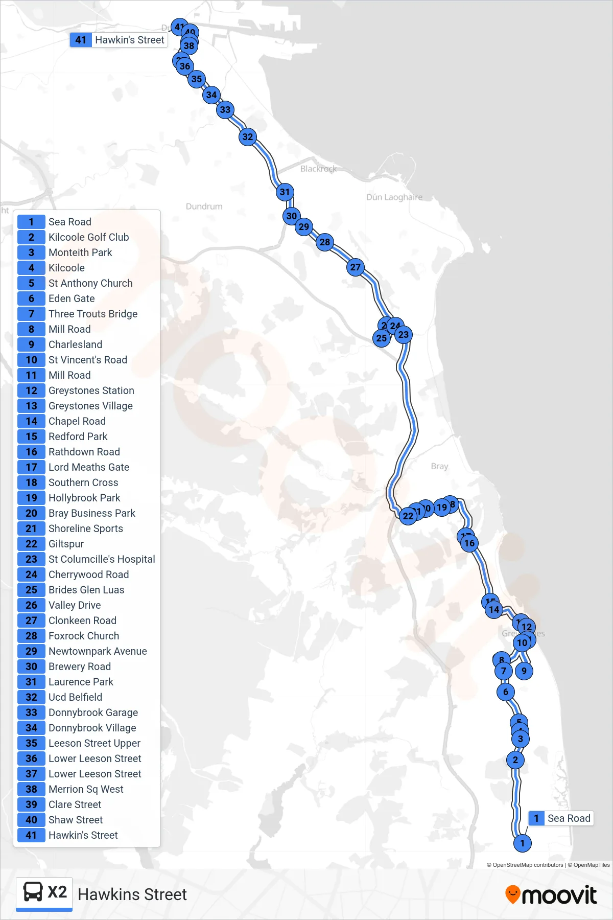
Stops list (X2 - Hawkins Street)
- Sea Road
- Kilcoole Golf Club
- Monteith Park
- Kilcoole
- St Anthony Church
- Eden Gate
- Three Trouts Bridge
- Mill Road
- Charlesland
- St Vincent's Road
- Mill Road
- Greystones Station
- Greystones Village
- Chapel Road
- Redford Park
- Rathdown Road
- Lord Meaths Gate
- Southern Cross
- Hollybrook Park
- Bray Business Park
- Shoreline Sports
- Giltspur
- St Columcille's Hospital
- Cherrywood Road
- Brides Glen Luas
- Valley Drive
- Clonkeen Road
- Foxrock Church
- Newtownpark Avenue
- Brewery Road
- Laurence Park
- Ucd Belfield
- Donnybrook Garage
- Donnybrook Village
- Leeson Street Upper
- Lower Leeson Street
- Lower Leeson Street
- Merrion Sq West
- Clare Street
- Shaw Street
- Hawkin's Street