
X79 Bus Route Map
View the X79 route map and see all X79 stops along the route. The map of X79 shows where the bus travels and the location of each stop, making it easy to understand the entire route at a glance.
Explore Arnold Engelhardt GmbH routes on the map and see where Arnold Engelhardt GmbH bus services operate. Use the X79 map to find bus stops and see how the X79 connects different areas along its trip.
All X79 stops on the map are displayed in route order, helping you follow the X79 bus from the first stop to the last.
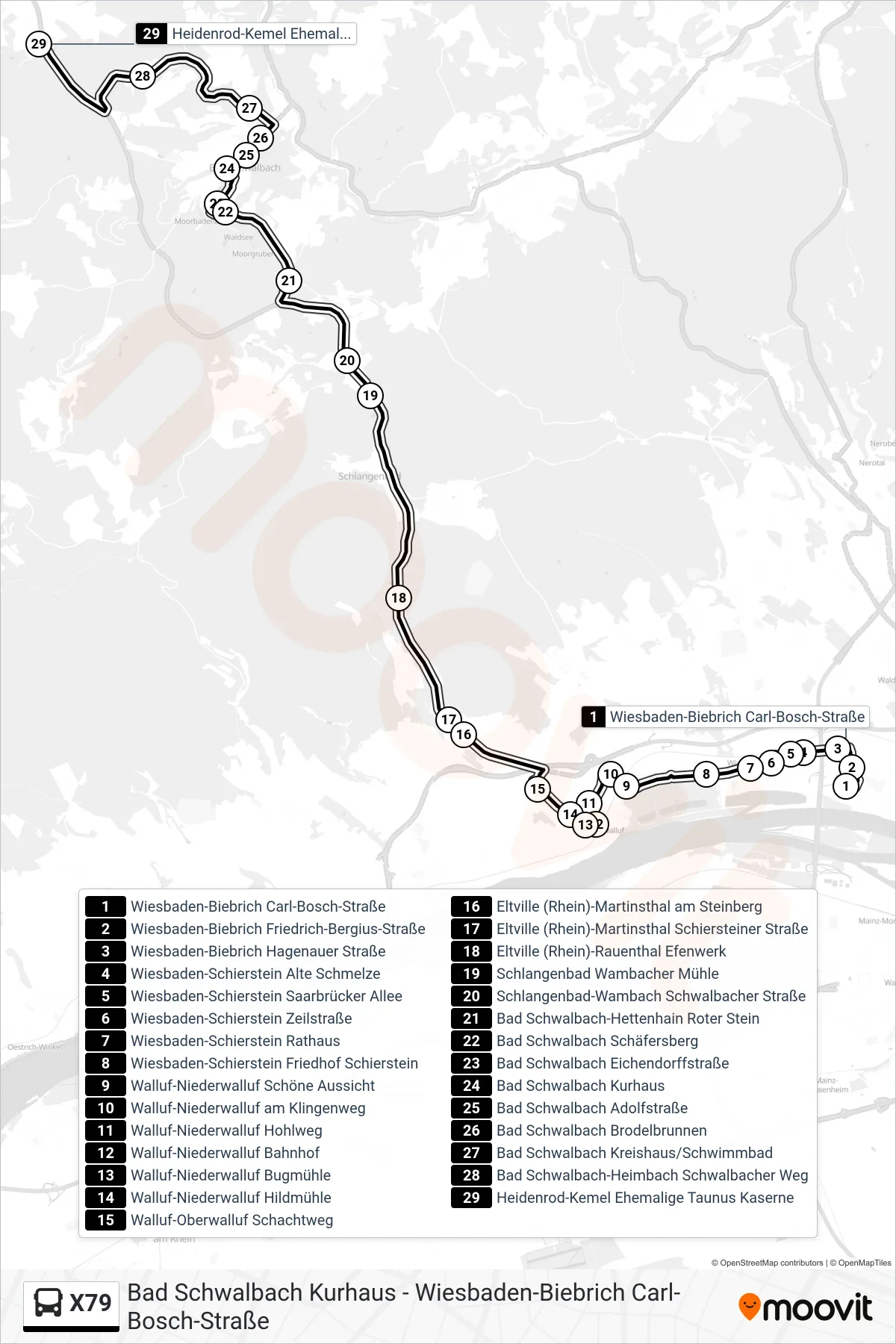
Stops list (X79 - Heidenrod-Kemel Ehemalige Taunus Kaserne)
- Wiesbaden-Biebrich Carl-Bosch-Straße
- Wiesbaden-Biebrich Friedrich-Bergius-Straße
- Wiesbaden-Biebrich Hagenauer Straße
- Wiesbaden-Schierstein Alte Schmelze
- Wiesbaden-Schierstein Saarbrücker Allee
- Wiesbaden-Schierstein Zeilstraße
- Wiesbaden-Schierstein Rathaus
- Wiesbaden-Schierstein Friedhof Schierstein
- Walluf-Niederwalluf Schöne Aussicht
- Walluf-Niederwalluf am Klingenweg
- Walluf-Niederwalluf Hohlweg
- Walluf-Niederwalluf Bahnhof
- Walluf-Niederwalluf Bugmühle
- Walluf-Niederwalluf Hildmühle
- Walluf-Oberwalluf Schachtweg
- Eltville (Rhein)-Martinsthal am Steinberg
- Eltville (Rhein)-Martinsthal Schiersteiner Straße
- Eltville (Rhein)-Rauenthal Efenwerk
- Schlangenbad Wambacher Mühle
- Schlangenbad-Wambach Schwalbacher Straße
- Bad Schwalbach-Hettenhain Roter Stein
- Bad Schwalbach Schäfersberg
- Bad Schwalbach Eichendorffstraße
- Bad Schwalbach Kurhaus
- Bad Schwalbach Adolfstraße
- Bad Schwalbach Brodelbrunnen
- Bad Schwalbach Kreishaus/Schwimmbad
- Bad Schwalbach-Heimbach Schwalbacher Weg
- Heidenrod-Kemel Ehemalige Taunus Kaserne