
XC Bus Route Map
View the XC route map and see all XC stops along the route. The map of XC shows where the bus travels and the location of each stop, making it easy to understand the entire route at a glance.
Explore Cecil Transit routes on the map and see where Cecil Transit bus services operate. Use the XC map to find bus stops and see how the XC connects different areas along its trip.
All XC stops on the map are displayed in route order, helping you follow the XC bus from the first stop to the last.
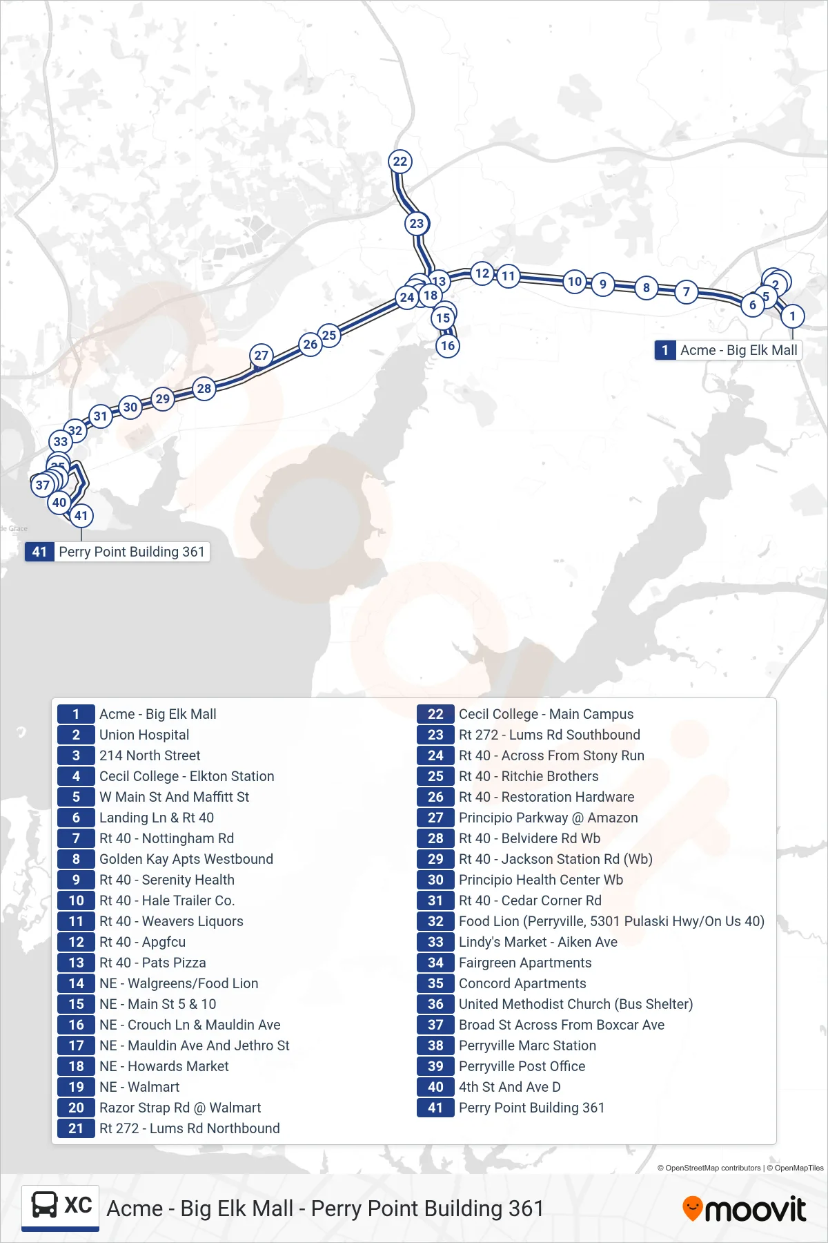
Stops list (XC - Perry Point Building 361)
- Acme - Big Elk Mall
- Union Hospital
- 214 North Street
- Cecil College - Elkton Station
- W Main St And Maffitt St
- Landing Ln & Rt 40
- Rt 40 - Nottingham Rd
- Golden Kay Apts Westbound
- Rt 40 - Serenity Health
- Rt 40 - Hale Trailer Co.
- Rt 40 - Weavers Liquors
- Rt 40 - Apgfcu
- Rt 40 - Pats Pizza
- NE - Walgreens/Food Lion
- NE - Main St 5 & 10
- NE - Crouch Ln & Mauldin Ave
- NE - Mauldin Ave And Jethro St
- NE - Howards Market
- NE - Walmart
- Razor Strap Rd @ Walmart
- Rt 272 - Lums Rd Northbound
- Cecil College - Main Campus
- Rt 272 - Lums Rd Southbound
- Rt 40 - Across From Stony Run
- Rt 40 - Ritchie Brothers
- Rt 40 - Restoration Hardware
- Principio Parkway @ Amazon
- Rt 40 - Belvidere Rd Wb
- Rt 40 - Jackson Station Rd (Wb)
- Principio Health Center Wb
- Rt 40 - Cedar Corner Rd
- Food Lion (Perryville, 5301 Pulaski Hwy/On Us 40)
- Lindy's Market - Aiken Ave
- Fairgreen Apartments
- Concord Apartments
- United Methodist Church (Bus Shelter)
- Broad St Across From Boxcar Ave
- Perryville Marc Station
- Perryville Post Office
- 4th St And Ave D
- Perry Point Building 361