
Y 33 Bus Route Map
View the Y 33 route map and see all Y 33 stops along the route. The map of Y 33 shows where the bus travels and the location of each stop, making it easy to understand the entire route at a glance.
Explore Próurbano routes on the map and see where Próurbano bus services operate. Use the Y 33 map to find bus stops and see how the Y 33 connects different areas along its trip.
All Y 33 stops on the map are displayed in route order, helping you follow the Y 33 bus from the first stop to the last.
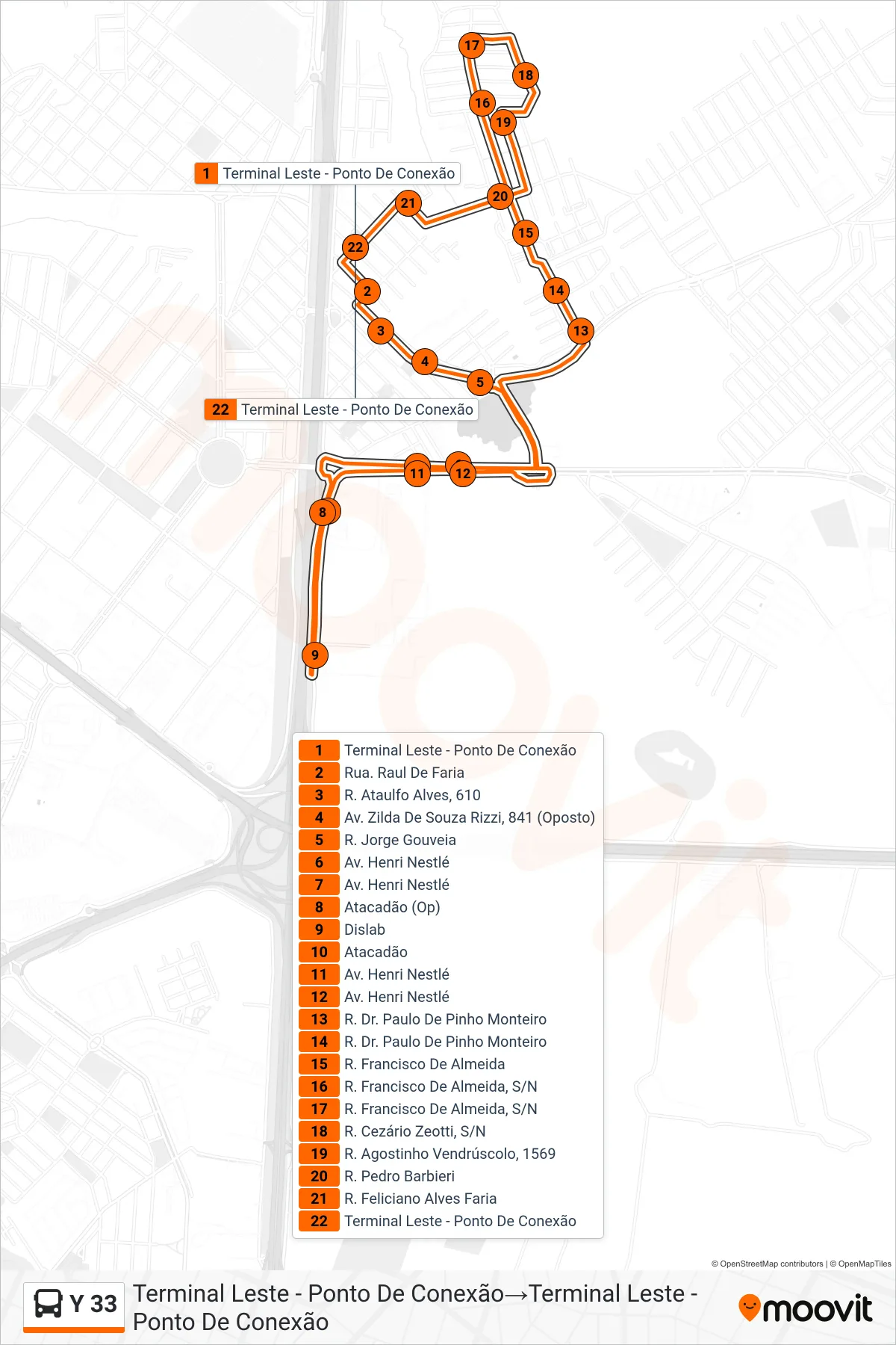
Stops list (Y 33 - Terminal Leste - Ponto De Conexão→Terminal Leste - Ponto De Conexão)
- Terminal Leste - Ponto De Conexão
- Rua. Raul De Faria
- R. Ataulfo Alves, 610
- Av. Zilda De Souza Rizzi, 841 (Oposto)
- R. Jorge Gouveia
- Av. Henri Nestlé
- Av. Henri Nestlé
- Atacadão (Op)
- Dislab
- Atacadão
- Av. Henri Nestlé
- Av. Henri Nestlé
- R. Dr. Paulo De Pinho Monteiro
- R. Dr. Paulo De Pinho Monteiro
- R. Francisco De Almeida
- R. Francisco De Almeida, S/N
- R. Francisco De Almeida, S/N
- R. Cezário Zeotti, S/N
- R. Agostinho Vendrúscolo, 1569
- R. Pedro Barbieri
- R. Feliciano Alves Faria
- Terminal Leste - Ponto De Conexão