
YELLOW Bus Route Map
View the YELLOW route map and see all YELLOW stops along the route. The map of YELLOW shows where the bus travels and the location of each stop, making it easy to understand the entire route at a glance.
Explore Calvert County Transportation routes on the map and see where Calvert County Transportation bus services operate. Use the YELLOW map to find bus stops and see how the YELLOW connects different areas along its trip.
All YELLOW stops on the map are displayed in route order, helping you follow the YELLOW bus from the first stop to the last.
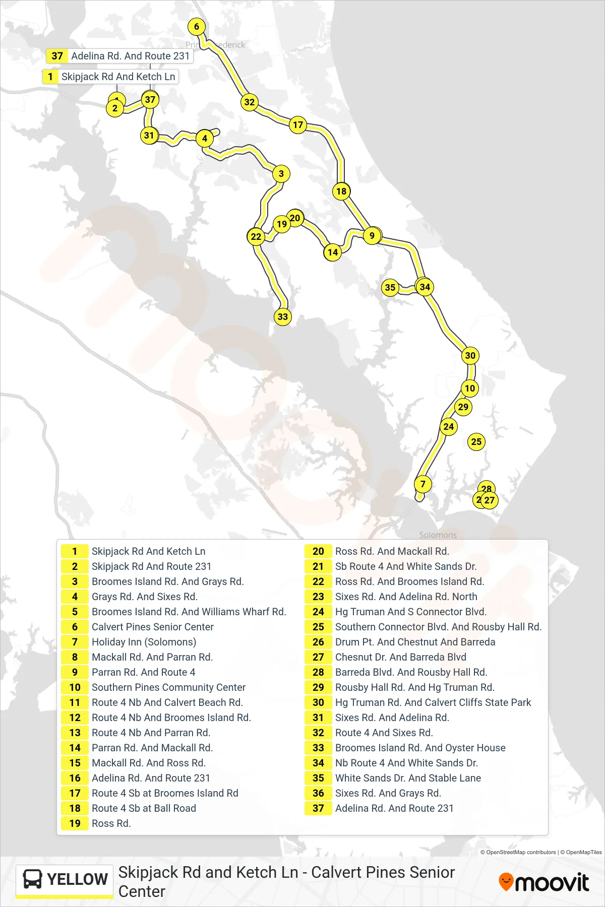
Stops list (YELLOW - Loop)
- Skipjack Rd And Ketch Ln
- Skipjack Rd And Route 231
- Broomes Island Rd. And Grays Rd.
- Grays Rd. And Sixes Rd.
- Broomes Island Rd. And Williams Wharf Rd.
- Calvert Pines Senior Center
- Holiday Inn (Solomons)
- Mackall Rd. And Parran Rd.
- Parran Rd. And Route 4
- Southern Pines Community Center
- Route 4 Nb And Calvert Beach Rd.
- Route 4 Nb And Broomes Island Rd.
- Route 4 Nb And Parran Rd.
- Parran Rd. And Mackall Rd.
- Mackall Rd. And Ross Rd.
- Adelina Rd. And Route 231
- Route 4 Sb at Broomes Island Rd
- Route 4 Sb at Ball Road
- Ross Rd.
- Ross Rd. And Mackall Rd.
- Sb Route 4 And White Sands Dr.
- Ross Rd. And Broomes Island Rd.
- Sixes Rd. And Adelina Rd. North
- Hg Truman And S Connector Blvd.
- Southern Connector Blvd. And Rousby Hall Rd.
- Drum Pt. And Chestnut And Barreda
- Chesnut Dr. And Barreda Blvd
- Barreda Blvd. And Rousby Hall Rd.
- Rousby Hall Rd. And Hg Truman Rd.
- Hg Truman Rd. And Calvert Cliffs State Park
- Sixes Rd. And Adelina Rd.
- Route 4 And Sixes Rd.
- Broomes Island Rd. And Oyster House
- Nb Route 4 And White Sands Dr.
- White Sands Dr. And Stable Lane
- Sixes Rd. And Grays Rd.
- Adelina Rd. And Route 231