How to get to next by bus?
Click on the bus route to see step by step directions with maps, line arrival times and updated time schedules.
From Slam Academy, Miami
51 minFrom Miami Marine Stadium, Key Biscayne
66 minFrom Miami Senior High School, Miami
58 minFrom The Salvation Army, Miami
56 minFrom Consulado de Mexico en Miami, Miami
56 minFrom mercy hospital trolley stop, Miami
75 minFrom Institute of Contemporary Art, Miami
34 minFrom Downtown Miami, Miami
35 minFrom Mercy Hospital, Miami
76 minFrom Ministerio Internacional El Rey Jesus, Miami
66 min
Bus stops near next in Miami Beach
Bus lines to next in Miami Beach
What are the closest stations to next?
The closest stations to next are:
- Washington Av & Lincoln Rd is 62 yards away, 2 min walk.
- Lincoln Rd & Washington Av is 117 yards away, 2 min walk.
- Lincoln Rd @ James Ave is 147 yards away, 3 min walk.
Which bus lines stop near next?
These bus lines stop near next: 100, 36.
What’s the nearest bus station to next in Miami Beach?
The nearest bus stations to next in Miami Beach are Washington Av & Lincoln Rd and Lincoln Rd & Washington Av. The closest one is a 2 min walk away.
What time is the first bus to next in Miami Beach?
The 79 is the first bus that goes to next in Miami Beach. It stops nearby at 3:01 AM.
What time is the last bus to next in Miami Beach?
The 100 is the last bus that goes to next in Miami Beach. It stops nearby at 3:36 AM.
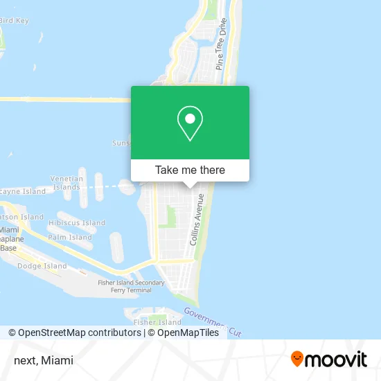
See next, Miami Beach, on the map
Public Transit to next in Miami Beach
Wondering how to get to next in Miami Beach? Moovit helps you find the best way to get to next with step-by-step directions from the nearest public transit station.
Moovit provides free maps and live directions to help you navigate through your city. View schedules, routes, timetables, and find out how long does it take to get to next in real time.
Looking for the nearest stop or station to next? Check out this list of stops closest to your destination: Washington Av & Lincoln Rd; Lincoln Rd & Washington Av; Lincoln Rd @ James Ave.
Bus: 100, 36, 14, 150, 15, 20, 79.
Want to see if there’s another route that gets you there at an earlier time? Moovit helps you find alternative routes or times. Get directions from and directions to next easily from the Moovit App or Website.
We make riding to next easy, which is why over 1.5 million users, including users in Miami Beach, trust Moovit as the best app for public transit. You don’t need to download an individual bus app or train app, Moovit is your all-in-one transit app that helps you find the best bus time or train time available.
For information on prices of bus, train and light rail, costs and ride fares to next, please check the Moovit app.
Use the app to navigate to popular places including to the airport, hospital, stadium, grocery store, mall, coffee shop, school, college, and university.
next Address: 420 Lincoln Rd Mall street in Miami Beach
- B2b Minimum Order,
- Alchemist,
- Zara,
- Ray-Ban,
- Lincoln Road,
- Havaianas,
- Fritz's Skate Bike & Surf Shop,
- Deep Sleep Studio (Sleep on Green),
- Sobe Health Center,
- Let's Get the Keys,
- World Crawl Miami,
- Martha Sweets Delicacies,
- Real Estate Agent Mina Koc,
- Law Offices of Bijan Sebastian Parwaresch and Associates,
- Bryan Granados Real Estate Sales and Investments,
- Miami Gift Shop,
- American Oilfield Standard,
- Grupo Medlegal Florida,
- Swoop Miami,
- Club Rapunzel
Places Near next (Miami Beach)
- Richard E. Gerstein Justice Building, Miami,
- Zoo Miami, Miami,
- Sawgrass Mall, Miami,
- Aventura Mall, Miami,
- Brickell City Centre, Miami,
- Keiser University Flagship Campus, West Palm Beach,
- Marlins Park, Miami,
- Aventura Mall, Miami Beach,
- Hard Rock Stadium, Miami Gardens,
- Bayside Marketplace, Miami,
- Sawgrass mall ( FL ), Miami Beach,
- Wynwood, Miami,
- Port of Miami Cruise Terminal, Miami,
- Dolphin Mall, Miami,
- Dolphin Mall Bus, Miami,
- Miami Freedom Park, Miami,
- Little Havana, Miami,
- 1351 NW 12th St, Miami,
- Miami-Dade County Courthouse, Miami,
- Miami Design District, Miami
How to get to popular places in Miami with public transit
Get around Miami Beach by public transit!
Traveling around Miami Beach has never been so easy. See step by step directions as you travel to any attraction, street or major public transit station. View bus and train schedules, arrival times, service alerts and detailed routes on a map, so you know exactly how to get to anywhere in Miami Beach.
When traveling to any destination around Miami Beach use Moovit's Live Directions with Get Off Notifications to know exactly where and how far to walk, how long to wait for your line, and how many stops are left. Moovit will alert you when it's time to get off — no need to constantly re-check whether yours is the next stop.
Wondering how to use public transit in Miami Beach or how to pay for public transit in Miami Beach? Moovit public transit app can help you navigate your way with public transit easily, and at minimum cost. It includes public transit fees, ticket prices, and costs. Looking for a map of Miami Beach public transit lines? Moovit public transit app shows all public transit maps in Miami Beach with all Bus, Train, Light Rail and Ferry routes and stops on an interactive map.
Miami has 4 transit type(s), including: Bus, Train, Light Rail and Ferry, operated by several transit agencies, including Broward County Transit, Miami-Dade Transit, Metrorail, Palm Tran, Tri-Rail, Brightline, MARTY, City of Homestead Trolley, Key West Transit, Treasure Coast Connector, GoLine IRT, Amtrak, Greyhound-us, FlixBus-us and Aventura Express Shuttle Bus