How to get to smart Start Ignition Interlock by bus?
Click on the bus route to see step by step directions with maps, line arrival times and updated time schedules.
From S/120 Bus Stop, Miami Beach
46 minFrom Dexter's Apartment, Miami Beach
67 minFrom Sawgrass Mills Mall, Miami
83 minFrom Miami Norland Senior High School, Miami Gardens
84 minFrom Broward College South Campus, Miramar-Pembroke Pines
65 minFrom Walmart North Miami Beach, Miami
64 minFrom Bal Harbour, Miami Beach
57 minFrom South Broward High School, Hollywood
47 minFrom Walmart North Miami Beach (Walmart Garden Center), Miami
64 minFrom Miramar, FL, Miramar-Pembroke Pines
58 min
Bus stop near smart Start Ignition Interlock in Hallandale Beach
- Id:0049 Hallandale Bch B/Se 16 A, 3 min walk,VIEW
Train station near smart Start Ignition Interlock in Hallandale Beach
- Aventura, 60 min walk,VIEW
Bus lines to smart Start Ignition Interlock in Hallandale Beach
What are the closest stations to smart Start Ignition Interlock?
The closest stations to smart Start Ignition Interlock are:
- Id:0049 Hallandale Bch B/Se 16 A is 124 yards away, 3 min walk.
- Aventura is 5019 yards away, 60 min walk.
Which bus lines stop near smart Start Ignition Interlock?
These bus lines stop near smart Start Ignition Interlock: 04, 28.
What’s the nearest bus station to smart Start Ignition Interlock in Hallandale Beach?
The nearest bus station to smart Start Ignition Interlock in Hallandale Beach is Id:0049 Hallandale Bch B/Se 16 A. It’s a 3 min walk away.
What time is the first train to smart Start Ignition Interlock in Hallandale Beach?
The BLFM is the first train that goes to smart Start Ignition Interlock in Hallandale Beach. It stops nearby at 6:04 AM.
What time is the last train to smart Start Ignition Interlock in Hallandale Beach?
The BLFM is the last train that goes to smart Start Ignition Interlock in Hallandale Beach. It stops nearby at 12:07 AM.
What time is the first bus to smart Start Ignition Interlock in Hallandale Beach?
The 28 is the first bus that goes to smart Start Ignition Interlock in Hallandale Beach. It stops nearby at 5:30 AM.
What time is the last bus to smart Start Ignition Interlock in Hallandale Beach?
The 28 is the last bus that goes to smart Start Ignition Interlock in Hallandale Beach. It stops nearby at 1:03 AM.
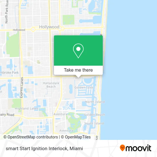
See smart Start Ignition Interlock, Hallandale Beach, on the map
Public Transit to smart Start Ignition Interlock in Hallandale Beach
Wondering how to get to smart Start Ignition Interlock in Hallandale Beach? Moovit helps you find the best way to get to smart Start Ignition Interlock with step-by-step directions from the nearest public transit station.
Moovit provides free maps and live directions to help you navigate through your city. View schedules, routes, timetables, and find out how long does it take to get to smart Start Ignition Interlock in real time.
Looking for the nearest stop or station to smart Start Ignition Interlock? Check out this list of stops closest to your destination: Id:0049 Hallandale Bch B/Se 16 A; Aventura.
Bus: 04, 28.Train: BLFM.
Want to see if there’s another route that gets you there at an earlier time? Moovit helps you find alternative routes or times. Get directions from and directions to smart Start Ignition Interlock easily from the Moovit App or Website.
We make riding to smart Start Ignition Interlock easy, which is why over 1.5 million users, including users in Hallandale Beach, trust Moovit as the best app for public transit. You don’t need to download an individual bus app or train app, Moovit is your all-in-one transit app that helps you find the best bus time or train time available.
For information on prices of bus, costs and ride fares to smart Start Ignition Interlock, please check the Moovit app.
Use the app to navigate to popular places including to the airport, hospital, stadium, grocery store, mall, coffee shop, school, college, and university.
smart Start Ignition Interlock Address: 1606 E Hallandale Beach Blvd Hallandale Beach, FL 33009 street in Hallandale Beach
- Popshelf,
- Diplomat Mall Shopping Center,
- Publix,
- Burlington,
- Burlington Coat Factory,
- Coinstar - Bitcoin ATM,
- RK Diplomat Center,
- Ross Dress for Less,
- Amazon Locker-Alvisio,
- Prestigious Tax Pro,
- ChargePoint,
- Synchrony Center,
- Knights Inn-Knights Inn Hallandale,
- Русская Аптека,
- Three Islands,
- Golden Isles, Florida,
- Diplomat Marina,
- A1A at Hallandale Beach Blvd,
- Walmart,
- Walmart Supercenter
Places Near smart Start Ignition Interlock (Hallandale Beach)
- Miami Design District, Miami,
- Bayside Marketplace, Miami,
- Zoo Miami, Miami,
- Aventura Mall, Miami Beach,
- Aventura Mall, Miami,
- Dolphin Mall Bus, Miami,
- Miami Freedom Park, Miami,
- Keiser University Flagship Campus, West Palm Beach,
- Richard E. Gerstein Justice Building, Miami,
- Dolphin Mall, Miami,
- Wynwood, Miami,
- Miami VA Hospital, Miami,
- Miami-Dade County Courthouse, Miami,
- Port of Miami Cruise Terminal, Miami,
- Brickell City Centre, Miami,
- Little Havana, Miami,
- Sawgrass Mall, Miami,
- Marlins Park, Miami,
- Sawgrass mall ( FL ), Miami Beach,
- Hard Rock Stadium, Miami Gardens
How to get to popular places in Miami with public transit
Get around Hallandale Beach by public transit!
Traveling around Hallandale Beach has never been so easy. See step by step directions as you travel to any attraction, street or major public transit station. View bus and train schedules, arrival times, service alerts and detailed routes on a map, so you know exactly how to get to anywhere in Hallandale Beach.
When traveling to any destination around Hallandale Beach use Moovit's Live Directions with Get Off Notifications to know exactly where and how far to walk, how long to wait for your line, and how many stops are left. Moovit will alert you when it's time to get off — no need to constantly re-check whether yours is the next stop.
Wondering how to use public transit in Hallandale Beach or how to pay for public transit in Hallandale Beach? Moovit public transit app can help you navigate your way with public transit easily, and at minimum cost. It includes public transit fees, ticket prices, and costs. Looking for a map of Hallandale Beach public transit lines? Moovit public transit app shows all public transit maps in Hallandale Beach with all Bus, Train, Light Rail and Ferry routes and stops on an interactive map.
Miami has 4 transit type(s), including: Bus, Train, Light Rail and Ferry, operated by several transit agencies, including Broward County Transit, Miami-Dade Transit, Metrorail, Palm Tran, Tri-Rail, Brightline, MARTY, City of Homestead Trolley, Key West Transit, Treasure Coast Connector, GoLine IRT, Amtrak, Greyhound-us, FlixBus-us and Aventura Express Shuttle Bus