Directions to Scawby (North Lincolnshire) with public transport
The following transport lines have routes that pass near Scawby
How to get to Scawby by bus?
Click on the bus route to see step by step directions with maps, line arrival times and updated time schedules.
Bus stops near Scawby in North Lincolnshire
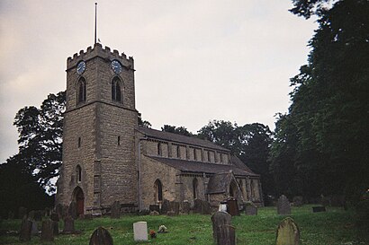
- Church, Scawby, 6 min walk,
- Gainsborough Lane (O/S 3), Sturton, 8 min walk,
Bus lines to Scawby in North Lincolnshire
- X4, Lakeside,
- C4, Kirton In Lindsey,
- 94, Brigg,
What are the nearest stations to Scawby?
The nearest stations to Scawby are:
- Church, Scawby is 406 meters away, 6 min walk.
- Gainsborough Lane (O/S 3), Sturton is 531 meters away, 8 min walk.
Which bus lines stop near Scawby?
These bus lines stop near Scawby: 53C, X4.
What’s the nearest bus stop to Scawby in North Lincolnshire?
The nearest bus stop to Scawby in North Lincolnshire is Church, Scawby. It’s a 6 min walk away.
See Scawby, North Lincolnshire, on the map
Public Transit to Scawby in North Lincolnshire
Wondering how to get to Scawby in North Lincolnshire, United Kingdom? Moovit helps you find the best way to get to Scawby with step-by-step directions from the nearest public transit station.
Moovit provides free maps and live directions to help you navigate through your city. View schedules, routes, timetables, and find out how long does it take to get to Scawby in real time.
Looking for the nearest stop or station to Scawby? Check out this list of stops closest to your destination: Church; Gainsborough Lane (O/S 3).
Bus: 53C, X4, C4, 94.
Want to see if there’s another route that gets you there at an earlier time? Moovit helps you find alternative routes or times. Get directions from and directions to Scawby easily from the Moovit App or Website.
We make riding to Scawby easy, which is why over 1.5 million users, including users in North Lincolnshire, trust Moovit as the best app for public transit. You don’t need to download an individual bus app or train app, Moovit is your all-in-one transit app that helps you find the best bus time or train time available.
For information on prices of bus and train, costs and ride fares to Scawby, please check the Moovit app.
Use the app to navigate to popular places including to the airport, hospital, stadium, grocery store, mall, coffee shop, school, college, and university.
Scawby Address: Scawby street in North Lincolnshire
Attractions near Scawby
M180 Junction 4,Hibaldstow Park,DoubleTree by Hilton Forest Pines Spa & Golf Resort,Forest Pines Golf & Spa Hotel,Forest Pines Golf Course,Hibaldstow,Appleby Village Hall,Dn20 0aq,howsham village hall,Brigg,Brigg Primary School,A18,Sir John Nelthorpe School.,Glebespray Kennels,The Vale Academy,Sir John Nelthorpe Lower School,Dn20 8dt,Dn20 0bj,Brickyard Lane,G H Clements & SonsHow to get to popular attractions in North Lincolnshire with public transportation
Lace Market, Nottingham,Waterside Campus, University Of Northampton, Northampton,M&S Distribution Centre, North West Leicestershire,Ferry Meadows Country Park, Peterborough,Lincoln Crematorium, Lincoln,Markeaton Park, Derby,Rutland Water, Rutland,Gateway College, Leicester,DoubleTree by Hilton Nottingham - Gateway Hotel, Nottingham,RAF Cranwell Main Guardroom, North Kesteven,Newton Building, Nottingham,Beeston Ward / Fleming Ward, Nottingham,Premier Inn Nottingham West, Broxtowe,Intu Derby, Derby,Hemswell Antiques Centre, North Lincolnshire,Sutton-On-Sea, East Lindsey,Scunthorpe Hospital, North Lincolnshire,Hmrc Enquiry Centre, Nottingham,Kings Mill Hospital, Ashfield,Ripley Police Station, Amber ValleyGet around East Midlands by public transport!
Travelling around East Midlands has never been so easy. See step by step directions as you travel to any attraction, street or major public transport station. View bus and train timetables, arrival times, service alerts and detailed routes on a map, so you know exactly how to get to anywhere in East Midlands.
When travelling to any destination around East Midlands use Moovit's Live Directions with Get Off Notifications to know exactly where and how far to walk, how long to wait for your line , and how many stops are left. Moovit will alert you when it’s time to get off — no need to constantly re-check whether yours is the next stop.
Wondering how to use public transport in East Midlands or how to pay for public transport in East Midlands? Moovit public transport app can help you navigate your way with public transport easily, and at minimum cost. It includes public transport fees, ticket prices, and costs. Looking for a map of East Midlands public transport lines? Moovit public transport app shows all public transport maps in East Midlands with all Bus, Train and Light rail routes and stops on an interactive map.
East Midlands has 3 transport type(s), including: Bus, Train and Light rail, operated by several transport agencies, including National Rail, Ashbourne Community Transport, Delaine Buses, Arriva Midlands, Centrebus, Our Centre, Hulleys of Baslow, D & G Bus, Stagecoach East Midlands, North Lincolnshire Council, Roberts Coaches, Hawkes Coaches, Lawson's of Corby, East Yorkshire, Soar Valley Community Bus