Directions to Wilford Lane (Rushcliffe) with public transport
The following transport lines have routes that pass near Wilford Lane
How to get to Wilford Lane by bus?
Click on the bus route to see step by step directions with maps, line arrival times and updated time schedules.
How to get to Wilford Lane by train?
Click on the train route to see step by step directions with maps, line arrival times and updated time schedules.
Bus stops near Wilford Lane in Rushcliffe
- Bruce Drive, West Bridgford, 2 min walk,
- Melton Grove, West Bridgford, 6 min walk,
- Balmoral Avenue, West Bridgford, 7 min walk,
Light Rail stations near Wilford Lane in Rushcliffe
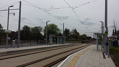
- Wilford Lane Tram Stop, Wilford, 16 min walk,
Bus lines to Wilford Lane in Rushcliffe
- 1, Nottingham-Loughborough,
- 1A, City-Clifton,
- 1B, City-Clifton,
- 1E, Nottingham-East Leake,
- 3, City-Clifton,
- 3A, City-Clifton,
- 4, Clifton - Nottingham,
- N4, NightBus City-Clifton,
- N44, Radcliffe On Trent - Becket School,
- KEYWORTH, Nottingham - Tollerton - Keyworth,
- 19, Melton Mowbray - Nottingham,
- 9, Nottingham,
- 10, Ruddington,
- 10C, Ruddington Business Park,
- 10X, Nottingham,
What are the nearest stations to Wilford Lane?
The nearest stations to Wilford Lane are:
- Bruce Drive, West Bridgford is 68 meters away, 2 min walk.
- Melton Grove, West Bridgford is 439 meters away, 6 min walk.
- Balmoral Avenue, West Bridgford is 468 meters away, 7 min walk.
- Wilford Lane Tram Stop, Wilford is 1185 meters away, 16 min walk.
Which bus lines stop near Wilford Lane?
These bus lines stop near Wilford Lane: 1, 10C, 1A, 9.
Which train lines stop near Wilford Lane?
These train lines stop near Wilford Lane: EAST MIDLANDS RAILWAY, NORTHERN.
What’s the nearest light rail station to Wilford Lane in Rushcliffe?
The nearest light rail station to Wilford Lane in Rushcliffe is Wilford Lane Tram Stop, Wilford. It’s a 16 min walk away.
What’s the nearest bus stop to Wilford Lane in Rushcliffe?
The nearest bus stop to Wilford Lane in Rushcliffe is Bruce Drive, West Bridgford. It’s a 2 min walk away.
What time is the first light rail to Wilford Lane in Rushcliffe?
The TRAM is the first light rail that goes to Wilford Lane in Rushcliffe. It stops nearby at 05:41.
What time is the last light rail to Wilford Lane in Rushcliffe?
The TRAM is the last light rail that goes to Wilford Lane in Rushcliffe. It stops nearby at 00:04.
What time is the first bus to Wilford Lane in Rushcliffe?
The KEYWORTH is the first bus that goes to Wilford Lane in Rushcliffe. It stops nearby at 03:14.
What time is the last bus to Wilford Lane in Rushcliffe?
The N4 is the last bus that goes to Wilford Lane in Rushcliffe. It stops nearby at 03:00.
See Wilford Lane, Rushcliffe, on the map
Public Transit to Wilford Lane in Rushcliffe
Wondering how to get to Wilford Lane in Rushcliffe, United Kingdom? Moovit helps you find the best way to get to Wilford Lane with step-by-step directions from the nearest public transit station.
Moovit provides free maps and live directions to help you navigate through your city. View schedules, routes, timetables, and find out how long does it take to get to Wilford Lane in real time.
Looking for the nearest stop or station to Wilford Lane? Check out this list of stops closest to your destination: Bruce Drive; Melton Grove; Balmoral Avenue; Wilford Lane Tram Stop.
Bus: 1, 10C, 1A, 9, 1B, 1E, 3, KEYWORTH, 19, 10, 10X.Train: EAST MIDLANDS RAILWAY, NORTHERN.
Want to see if there’s another route that gets you there at an earlier time? Moovit helps you find alternative routes or times. Get directions from and directions to Wilford Lane easily from the Moovit App or Website.
We make riding to Wilford Lane easy, which is why over 1.5 million users, including users in Rushcliffe, trust Moovit as the best app for public transit. You don’t need to download an individual bus app or train app, Moovit is your all-in-one transit app that helps you find the best bus time or train time available.
For information on prices of bus, train and light rail, costs and ride fares to Wilford Lane, please check the Moovit app.
Use the app to navigate to popular places including to the airport, hospital, stadium, grocery store, mall, coffee shop, school, college, and university.
Wilford Lane Address: West Bridgford Nottingham street in Rushcliffe
Attractions near Wilford Lane
Moretime Pa Services,Ikanos Consulting,The Beeches Hotel Leisure Club Nottingham,Mercia Ceilings and Partitioning Limited,Ceri Armstrong Garment Trade,Uni2 Rent,Mesh Recruitment,Kids Planet West Bridgford,Beaver Green Management,The Alpha Pill,River Trent (Nottingham),360 Concepts,Castle Healthcare Practice,ALDI,Hickory House Day Nursery,The Health Haven Nottingham Limited,Wilford Suspension Bridge,Lk Residential,The Family Chemist,CapesouthHow to get to popular attractions in Rushcliffe with public transportation
Nottingham Forest Football Club, Rushcliffe,Blundell Park (Grimsby Town Football Club), North East Lincolnshire,Derby College (The Roundhouse), Derby,Sacrewell Farm, Peterborough,shambala festival, Harborough,Fengate, Peterborough,Bruntingthorpe, Harborough,Twycross Zoo,Lincolnshire County Council, Lexicon House, North Kesteven,Foxton Locks, Harborough,Rushey Mead School, Leicester,Le10 3bq, Hinckley And Bosworth,Attenborough Nature Reserve, Nottingham,Groby Road, Leicester,Elvaston Castle Country Park, South Derbyshire,South Midlands Mail Centre, Northampton,Beeston Hockey Club, Nottingham,Bloodstock Festivals, Derby,Sincil Bank Stadium-Lincoln City Football Club, Lincoln,Premier Inn Nottingham West, BroxtoweGet around East Midlands by public transport!
Travelling around East Midlands has never been so easy. See step by step directions as you travel to any attraction, street or major public transport station. View bus and train timetables, arrival times, service alerts and detailed routes on a map, so you know exactly how to get to anywhere in East Midlands.
When travelling to any destination around East Midlands use Moovit's Live Directions with Get Off Notifications to know exactly where and how far to walk, how long to wait for your line , and how many stops are left. Moovit will alert you when it’s time to get off — no need to constantly re-check whether yours is the next stop.
Wondering how to use public transport in East Midlands or how to pay for public transport in East Midlands? Moovit public transport app can help you navigate your way with public transport easily, and at minimum cost. It includes public transport fees, ticket prices, and costs. Looking for a map of East Midlands public transport lines? Moovit public transport app shows all public transport maps in East Midlands with all Bus, Train and Light rail routes and stops on an interactive map.
East Midlands has 3 transport type(s), including: Bus, Train and Light rail, operated by several transport agencies, including National Rail, Ashbourne Community Transport, Delaine Buses, Arriva Midlands, Centrebus, Our Centre, Hulleys of Baslow, D & G Bus, Stagecoach East Midlands, North Lincolnshire Council, Roberts Coaches, Lawson's of Corby, Hawkes Coaches, East Yorkshire, Soar Valley Community Bus