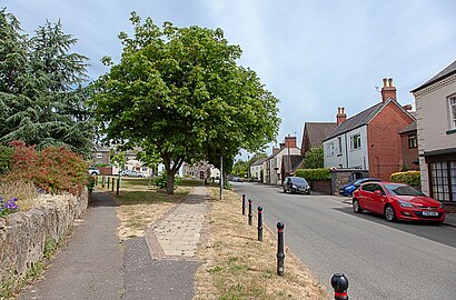
Directions to Markfield (Hinckley And Bosworth) with public transport
The following transport lines have routes that pass near Markfield
How to get to Markfield by bus?
Click on the bus route to see step by step directions with maps, line arrival times and updated time schedules.
Bus stops near Markfield in Hinckley And Bosworth
- Meadow Lane, Markfield, 3 min walk,
- Cemetery, Markfield, 6 min walk,
Bus lines to Markfield in Hinckley And Bosworth
- 29, Coalville,
- 29B, Swadlincote,
- 125, Leicester,
- 29A, Swadlincote,
What are the nearest stations to Markfield?
The nearest stations to Markfield are:
- Meadow Lane, Markfield is 160 meters away, 3 min walk.
- Cemetery, Markfield is 430 meters away, 6 min walk.
Which bus lines stop near Markfield?
These bus lines stop near Markfield: 29, 29B.
What’s the nearest bus stop to Markfield in Hinckley And Bosworth?
The nearest bus stop to Markfield in Hinckley And Bosworth is Meadow Lane, Markfield. It’s a 3 min walk away.
What time is the first bus to Markfield in Hinckley And Bosworth?
The 29 is the first bus that goes to Markfield in Hinckley And Bosworth. It stops nearby at 05:53.
What time is the last bus to Markfield in Hinckley And Bosworth?
The 29 is the last bus that goes to Markfield in Hinckley And Bosworth. It stops nearby at 22:47.
See Markfield, Hinckley And Bosworth, on the map
Public Transit to Markfield in Hinckley And Bosworth
Wondering how to get to Markfield in Hinckley And Bosworth, United Kingdom? Moovit helps you find the best way to get to Markfield with step-by-step directions from the nearest public transit station.
Moovit provides free maps and live directions to help you navigate through your city. View schedules, routes, timetables, and find out how long does it take to get to Markfield in real time.
Looking for the nearest stop or station to Markfield? Check out this list of stops closest to your destination: Meadow Lane; Cemetery.
Bus: 29, 29B, 125, 29A.
Want to see if there’s another route that gets you there at an earlier time? Moovit helps you find alternative routes or times. Get directions from and directions to Markfield easily from the Moovit App or Website.
We make riding to Markfield easy, which is why over 1.5 million users, including users in Hinckley And Bosworth, trust Moovit as the best app for public transit. You don’t need to download an individual bus app or train app, Moovit is your all-in-one transit app that helps you find the best bus time or train time available.
For information on prices of bus, costs and ride fares to Markfield, please check the Moovit app.
Use the app to navigate to popular places including to the airport, hospital, stadium, grocery store, mall, coffee shop, school, college, and university.
Markfield Address: Oakfield Avenue street in Hinckley And Bosworth
Popular routes to Markfield, Hinckley And Bosworth
Attractions near Markfield
Pokefan Tom CR,C Hill Homes,Cslspray,TTP Homes,Collaborative Living,F G Harris Hardware Mica Local Markfield,The Co-Operative Food - Markfield,B Cool,TK Couriers,Assisistent19,Markfield Medical Centre,WW,Cranden Joinery and Home Improvements,Amazon Counter-Post Office Markfield,GCS Engineering,S.Louise Beauty,Slouise Pr,Shortys,Markfield Community Library,Vasro Lucra ZigroHow to get to popular attractions in Hinckley And Bosworth with public transportation
Isebrook Hospital, Wellingborough,Riverside Hub, Northampton,Southview Holiday Park near Skegness, East Lindsey,Nene Park, East Northamptonshire,Hardwick Old Hall, North East Derbyshire,Morrisons Distribution Centre, Kettering,Showcase Cinemas, Nottingham,S43 3fg, Chesterfield,Westcotes Health Centre, Leicester,NG7 1GX, Nottingham,RAF Cranwell Main Guardroom, North Kesteven,Twycross Zoo,Belvoir Castle, Melton,Ilkeston Community Hospital, Ilkeston, Erewash,Nottingham University Hospital, Nottingham,Wilford Lane, Rushcliffe,Royal Mail Sorting Office, Northampton,Northampton Railway Station, Northampton,Hinckley and Bosworth Community Hospital, Hinckley And Bosworth,Dusk Till Dawn, NottinghamGet around East Midlands by public transport!
Travelling around East Midlands has never been so easy. See step by step directions as you travel to any attraction, street or major public transport station. View bus and train timetables, arrival times, service alerts and detailed routes on a map, so you know exactly how to get to anywhere in East Midlands.
When travelling to any destination around East Midlands use Moovit's Live Directions with Get Off Notifications to know exactly where and how far to walk, how long to wait for your line , and how many stops are left. Moovit will alert you when it’s time to get off — no need to constantly re-check whether yours is the next stop.
Wondering how to use public transport in East Midlands or how to pay for public transport in East Midlands? Moovit public transport app can help you navigate your way with public transport easily, and at minimum cost. It includes public transport fees, ticket prices, and costs. Looking for a map of East Midlands public transport lines? Moovit public transport app shows all public transport maps in East Midlands with all Bus, Train and Light rail routes and stops on an interactive map.
East Midlands has 3 transport type(s), including: Bus, Train and Light rail, operated by several transport agencies, including National Rail, Ashbourne Community Transport, Delaine Buses, Arriva Midlands, Centrebus, Our Centre, Hulleys of Baslow, D & G Bus, Stagecoach East Midlands, North Lincolnshire Council, Roberts Coaches, Lawson's of Corby, Hawkes Coaches, East Yorkshire, Soar Valley Community Bus