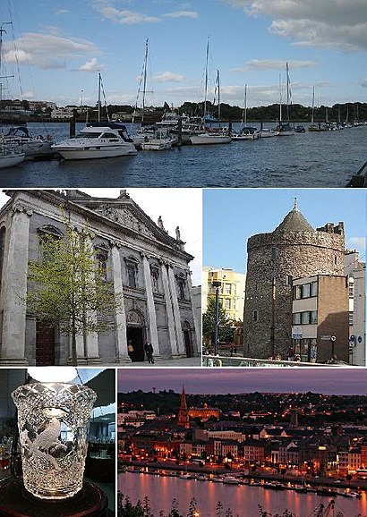
See Waterford on the map
Directions to Waterford with public transportation
The following transit lines have routes that pass near Waterford
Bus:
How to get to Waterford by Bus?
Click on the Bus route to see step by step directions with maps, line arrival times and updated time schedules.
Bus stations near Waterford
- Waterford Ind Est,1 min walk,
- Ballybeg,3 min walk,
- Setu Brown's Road,12 min walk,
- Brownes Road,13 min walk,
Train stations near Waterford
- Waterford (Plunkett),11 min walk,
Bus lines to Waterford
- 354,Portlaw,
- 667,Waterford Hospital,
- W1,Merchants Quay,
- W2,The Clock Tower,
- W4,Brownes Road,
What are the closest stations to Waterford?
The closest stations to Waterford are:
- Waterford Ind Est is 38 meters away, 1 min walk.
- Ballybeg is 130 meters away, 3 min walk.
- Waterford (Plunkett) is 813 meters away, 11 min walk.
- Setu Brown's Road is 858 meters away, 12 min walk.
- Brownes Road is 958 meters away, 13 min walk.
Which Bus lines stop near Waterford?
These Bus lines stop near Waterford: 354, 40, 667, W1
What’s the nearest train station to Waterford?
The nearest train station to Waterford is Waterford (Plunkett). It’s a 11 min walk away.
What’s the nearest bus stop to Waterford?
The nearest bus stop to Waterford is Waterford Ind Est. It’s a 1 min walk away.
What time is the first Train to Waterford?
The RAIL is the first Train that goes to Waterford. It stops nearby at 5:55 AM.
What time is the last Train to Waterford?
The RAIL is the last Train that goes to Waterford. It stops nearby at 8:53 PM.
What time is the first Bus to Waterford?
The W4 is the first Bus that goes to Waterford. It stops nearby at 6:30 AM.
What time is the last Bus to Waterford?
The W4 is the last Bus that goes to Waterford. It stops nearby at 11:50 PM.
How much is the Bus fare to Waterford?
The Bus fare to Waterford costs about €1.55.
See Waterford on the map

Public Transportation to Waterford
Wondering how to get to Waterford, Ireland? Moovit helps you find the best way to get to Waterford with step-by-step directions from the nearest public transit station.
Moovit provides free maps and live directions to help you navigate through your city. View schedules, routes, timetables, and find out how long does it take to get to Waterford in real time.
Looking for the nearest stop or station to Waterford? Check out this list of stops closest to your destination: Waterford Ind Est; Ballybeg; Waterford (Plunkett); Setu Brown's Road; Brownes Road.
Bus:
Want to see if there’s another route that gets you there at an earlier time? Moovit helps you find alternative routes or times. Get directions from and directions to Waterford easily from the Moovit App or Website.
We make riding to Waterford easy, which is why over 1.5 million users, including users in Waterford, trust Moovit as the best app for public transit. You don’t need to download an individual bus app or train app, Moovit is your all-in-one transit app that helps you find the best bus time or train time available.
For information on prices of Bus and Train, costs and ride fares to Waterford, please check the Moovit app.
Use the app to navigate to popular places including to the airport, hospital, stadium, grocery store, mall, coffee shop, school, college, and university.
Waterford Address: Cork Road, Waterford, X91 AKV7, Ireland street in Waterford

Attractions near Waterford
- Daybreak
- Waterford Industrial Park
- St. Joseph's
- Harris Windows
- Waterford Business Park
- Store All Self Storage Centre
- Crystal Sports & Leisure Centre
- St Otterans Cemetery
- Pat Rockett Karate & Kickboxing Academy
- Artful Annie Administration
- Computing at Wit
- Waterford College
- Bausch & Lomb Ireland
- Stove Depot
- Tom Murphycar Sales
- Waterford Carpets
- PM Autos
- Orchardstown Garden Centre
- Affordable Luxury Furniture
- Ida Waterford Industrial Estate Western Extension
How to get to popular attractions in Waterford with public transit
- Rds Simmonscourt, Dublin
- Blanchardstown Shopping Centre, Blanchardstown
- Clonmel / Cluain Meala, Clonmel
- Clayton Hotel Leopardstown, Glencullen
- Rathmines / Ráth Maonais, Dublin
- Connolly Train Station, Dublin
- Howth, Howth
- Carrigaline, Carrigaline
- Trim / Baile Átha Troim, Trim
- Malahide, Malahide
- St. James's Hospital (Central), Dublin
- The Fumbally, Dublin
- Sandymount Strand, Dublin
- Sheraton Athlone Hotel, Athlone
- Thurles Railway Station, Thurles
- The Square Shopping Centre, Tallaght
- Portmarnock, Portmarnock
- Dublin City University (DCU), Dublin
- Kilmainham Gaol, Dublin
- Navan / an Uaimh, Navan