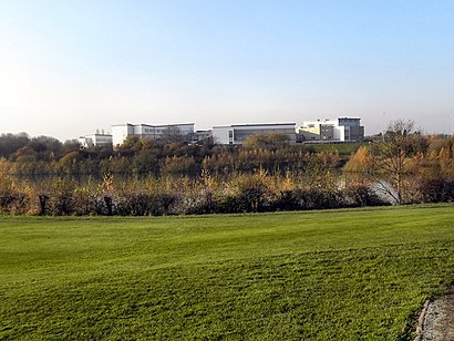
Directions to Wright Robinson College (Manchester) with public transport
The following transport lines have routes that pass near Wright Robinson College
How to get to Wright Robinson College by bus?
Click on the bus route to see step by step directions with maps, line arrival times and updated time schedules.
How to get to Wright Robinson College by train?
Click on the train route to see step by step directions with maps, line arrival times and updated time schedules.
How to get to Wright Robinson College by light rail?
Click on the light rail route to see step by step directions with maps, line arrival times and updated time schedules.
Bus stops near Wright Robinson College in Manchester
- Wright Robinson Sports College, 3 min walk,
- Sandown Street, 7 min walk,
- Gransmoor Road, 16 min walk,
- Booth Road, 17 min walk,
- Fairfield Avenue, 21 min walk,
Light Rail stations near Wright Robinson College in Manchester
- Cemetery Road (Manchester Metrolink), 11 min walk,
Train stations near Wright Robinson College in Manchester
- Fairfield, 14 min walk,
Bus lines to Wright Robinson College in Manchester
- 171, East Didsbury,
- 172, Abbey Hey,
- 703, Monsall,
- 704, Harpurhey,
- 705, Abbey Hey,
- 705, Kingston,
- 706, Levenshulme,
- 7, Gorton,
- 688, Ryder Brow,
- 713, Belle Vue,
- 725, Belle Vue,
- 219, Glossop,
- 220, Stalybridge,
- 221, Manchester City Centre,
- 793, Littlemoss,
- 700, Fairfield,
- 719, Manchester City Centre,
- 700, Dane Bank,
What are the nearest stations to Wright Robinson College?
The nearest stations to Wright Robinson College are:
- Wright Robinson Sports College is 158 meters away, 3 min walk.
- Sandown Street is 530 meters away, 7 min walk.
- Cemetery Road (Manchester Metrolink) is 828 meters away, 11 min walk.
- Fairfield is 1074 meters away, 14 min walk.
- Gransmoor Road is 1214 meters away, 16 min walk.
- Booth Road is 1318 meters away, 17 min walk.
- Fairfield Avenue is 1574 meters away, 21 min walk.
Which bus lines stop near Wright Robinson College?
These bus lines stop near Wright Robinson College: 172, 202, 219, 53.
Which train line stops near Wright Robinson College?
NORTHERN
Which light rail line stops near Wright Robinson College?
BLUE LINE
What’s the nearest light rail station to Wright Robinson College in Manchester?
The nearest light rail station to Wright Robinson College in Manchester is Cemetery Road (Manchester Metrolink). It’s a 11 min walk away.
What’s the nearest train station to Wright Robinson College in Manchester?
The nearest train station to Wright Robinson College in Manchester is Fairfield. It’s a 14 min walk away.
What’s the nearest bus stop to Wright Robinson College in Manchester?
The nearest bus stop to Wright Robinson College in Manchester is Wright Robinson Sports College. It’s a 3 min walk away.
What time is the first light rail to Wright Robinson College in Manchester?
The BLUE LINE is the first light rail that goes to Wright Robinson College in Manchester. It stops nearby at 06:35.
What time is the last light rail to Wright Robinson College in Manchester?
The BLUE LINE is the last light rail that goes to Wright Robinson College in Manchester. It stops nearby at 00:08.
What time is the first bus to Wright Robinson College in Manchester?
The 219 is the first bus that goes to Wright Robinson College in Manchester. It stops nearby at 05:53.
What time is the last bus to Wright Robinson College in Manchester?
The 219 is the last bus that goes to Wright Robinson College in Manchester. It stops nearby at 00:01.
See Wright Robinson College, Manchester, on the map
Public Transit to Wright Robinson College in Manchester
Wondering how to get to Wright Robinson College in Manchester, United Kingdom? Moovit helps you find the best way to get to Wright Robinson College with step-by-step directions from the nearest public transit station.
Moovit provides free maps and live directions to help you navigate through your city. View schedules, routes, timetables, and find out how long does it take to get to Wright Robinson College in real time.
Looking for the nearest stop or station to Wright Robinson College? Check out this list of stops closest to your destination: Wright Robinson Sports College; Sandown Street; Cemetery Road (Manchester Metrolink); Fairfield; Gransmoor Road; Booth Road; Fairfield Avenue.
Bus: 172, 202, 219, 53, 171, 703, 704, 705, 7, 688, 713, 725, 220, 221, 793, 700, 719, 700.Train: NORTHERN.Light rail: BLUE LINE.
Want to see if there’s another route that gets you there at an earlier time? Moovit helps you find alternative routes or times. Get directions from and directions to Wright Robinson College easily from the Moovit App or Website.
We make riding to Wright Robinson College easy, which is why over 1.5 million users, including users in Manchester, trust Moovit as the best app for public transit. You don’t need to download an individual bus app or train app, Moovit is your all-in-one transit app that helps you find the best bus time or train time available.
For information on prices of bus, light rail and train, costs and ride fares to Wright Robinson College, please check the Moovit app.
Use the app to navigate to popular places including to the airport, hospital, stadium, grocery store, mall, coffee shop, school, college, and university.
Wright Robinson College Address: Abbey Hey Lane street in Manchester
Attractions near Wright Robinson College
Wright Robinson School,Wright Robinson Specialist College,M18 8rl,Godfrey Ermen Playing Fields,Hare & Hounds,The Donkey Sanctuary Manchester,Donkey Sanctuary And Therapy Centre,St P & J URC,Maxtrax Community Interest Company,St Anne's Rc Primary School,Abbey Hey Lane Vine,Kelly Rimmer,220 Bus,Fairfield Railway Station (FRF),Keys Group-Ashton Old Road,Delamere Park,Fairfield,Fairfield Golf and Sailing Club,Fairfield Pro Shop Within Fairfield Golf & Sailing Club,The GroveHow to get to popular attractions in Manchester with public transportation
Blue Planet Aquarium, Ellesmere Port, Ellesmere Port,Clarendon Park, Salford,X43 The Witch Way Bus, Manchester,Delamere Forest, Delamere,Haigh Hall and Country Park, Aspull,Clinical Sciences Building, Fazakerley,Vue Cinemas, Manchester,Wilmslow Road, Manchester,Manchester Academy 2, Manchester,Highfield Hospital, Rochdale, Rochdale,L13, Liverpool,Rochdale Infirmary, Rochdale,X-ray department - Preston Royal Hospital, Preston,Royal Preston Hospital, Preston,Premier Inn Manchester Old Trafford, Trafford Bar,Manchester Crown Square Crown Court, Manchester,Manchester Civil Justice Centre, Manchester,Albert's Schloss, Manchester,The Airport Pub & Grill, Manchester,Witton Park, Blackburn, BlackburnGet around North West by public transport!
Travelling around North West has never been so easy. See step by step directions as you travel to any attraction, street or major public transport station. View bus and train timetables, arrival times, service alerts and detailed routes on a map, so you know exactly how to get to anywhere in North West.
When travelling to any destination around North West use Moovit's Live Directions with Get Off Notifications to know exactly where and how far to walk, how long to wait for your line , and how many stops are left. Moovit will alert you when it’s time to get off — no need to constantly re-check whether yours is the next stop.
Wondering how to use public transport in North West or how to pay for public transport in North West? Moovit public transport app can help you navigate your way with public transport easily, and at minimum cost. It includes public transport fees, ticket prices, and costs. Looking for a map of North West public transport lines? Moovit public transport app shows all public transport maps in North West with all Bus, Train, Light rail and Ferry routes and stops on an interactive map.
North West has 4 transport type(s), including: Bus, Train, Light rail and Ferry, operated by several transport agencies, including Stagecoach Manchester, Arriva North West, Diamond Bus North West, Stagecoach Merseyside and South Lancashire, Stagecoach Cumbria and North Lancashire, First Greater Manchester, First Halifax, National Express, Warrington's Own Buses, First Potteries, Rosso, Blackpool Transport, The Blackburn Bus Company, The Burnley Bus Company, Vision Bus