Directions to Achimota (Accra) with public transportation
The following transit lines have routes that pass near Achimota
How to get to Achimota by bus?
Click on the bus route to see step by step directions with maps, line arrival times and updated time schedules.
Bus stops near Achimota in Accra
- Curve, 10 min walk,
- Achimota Overhead, 13 min walk,
- Six Pillars, 13 min walk,
- Achimota New Station, 14 min walk,
- Achimota Club House, 16 min walk,
Bus lines to Achimota in Accra
- 117, Achimota,
- 118, Teshie-Nungua,
- 399, Nima Overhead Maamobi,
- 84, Kuntunse/Satelite ↔ Achimota,
- 85, Akweteman Zongo ↔ Achimota,
- 88, Asofan ↔ Achimota,
- 90, Darkuman ↔ Achimota,
- 92, Dome /Ashongman Estates ↔ Achimota,
- 104, Mayera/Adusa ↔ Achimota,
- 105, Medie/Kotoku ↔ Achimota,
- 114, Taifa ↔ Achimota,
- 314, Kwashieman ↔ Achimota,
- 408, Pokuase Amasaman ↔ Nima Overhead,
- 93, Dome Pillar 2 ↔ Achimota,
- 99, Legon ↔ Achimota,
- 100, Legon Station ↔ Achimota,
- 102, Madina Station ↔ Achimota,
- 116, Tema ↔ Achimota,
- 76, 37 ↔ Achimota,
- 81, Adenta Station ↔ Achimota,
What are the closest stations to Achimota?
The closest stations to Achimota are:
- Curve is 765 meters away, 10 min walk.
- Achimota Overhead is 922 meters away, 13 min walk.
- Six Pillars is 961 meters away, 13 min walk.
- Achimota New Station is 1033 meters away, 14 min walk.
- Achimota Club House is 1236 meters away, 16 min walk.
Which bus lines stop near Achimota?
These bus lines stop near Achimota: 100, 116, 235, 31, 399, 6, 82.
What’s the nearest bus stop to Achimota in Accra?
The nearest bus stop to Achimota in Accra is Curve. It’s a 10 min walk away.
What time is the first bus to Achimota in Accra?
The 90 is the first bus that goes to Achimota in Accra. It stops nearby at 5:00 AM.
What time is the last bus to Achimota in Accra?
The 112 is the last bus that goes to Achimota in Accra. It stops nearby at 11:09 PM.
See Achimota, Accra, on the map
Public Transit to Achimota in Accra
Wondering how to get to Achimota in Accra, Ghana? Moovit helps you find the best way to get to Achimota with step-by-step directions from the nearest public transit station.
Moovit provides free maps and live directions to help you navigate through your city. View schedules, routes, timetables, and find out how long does it take to get to Achimota in real time.
Looking for the nearest stop or station to Achimota? Check out this list of stops closest to your destination: Curve; Achimota Overhead; Six Pillars; Achimota New Station; Achimota Club House.
Bus: 100, 116, 235, 31, 399, 6, 82, 117, 118, 84, 85, 88, 90, 92, 93, 99, 102, 76, 81, 98, 103, 377, 380.
Want to see if there’s another route that gets you there at an earlier time? Moovit helps you find alternative routes or times. Get directions from and directions to Achimota easily from the Moovit App or Website.
We make riding to Achimota easy, which is why over 1.5 million users, including users in Accra, trust Moovit as the best app for public transit. You don’t need to download an individual bus app or train app, Moovit is your all-in-one transit app that helps you find the best bus time or train time available.
For information on prices of bus, costs and ride fares to Achimota, please check the Moovit app.
Use the app to navigate to popular places including to the airport, hospital, stadium, grocery store, mall, coffee shop, school, college, and university.
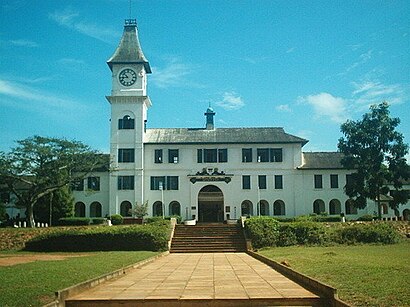
Achimota Address: Golf Street street in Accra
Attractions near Achimota
Aachimota Rubbish Dump,Zoompak Achimota Transfer Station,Weija Junction,Terminal 3,Presbyterian Church Of Ghana, Achimota Logos,Achimota Forest Reserve,Empowerment Worship Centre,Elim Agency,International Deliverance And Prayer Ministry,Saint Paul Anglican Church, Achimota,Stanbic Bank - Achimota,Qowa Clothing Wholesale Outlet 1,King Jasper Haircut Achimota Neoplan,Treet bar and grill,Achimota New Station Police Station,Pig Farm,Rockster's Roofing Systems,Easy Internet Cafe,International Commercial Bank,Kantanka ShowroomHow to get to popular attractions in Accra with public transit
Bluecrest College, Accra,Adabraka Polyclinic (Ridge Hospital OPD), Accra,Neoplan Station, Accra,Ideal College, Accra,Kotoka International Airport Arrival Lounge, Accra,Arena - station, Accra,Kingsby Roundabout, Accra,The Salvation Army - Community 12, Tema,The Honeysuckle (Labone), Accra,Metro Tv, Accra,Tarkwa Ford Station, Accra,Champion Divine Clinic, Accra,University of Ghana-City Campus, Accra,Accra Regional Police Headquarters, Accra,Laterbiokorshie, Accra,Efua Sutherland Children's Park, Accra,Airport Residential Area near National service Secretariat, Accra,Ridge Hospital (Ghana Health Services), Accra,Community 19 , Tema,Tudu Station, AccraGet around Accra by public transit!
Traveling around Accra has never been so easy. See step by step directions as you travel to any attraction, street or major public transit station. View bus and train schedules, arrival times, service alerts and detailed routes on a map, so you know exactly how to get to anywhere in Accra.
When traveling to any destination around Accra use Moovit's Live Directions with Get Off Notifications to know exactly where and how far to walk, how long to wait for your line, and how many stops are left. Moovit will alert you when it's time to get off — no need to constantly re-check whether yours is the next stop.
Wondering how to use public transit in Accra or how to pay for public transit in Accra? Moovit public transit app can help you navigate your way with public transit easily, and at minimum cost. It includes public transit fees, ticket prices, and costs. Looking for a map of Accra public transit lines? Moovit public transit app shows all public transit maps in Accra with all bus routes and stops on an interactive map.
Accra has 1 transit type(s), including: bus, operated by several transit agencies, including AMA Department of Transport