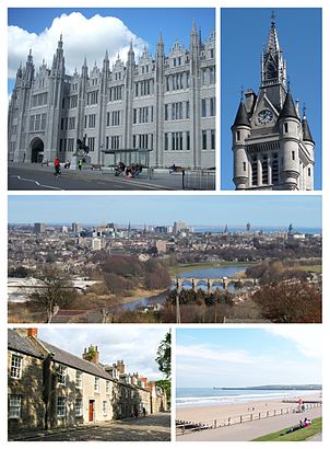
See Aberdeen City on the map
Directions to Aberdeen City with public transportation
The following transport lines have routes that pass near Aberdeen City
Bus:
Train:
How to get to Aberdeen City by Bus?
Click on the Bus route to see step by step directions with maps, line arrival times and updated time schedules.
How to get to Aberdeen City by Train?
Click on the Train route to see step by step directions with maps, line arrival times and updated time schedules.
Bus stations near Aberdeen City
- Mounthooly Roundabout, Causewayend,1 min walk,
- George Street, Aberdeen,5 min walk,
- Advocates' Road, Spital,7 min walk,
{{TRANSIT_TYPE}#Capitalized} routes to Aberdeen City
- 18,Chaleston/Redmoss - Dyce,
- 18A,Chaleston/Redmoss - Dyce,
- 18S,Dyce - Lochside Academy,
- 18S,Lochside Academy - Dyce,
- 23,Heathryfold - Sheddocksley,
- 727,Aberdeen Union Square - Aberdeen Airport,
- 11,Woodend,
- 11A,Northfield,
- X14,Aberdeen,
- X20,Kemnay,
- 20,Old Aberdeen,
What are the nearest stations to Aberdeen City?
The nearest stations to Aberdeen City are:
- Mounthooly Roundabout, Causewayend is 34 meters away, 1 min walk.
- George Street, Aberdeen is 321 meters away, 5 min walk.
- Advocates' Road, Spital is 441 meters away, 7 min walk.
Which Bus lines stop near Aberdeen City?
These Bus lines stop near Aberdeen City: 17, 18, 23, 727, 8
Which Train lines stop near Aberdeen City?
These Train lines stop near Aberdeen City: SCOTRAIL
What’s the nearest bus stop to Aberdeen City?
The nearest bus stop to Aberdeen City is Mounthooly Roundabout, Causewayend. It’s a 1 min walk away.
See Aberdeen City on the map

Public Transportation to Aberdeen City
Wondering how to get to Aberdeen City, United Kingdom? Moovit helps you find the best way to get to Aberdeen City with step-by-step directions from the nearest public transit station.
Moovit provides free maps and live directions to help you navigate through your city. View schedules, routes, timetables, and find out how long does it take to get to Aberdeen City in real time.
Looking for the nearest stop or station to Aberdeen City? Check out this list of stops closest to your destination: Mounthooly Roundabout; George Street; Advocates' Road.
Bus:Train:
Want to see if there’s another route that gets you there at an earlier time? Moovit helps you find alternative routes or times. Get directions from and directions to Aberdeen City easily from the Moovit App or Website.
We make riding to Aberdeen City easy, which is why over 1.5 million users, including users in Aberdeen, trust Moovit as the best app for public transit. You don’t need to download an individual bus app or train app, Moovit is your all-in-one transit app that helps you find the best bus time or train time available.
For information on prices of Bus and Train, costs and ride fares to Aberdeen City, please check the Moovit app.
Use the app to navigate to popular places including to the airport, hospital, stadium, grocery store, mall, coffee shop, school, college, and university.
Aberdeen City Address: Causewayend street in Aberdeen

Attractions near Aberdeen City
- Kwik Fit
- England,George,
- Seaforth Maritime
- Ab2 3tj
- Ab25 3tj
- 24 Canal Road
- Mounthooly Roundabout, Aberdeen
- Transport Club
- Aberdeen Transport Social & Athletic Club
- Arnold Clark Car Rental
- Mounthooly Roundabout
- Drain Centre
- Ab25 3tl
- Causewayend Primary School
- Ab9 2wj
- Ab25 3wj
- Ab2 3tl
- Moir,Hamish,
- Aberdeen Funeral Directors
- Granherne Ltd.
How to get to popular attractions in Aberdeen with public transportation
- The Sir John Moore (Wetherspoon), Glasgow
- Costco Wholesale, Glasgow
- The Queen Elizabeth University Hospital Campus, Glasgow
- Scottish National Gallery, Edinburgh
- Motherwell Railway Station (MTH), Motherwell
- Cathcart Railway Station (CCT), Glasgow
- Glasgow Central Railway Station (GLC), Glasgow
- The Crystal Palace (Wetherspoon), Glasgow
- IKEA, Glasgow
- Fir Park Stadium, Motherwell
- Virgin Active, Glasgow
- Dunfermline, Dunfermline
- The Standing Order (Wetherspoon), Edinburgh
- River Clyde, Glasgow City
- Tynecastle Park, Edinburgh
- O2 ABC, Glasgow
- The Shore, Edinburgh
- Kirkcaldy Bus Station, Kirkcaldy And Dysart
- Hard Rock Cafe Edinburgh, Edinburgh
- Nuffield Health Glasgow Central Fitness & Wellbeing Gym, Glasgow