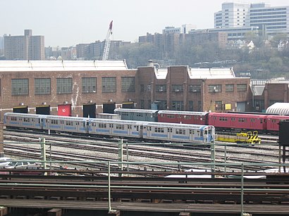
Directions to Coney Island Yard (Brooklyn) with public transportation
The following transit lines have routes that pass near Coney Island Yard
How to get to Coney Island Yard by bus?
Click on the bus route to see step by step directions with maps, line arrival times and updated time schedules.
How to get to Coney Island Yard by subway?
Click on the subway route to see step by step directions with maps, line arrival times and updated time schedules.
Subway stations near Coney Island Yard in Brooklyn
- Avenue X [F], 9 min walk,
- 86 St [N], 14 min walk,
- Coney Island - Stillwell Av [D,F,N,Q], 31 min walk,
What are the closest stations to Coney Island Yard?
The closest stations to Coney Island Yard are:
- Avenue X [F] is 692 yards away, 9 min walk.
- 86 St [N] is 1122 yards away, 14 min walk.
- Coney Island - Stillwell Av [D,F,N,Q] is 2620 yards away, 31 min walk.
Which bus lines stop near Coney Island Yard?
These bus lines stop near Coney Island Yard: B1, B4.
Which subway line stops near Coney Island Yard?
F
What’s the nearest subway station to Coney Island Yard in Brooklyn?
The nearest subway station to Coney Island Yard in Brooklyn is Avenue X [F]. It’s a 9 min walk away.
See Coney Island Yard, Brooklyn, on the map
Public Transit to Coney Island Yard in Brooklyn
Wondering how to get to Coney Island Yard in Brooklyn, United States? Moovit helps you find the best way to get to Coney Island Yard with step-by-step directions from the nearest public transit station.
Moovit provides free maps and live directions to help you navigate through your city. View schedules, routes, timetables, and find out how long does it take to get to Coney Island Yard in real time.
Looking for the nearest stop or station to Coney Island Yard? Check out this list of stops closest to your destination: Avenue X [F]; 86 St [N]; Coney Island - Stillwell Av [D,F,N,Q].
Bus: B1, B4.Subway: F, FX, N, W, D, Q.
Want to see if there’s another route that gets you there at an earlier time? Moovit helps you find alternative routes or times. Get directions from and directions to Coney Island Yard easily from the Moovit App or Website.
We make riding to Coney Island Yard easy, which is why over 1.5 million users, including users in Brooklyn, trust Moovit as the best app for public transit. You don’t need to download an individual bus app or train app, Moovit is your all-in-one transit app that helps you find the best bus time or train time available.
For information on prices of subway and bus, costs and ride fares to Coney Island Yard, please check the Moovit app.
Use the app to navigate to popular places including to the airport, hospital, stadium, grocery store, mall, coffee shop, school, college, and university.
Location: Brooklyn, New York - New Jersey
Attractions near Coney Island Yard
Coney Island Yard - Tower B,MTA - Coney Island Overhaul Shop,Coney Island yard Fire School,MTA C.I. Yard Culver Trailer,MTA Coney Island Mac Center,2556 Shell Road,MAC 5 NYCT,Shell Avenue Z,Shell Rd & Avenue Z,Shell Rd and Ave Z,MTA - Coney Island Yard - (F) Culver Tracks,Gil Hodges Little League Baseball Field,MatchPoint NYC,Mta Stillwell Yard,Ave Y and Shell,Avenue Y and Shell Rd,Shell Rd and Avenue Y,Shell Avenue Y,Match Point Nyc,MTA Coney Island Occupational Safety Training CenterHow to get to popular attractions in Brooklyn with public transit
Astor Place Subway Station, Manhattan,New Yorker A Wyndham Hotel, Manhattan,Gershwin Theatre, Manhattan,Borgata Jitney, Atlantic City, Nj,Brooklyn Public Library,Downtown, Manhattan,United Palace, Manhattan,Fire Island Ferry Terminal, Bay Shore, Ny,Jake's 58 Casino, Islandia, Ny,Nueva York Ciudad de,Bronx Zoo, Bronx,845 Barretto Street, Bronx,Stuyvesant High School, Manhattan,Stone St, Manhattan,American Dream, East Rutherford, Nj,14th St & 6th Ave, Manhattan,Trinity Church, Manhattan,Greene Street, Manhattan,Purchase, NY, Harrison, Ny,Brooklyn Botanic GardenGet around New York - New Jersey by public transit!
Traveling around New York - New Jersey has never been so easy. See step by step directions as you travel to any attraction, street or major public transit station. View bus and train schedules, arrival times, service alerts and detailed routes on a map, so you know exactly how to get to anywhere in New York - New Jersey.
When traveling to any destination around New York - New Jersey use Moovit's Live Directions with Get Off Notifications to know exactly where and how far to walk, how long to wait for your line, and how many stops are left. Moovit will alert you when it's time to get off — no need to constantly re-check whether yours is the next stop.
Wondering how to use public transit in New York - New Jersey or how to pay for public transit in New York - New Jersey? Moovit public transit app can help you navigate your way with public transit easily, and at minimum cost. It includes public transit fees, ticket prices, and costs. Looking for a map of New York - New Jersey public transit lines? Moovit public transit app shows all public transit maps in New York - New Jersey with all Bus, Train, Subway, Light Rail, Ferry and Cable Car routes and stops on an interactive map.
New York - New Jersey has 6 transit type(s), including: Bus, Train, Subway, Light Rail, Ferry and Cable Car, operated by several transit agencies, including MTA Subway, Metro-North Railroad, LIRR, PATH, Shore Line East, MTA Bus Company, MTA New York City Transit - Express routes, MTA Bus, NJ Transit, NYC Ferry, NICE bus, Bee-Line Bus, NJ Transit Rail, Norwalk Transit District, CTTransit - Waterbury-Meriden