Directions to Hilton Baltimore with public transportation
The following transit lines have routes that pass near Hilton Baltimore
How to get to Hilton Baltimore by bus?
Click on the bus route to see step by step directions with maps, line arrival times and updated time schedules.
Bus stops near Hilton Baltimore
- Eutaw St. - Camden Yards (Eb), 1 min walk,
- Greene St & Lombard St Sb FS, 1 min walk,
- Paca St & Lombard St Nb FS, 2 min walk,
- Pratt St & Howard St, 3 min walk,
- Russell St & Camden St Nb, 3 min walk,
- Lombard St & Eutaw St, 3 min walk,
- Lombard St & Eutaw St FS Wb, 3 min walk,
- Howard St & Pratt St Ns (Convention Center), 3 min walk,
- Howard St & Pratt St FS Nb, 4 min walk,
Light Rail stations near Hilton Baltimore
- University Center / Baltimore St., 6 min walk,
Metro stations near Hilton Baltimore
- Charles Center Metro, 8 min walk,
Train stations near Hilton Baltimore
- Camden Station, 10 min walk,
Bus lines to Hilton Baltimore
- ORANGE ROUTE, Jewish Museum Of Maryland (Wb),
- 210, 210/5 Kent Island,
- 215, 215/2 Annapolis,
- 73, Wagner's Point,
- CITYLINK BROWN, Um Medical Center,
- CITYLINK NAVY, Medical Center,
- CITYLINK YELLOW, Mondawmin Metro,
- 54, Carney Park & Ride,
- 76, Downtown Via Crossroads,
- 94, Downtown,
- 154, Carney,
- 163, Tradepoint Atlantic,
- 703, Federal Hill- Students Only,
- 69, Patapsco Station - Jumpers Hole,
- 70, Patapsco Station - Annapolis,
- 75, Patapsco Station - Arundel Mills,
- 704, Canton/Fells Point- Students Only,
- 310, 310/8 Columbia Mall,
- 320, 320/3 Snowden River Park & Ride,
- 410, 410/4 Centreville - Bel Air,
What are the closest stations to Hilton Baltimore?
The closest stations to Hilton Baltimore are:
- Eutaw St. - Camden Yards (Eb) is 32 yards away, 1 min walk.
- Greene St & Lombard St Sb FS is 69 yards away, 1 min walk.
- Paca St & Lombard St Nb FS is 115 yards away, 2 min walk.
- Pratt St & Howard St is 156 yards away, 3 min walk.
- Russell St & Camden St Nb is 164 yards away, 3 min walk.
- Lombard St & Eutaw St is 180 yards away, 3 min walk.
- Lombard St & Eutaw St FS Wb is 180 yards away, 3 min walk.
- Howard St & Pratt St Ns (Convention Center) is 186 yards away, 3 min walk.
- Howard St & Pratt St FS Nb is 218 yards away, 4 min walk.
- University Center / Baltimore St. is 428 yards away, 6 min walk.
- Charles Center Metro is 584 yards away, 8 min walk.
- Camden Station is 797 yards away, 10 min walk.
Which bus lines stop near Hilton Baltimore?
These bus lines stop near Hilton Baltimore: 154, 73, 78, 94, CITYLINK NAVY, ORANGE ROUTE.
Which light rail line stops near Hilton Baltimore?
LIGHT RAIL
What’s the nearest light rail station to Hilton Baltimore?
The nearest light rail station to Hilton Baltimore is University Center / Baltimore St.. It’s a 6 min walk away.
What’s the nearest metro station to Hilton Baltimore?
The nearest metro station to Hilton Baltimore is Charles Center Metro. It’s a 8 min walk away.
What’s the nearest train station to Hilton Baltimore?
The nearest train station to Hilton Baltimore is Camden Station. It’s a 10 min walk away.
What’s the nearest bus stop to Hilton Baltimore?
The nearest bus stops to Hilton Baltimore are Eutaw St. - Camden Yards (Eb) and Greene St & Lombard St Sb FS. The closest one is a 1 min walk away.
What time is the first light rail to Hilton Baltimore?
The LIGHT RAIL is the first light rail that goes to Hilton Baltimore. It stops nearby at 4:03 AM.
What time is the last light rail to Hilton Baltimore?
The LIGHT RAIL is the last light rail that goes to Hilton Baltimore. It stops nearby at 1:17 AM.
What time is the first metro to Hilton Baltimore?
The METRO is the first metro that goes to Hilton Baltimore. It stops nearby at 5:09 AM.
What time is the last metro to Hilton Baltimore?
The METRO is the last metro that goes to Hilton Baltimore. It stops nearby at 12:25 AM.
What time is the first train to Hilton Baltimore?
The MARC is the first train that goes to Hilton Baltimore. It stops nearby at 5:00 AM.
What time is the last train to Hilton Baltimore?
The MARC is the last train that goes to Hilton Baltimore. It stops nearby at 8:55 PM.
What time is the first bus to Hilton Baltimore?
The 75 is the first bus that goes to Hilton Baltimore. It stops nearby at 3:08 AM.
What time is the last bus to Hilton Baltimore?
The CITYLINK YELLOW is the last bus that goes to Hilton Baltimore. It stops nearby at 3:20 AM.
See Hilton Baltimore on the map
Public Transportation to Hilton Baltimore
Wondering how to get to Hilton Baltimore, United States? Moovit helps you find the best way to get to Hilton Baltimore with step-by-step directions from the nearest public transit station.
Moovit provides free maps and live directions to help you navigate through your city. View schedules, routes, timetables, and find out how long does it take to get to Hilton Baltimore in real time.
Looking for the nearest stop or station to Hilton Baltimore? Check out this list of stops closest to your destination: Eutaw St. - Camden Yards (Eb); Greene St & Lombard St Sb FS; Paca St & Lombard St Nb FS; Pratt St & Howard St; Russell St & Camden St Nb; Lombard St & Eutaw St; Lombard St & Eutaw St FS Wb; Howard St & Pratt St Ns (Convention Center); Howard St & Pratt St FS Nb; University Center / Baltimore St.; Charles Center Metro; Camden Station.
Bus: 154, 73, 78, 94, CITYLINK NAVY, ORANGE ROUTE, 210, 215, 704.Train: MARC.Metro: METRO.Light Rail: LIGHT RAIL.
Want to see if there’s another route that gets you there at an earlier time? Moovit helps you find alternative routes or times. Get directions from and directions to Hilton Baltimore easily from the Moovit App or Website.
We make riding to Hilton Baltimore easy, which is why over 1.5 million users, including users in Baltimore, trust Moovit as the best app for public transit. You don’t need to download an individual bus app or train app, Moovit is your all-in-one transit app that helps you find the best bus time or train time available.
For information on prices of bus and light rail, costs and ride fares to Hilton Baltimore, please check the Moovit app.
Use the app to navigate to popular places including to the airport, hospital, stadium, grocery store, mall, coffee shop, school, college, and university.
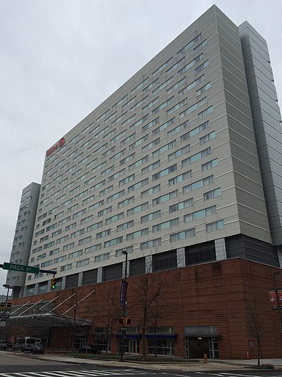
Hilton Baltimore Address: 401 W Pratt St (at Eutaw St) street in Baltimore
Attractions near Hilton Baltimore
Baltimore Casino Rentals,Asap Site Services of Baltimore,Flash,Hilton Baltimore Convention Center,Pratt St S Eutaw St,Eutaw Street,Concierge Lounge at Marriott Inner Harbor Camden Yards,W Camden S Eutaw St,Marriot-Baltimore Ner Harbor at Camden Yards,Section 771,Tang Garland - Tang, Garland MD,Alghamdi Salem - Alghamdi, Salem MD,Bach Hannah - Bach, Hannah MD,Leiter Nikita - Leiter, Nikita MD,Vedrana Hodzic, MD,Pickles Pub,Oriole Park At Camden Yards,Baltimore Marriott Inner Harbor at Camden Yards,Adt Security,Camden YardsHow to get to popular attractions in Baltimore with public transit
National City Christian Church, Washington,Rome Building - Johns Hopkins SAIS, Washington,Cooks Lane, Baltimore,Carver Vo-Tech High School, Baltimore,Broken Land Park & Ride, Howard County,St. Casimir Catholic Church, Baltimore,Park Potomac Place, Montgomery County,Oak Hill, VA, Fairfax County,Mason F. Lord Building - Johns Hopkins Bayview, Baltimore,U.S. Customs And Border Protection (CBP), Washington,Fannie Mae, Fairfax County,Wilde Lake High School, Howard County,Edmondson High School, Baltimore,Parkdale High School, Prince George's County,Federal Reserve Board, Washington,National Gallery Of Art, Washington,Fairchild Building, Washington,I-95 Exit 55 (Key Hwy), Baltimore,U.S. 301 Park and Ride, Charles County,Busboys And Poets - Takoma, WashingtonGet around Washington, D.C. - Baltimore, MD by public transit!
Traveling around Washington, D.C. - Baltimore, MD has never been so easy. See step by step directions as you travel to any attraction, street or major public transit station. View bus and train schedules, arrival times, service alerts and detailed routes on a map, so you know exactly how to get to anywhere in Washington, D.C. - Baltimore, MD.
When traveling to any destination around Washington, D.C. - Baltimore, MD use Moovit's Live Directions with Get Off Notifications to know exactly where and how far to walk, how long to wait for your line, and how many stops are left. Moovit will alert you when it's time to get off — no need to constantly re-check whether yours is the next stop.
Wondering how to use public transit in Washington, D.C. - Baltimore, MD or how to pay for public transit in Washington, D.C. - Baltimore, MD? Moovit public transit app can help you navigate your way with public transit easily, and at minimum cost. It includes public transit fees, ticket prices, and costs. Looking for a map of Washington, D.C. - Baltimore, MD public transit lines? Moovit public transit app shows all public transit maps in Washington, D.C. - Baltimore, MD with all Bus, Train, Metro, Light Rail and Ferry routes and stops on an interactive map.
Washington, D.C. - Baltimore, MD has 5 transit type(s), including: Bus, Train, Metro, Light Rail and Ferry, operated by several transit agencies, including WMATA, Montgomery County Ride On, Montgomery County MD Ride On, Fairfax Connector, TheBus, PRTC, DC Circulator, DASH - Alexandria, Arlington Transit (ART), DC Streetcar, RTA of Central Maryland, FRED, MDOT MTA, Marc, Virginia Railway Express (VRE)