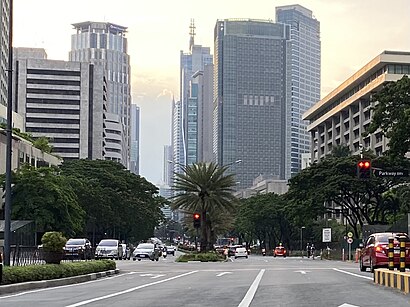
Directions to Ayala Avenue (Makati City) with public transportation
The following transit lines have routes that pass near Ayala Avenue
How to get to Ayala Avenue by bus?
Click on the bus route to see step by step directions with maps, line arrival times and updated time schedules.
How to get to Ayala Avenue by train?
Click on the train route to see step by step directions with maps, line arrival times and updated time schedules.
Bus stops near Ayala Avenue in Makati City
- Ayala Ave, Makati City, Manila, 3 min walk,
- Senator Gil Puyat Ave, Makati City, 5 min walk,
- Dela Rosa Street / Don Chino Roces Avenue Intersection, Makati City, 6 min walk,
- Del Rosa Street, Makati City, 6 min walk,
- V.A. Rufino St / Don Chino Roces Avenue Intersection, Makati City, 7 min walk,
- Kamagong / Sacred Heart St, Makati City, Manila, 10 min walk,
Train stations near Ayala Avenue in Makati City
- Buendia Pnr, 20 min walk,
- Ayala Mrt, 23 min walk,
Bus lines to Ayala Avenue in Makati City
- BUS, Grotto - Baclaran via Commonwealth Ave, Ayala,
- BUS, SM Fairview Ayala Leveriza via EDSA,
- BUS, Baclaran-Malanday viaEDSA, McArthur, Ayala,
- BUS, Baclaran Navotas via Ayala,
- BUS, Baclaran-Navotas Terminal via Edsa Ayala,
- BUS, Ayala Quiapo via Kamagong Taft,
- BUS, Asturias-Ayala via Buendia Ave, Taft Ave,
- BUS, Monumento Philcite via Ayala EDSA,
- BUS, Taguig - SM Fairview via Lagro Ayala Buendia EDSA,
- BUS, Grotto - NAIA via EDSA, Ayala, Buendia Extn,
- BUS, Leveriza Monumento,
- BUS, San Mateo - Baclaran via EDSA, Ayala, Commonwealth Ave,
- BUS, Baclaran - SM Fairview via Lagro, Ayala,
- BUS, Baclaran - Montalban via EDSA,
- BUS, Sta Maria - Baclaran NLEX EDSA,
- BUS, Ayala Grotto (SJDM) via Leveriza,
- BUS, Baclaran-Nvaliches via EDSA Mind AveAyala,
- JEEP, Ayala - Washington,
- JEEP, AYALA - ZAPOTE RD,
- JEEP, GUADALUPE IBABAW - AYALA,
What are the closest stations to Ayala Avenue?
The closest stations to Ayala Avenue are:
- Ayala Ave, Makati City, Manila is 209 meters away, 3 min walk.
- Senator Gil Puyat Ave, Makati City is 338 meters away, 5 min walk.
- Dela Rosa Street / Don Chino Roces Avenue Intersection, Makati City is 417 meters away, 6 min walk.
- Del Rosa Street, Makati City is 459 meters away, 6 min walk.
- V.A. Rufino St / Don Chino Roces Avenue Intersection, Makati City is 489 meters away, 7 min walk.
- Kamagong / Sacred Heart St, Makati City, Manila is 743 meters away, 10 min walk.
- Buendia Pnr is 1515 meters away, 20 min walk.
- Ayala Mrt is 1774 meters away, 23 min walk.
Which bus lines stop near Ayala Avenue?
These bus lines stop near Ayala Avenue: BUS, JEEP.
Which train line stops near Ayala Avenue?
PNR MC
What’s the nearest train station to Ayala Avenue in Makati City?
The nearest train station to Ayala Avenue in Makati City is Buendia Pnr. It’s a 20 min walk away.
What’s the nearest bus stop to Ayala Avenue in Makati City?
The nearest bus stop to Ayala Avenue in Makati City is Ayala Ave, Makati City, Manila. It’s a 3 min walk away.
What time is the first train to Ayala Avenue in Makati City?
The MRT3 is the first train that goes to Ayala Avenue in Makati City. It stops nearby at 5:17 AM.
What time is the last train to Ayala Avenue in Makati City?
The PNR MC is the last train that goes to Ayala Avenue in Makati City. It stops nearby at 1:13 AM.
What time is the first bus to Ayala Avenue in Makati City?
The BUS is the first bus that goes to Ayala Avenue in Makati City. It stops nearby at 3:00 AM.
What time is the last bus to Ayala Avenue in Makati City?
The BUS is the last bus that goes to Ayala Avenue in Makati City. It stops nearby at 4:08 AM.
See Ayala Avenue, Makati City, on the map
Public Transit to Ayala Avenue in Makati City
How to get to Ayala Avenue in Makati City, Philippines?
It’s easy with Moovit. Type in your street address and Moovit’s route finder will locate the fastest way to get you there! Not sure where to get off on the street? Download the Moovit App to find live directions (including where to get off on Ayala Avenue), see timetables and get the estimated arrival times for your favorite bus or train lines.
Looking for the nearest stop or station to Ayala Avenue? Check out this list of closest stops available to your destination: Ayala Ave; Senator Gil Puyat Ave; Dela Rosa Street / Don Chino Roces Avenue Intersection; Del Rosa Street; V.A. Rufino St / Don Chino Roces Avenue Intersection; Kamagong / Sacred Heart St; Buendia Pnr; Ayala Mrt.
Bus: BUS, JEEP.Train: PNR MC, MRT3.
Download the Moovit App to see the current schedule and routes available for Makati City. No need to install a special bus app to check the bus time or a train app to get train time. Moovit is the only all-in-one transit app that helps you get where you need to go.
We make riding on public transit to Ayala Avenue easy, which is why over 1.5 million users, including users in Makati City trust Moovit as the best app for public transit.
Use the app to navigate to popular places including to the airport, hospital, stadium, grocery store, mall, coffee shop, school, college, and university.
Location: Makati City, Manila
Streets near Ayala Avenue, Makati City
Senator Gil Puyat Avenue, Makati City,Urban Avenue, Makati City,H. V. Dela Costa Street, Makati City,Rcbc Plaza, Makati City,Emergency Lane, Makati City,Geronimo, Makati City,Salcedo Street, Makati City,Tindalo Street, Makati City,Valero Access Road 4, Makati City,Zuellig Loop, Makati City,Dela Rosa Access Road 3, Makati City,Dela Rosa, Makati City,Ayala Avenue Extension, Makati City,Talisay St, Makati City,L.P. Leviste, Makati City,Sotto Street, Makati City,Bagtikan Street, Makati City,L. P. Leviste Street, Makati City,Bolanos Street, Makati City,Esteban Street, Makati CityGet around Manila by public transit!
Traveling around Manila has never been so easy. See step by step directions as you travel to any attraction, street or major public transit station. View bus and train schedules, arrival times, service alerts and detailed routes on a map, so you know exactly how to get to anywhere in Manila.
When traveling to any destination around Manila use Moovit's Live Directions with Get Off Notifications to know exactly where and how far to walk, how long to wait for your line, and how many stops are left. Moovit will alert you when it's time to get off — no need to constantly re-check whether yours is the next stop.
Wondering how to use public transit in Manila or how to pay for public transit in Manila? Moovit public transit app can help you navigate your way with public transit easily, and at minimum cost. It includes public transit fees, ticket prices, and costs. Looking for a map of Manila public transit lines? Moovit public transit app shows all public transit maps in Manila with all Bus and Train routes and stops on an interactive map.
Manila has 2 transit type(s), including: Bus and Train, operated by several transit agencies, including MRTC, LRTA, PNR, LTFRB, BGC Bus, P2P, UV Express