
大埔區 Public Transit Trip Planner

See 大埔區 on the map

Directions to 大埔區 with public transportation

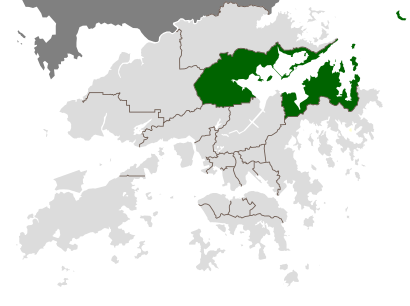
The following transit lines have routes that pass near 大埔區

  • BusBus:
  • SubwaySubway:

How to get to 大埔區 by Bus?

Click on the Bus route to see step by step directions with maps, line arrival times and updated time schedules.

How to get to 大埔區 by Subway?

Click on the Subway route to see step by step directions with maps, line arrival times and updated time schedules.

Bus stations near 大埔區

  • 大埔墟站 Tai Po Market Station,2 min walk,
  • 大埔墟站專線小巴總站 Tai Po Market Station Minibus Terminus,2 min walk,
  • 大埔墟站小巴總站 Tai Po Market Station Plb Terminus,2 min walk,
  • 新達廣場 Uptown Plaza,2 min walk,
  • 大埔墟站巴士總站 Tai Po Market Station B/T,3 min walk,
  • 南運路, 新達廣場外 Nam Wan Road, Outside Uptown Plaza,4 min walk,
  • 廣福道, 王肇枝中學外 Kwong Fuk Road, Outside Wong Shiu Chi Secondary School,6 min walk,
  • 王肇枝中學 Wong Shiu Chi Secondary School,7 min walk,
  • 大埔運頭角里 Wan Tau Kok Lane Tai Po,9 min walk,

Subway stations near 大埔區

  • 太和 Tai Wo,14 min walk,

Bus lines to 大埔區

  • NR59,大埔墟(循環線) Tai Po Market (Circular),
  • 20A,大埔墟站專線小巴總站 Tai Po Market Station - 雅麗氏何妙齡那打素醫院 Tai Po Nethersole Hospital (Cirular),
  • 20B,大埔墟站 Tai Po Market Station - 洞梓 Tung Tsz,
  • 20C,大埔墟站 Tai Po Market Station - 大美督 Tai Mei Tuk,
  • 20E,大埔墟站 Tai Po Market Station - 山寮(循環線) Shan Liu (Circular),
  • 20G,黃魚灘(樂善村) Wong Yue Tan (Lok Sin Village) - 大埔墟站 Tai Po Market Station,
  • 20K,大埔墟站 Tai Po Market Station - 三門仔 Sam Mum Tsai,
  • 20P,鳳園 Fung Yuen - 大埔墟站(循環線) Tai Po Market Station (Circular),
  • 20R,大埔墟站 Tai Po Market Station - 烏蛟騰 Wu Kau Tang,
  • 20S,馬窩 Ma Wo - 大埔墟(循環線) Tai Po Market (Circular),
  • 20T,大埔墟站 Tai Po Market Station - 慈山寺 Tsz Shan Monastery,
  • 20X,大埔墟站專線小巴總站 Tai Po Market Station - 雅麗氏何妙齡那打素醫院 Tai Po Nethersole Hospital,
  • 23K,新屋家 San Uk Ka - 大埔墟 Tai Po Market (Circular),
  • 23S,大埔墟站專線小巴總站 Tai Po Market - 打鐵屻通路 Ta Tit Yan,
  • 28K,大埔墟站 Tai Po Market Station - 沙田(白鶴汀街)(循環線) Sha Tin (Pak Hok Ting Street)(Circular),
  • A47X,機場 Airport,
  • 72C,大埔墟站 Tai Po Market Station,
  • NR532,大埔墟站(循環線) Tai Po Market Station(Cir),
  • K12,大埔墟站 Tai Po Market Station - 八號花園 Eightland Gardens,
  • K14,大埔中心 Tai Po Central - 大埔墟站 Tai Po Market Station,
Questions & Answers
  • What are the closest stations to 大埔區?

    The closest stations to 大埔區 are:

    • 大埔墟站 Tai Po Market Station is 67 meters away, 2 min walk.
    • 大埔墟站專線小巴總站 Tai Po Market Station Minibus Terminus is 86 meters away, 2 min walk.
    • 大埔墟站小巴總站 Tai Po Market Station Plb Terminus is 100 meters away, 2 min walk.
    • 新達廣場 Uptown Plaza is 100 meters away, 2 min walk.
    • 大埔墟站巴士總站 Tai Po Market Station B/T is 151 meters away, 3 min walk.
    • 南運路, 新達廣場外 Nam Wan Road, Outside Uptown Plaza is 195 meters away, 4 min walk.
    • 廣福道, 王肇枝中學外 Kwong Fuk Road, Outside Wong Shiu Chi Secondary School is 430 meters away, 6 min walk.
    • 王肇枝中學 Wong Shiu Chi Secondary School is 445 meters away, 7 min walk.
    • 大埔運頭角里 Wan Tau Kok Lane Tai Po is 583 meters away, 9 min walk.
    • 太和 Tai Wo is 1021 meters away, 14 min walk.
  • Which Bus lines stop near 大埔區?

    These Bus lines stop near 大埔區: 20C, 64K, 72, 73X, W3

  • Which Subway lines stop near 大埔區?

    These Subway lines stop near 大埔區: 東鐵綫 EAST RAIL LINE

  • What’s the nearest subway station to 大埔區?

    The nearest subway station to 大埔區 is 太和 Tai Wo. It’s a 14 min walk away.

  • What’s the nearest bus stop to 大埔區?

    The nearest bus stops to 大埔區 are 大埔墟站 Tai Po Market Station, 大埔墟站專線小巴總站 Tai Po Market Station Minibus Terminus, 大埔墟站小巴總站 Tai Po Market Station Plb Terminus and 新達廣場 Uptown Plaza. The closest one is a 2 min walk away.

  • What time is the first Subway to 大埔區?

    The 東鐵綫 EAST RAIL LINE is the first Subway that goes to 大埔區. It stops nearby at 5:48 AM.

  • What time is the last Subway to 大埔區?

    The 東鐵綫 EAST RAIL LINE is the last Subway that goes to 大埔區. It stops nearby at 12:33 AM.

  • What time is the first Bus to 大埔區?

    The N271 is the first Bus that goes to 大埔區. It stops nearby at 3:00 AM.

  • What time is the last Bus to 大埔區?

    The 20C is the last Bus that goes to 大埔區. It stops nearby at 2:13 AM.

  • How much is the Subway fare to 大埔區?

    The Subway fare to 大埔區 costs about $3.90 - $50.80.

  • How much is the Bus fare to 大埔區?

    The Bus fare to 大埔區 costs about $5.00 - $11.10.

See 大埔區 on the map

The Most Popular Urban Mobility App in Hong Kong.
All local mobility options in one app

Public Transportation to 大埔區

Wondering how to get to 大埔區, Hong Kong? Moovit helps you find the best way to get to 大埔區 with step-by-step directions from the nearest public transit station.

Moovit provides free maps and live directions to help you navigate through your city. View schedules, routes, timetables, and find out how long does it take to get to 大埔區 in real time.

Looking for the nearest stop or station to 大埔區? Check out this list of stops closest to your destination: 大埔墟站 Tai Po Market Station; 大埔墟站專線小巴總站 Tai Po Market Station Minibus Terminus; 大埔墟站小巴總站 Tai Po Market Station Plb Terminus; 新達廣場 Uptown Plaza; 大埔墟站巴士總站 Tai Po Market Station B/T; 南運路; 廣福道; 王肇枝中學 Wong Shiu Chi Secondary School; 大埔運頭角里 Wan Tau Kok Lane Tai Po; 太和 Tai Wo.

Bus:Subway:

Want to see if there’s another route that gets you there at an earlier time? Moovit helps you find alternative routes or times. Get directions from and directions to 大埔區 easily from the Moovit App or Website.

We make riding to 大埔區 easy, which is why over 1.5 million users, including users in Hong Kong, trust Moovit as the best app for public transit. You don’t need to download an individual bus app or train app, Moovit is your all-in-one transit app that helps you find the best bus time or train time available.

For information on prices of Bus and Subway, costs and ride fares to 大埔區, please check the Moovit app.

Use the app to navigate to popular places including to the airport, hospital, stadium, grocery store, mall, coffee shop, school, college, and university.

Location: Hong Kong

大埔區
大埔區Tai Po District is one of the 18 districts of Hong Kong. The suburban district covers the areas of Tai Po New Town (including areas such as Tai Po Market, Tai Po Old Market, Tai Po Industrial Estate, Tai Wo Estate), Tai Po Tau, Tai Po Kau, Hong Lok Yuen, Ting Kok, Plover Cove, Lam Tsuen Valley, Tai Mei Tuk and other surrounding areas, and its exclaves Sai Kung North, in the northern part of the Sai Kung Peninsula and including islands such as Grass Island (Tap Mun), and Ping Chau (Tung Ping Chau). Tai Po proper and Sai Kung North are divided by the Tolo Channel and the Tolo Harbour (Tai Po Hoi). The district is located in the Eastern New Territories. The de facto administrative centre of the district is Tai Po New Town. Like Yuen Long, the area of Tai Po used to be a traditional market town. Tai Po New Town, a satellite town, developed around the area of Tai Po and on reclaimed land on the estuaries of Lam Tsuen and Tai Po rivers. It had a population of 310,879 in 2001. The district has the third lowest population density in Hong Kong.
How to get to 大埔區 with public transit - About the place

Public transit lines with stations closest to 大埔區

Subway lines with stations closest to 大埔區

Bus lines with stations closest to 大埔區

Easier to get to 大埔區 in…