Directions to Lake Arbor with public transportation
The following transit lines have routes that pass near Lake Arbor
How to get to Lake Arbor by bus?
Click on the bus route to see step by step directions with maps, line arrival times and updated time schedules.
How to get to Lake Arbor by metro?
Click on the metro route to see step by step directions with maps, line arrival times and updated time schedules.
Bus stops near Lake Arbor
- Campus Way North & Lake Arbor Way, 3 min walk,
Bus lines to Lake Arbor
- C26, West To Downtown Largo,
What are the closest stations to Lake Arbor?
The closest stations to Lake Arbor are:
- Campus Way North & Lake Arbor Way is 196 yards away, 3 min walk.
Which bus lines stop near Lake Arbor?
These bus lines stop near Lake Arbor: 21X, C26.
Which metro line stops near Lake Arbor?
METRORAIL SILVER LINE
What’s the nearest bus stop to Lake Arbor?
The nearest bus stop to Lake Arbor is Campus Way North & Lake Arbor Way. It’s a 3 min walk away.
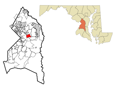
See Lake Arbor on the map
Public Transportation to Lake Arbor
Wondering how to get to Lake Arbor, United States? Moovit helps you find the best way to get to Lake Arbor with step-by-step directions from the nearest public transit station.
Moovit provides free maps and live directions to help you navigate through your city. View schedules, routes, timetables, and find out how long does it take to get to Lake Arbor in real time.
Looking for the nearest stop or station to Lake Arbor? Check out this list of stops closest to your destination: Campus Way North & Lake Arbor Way.
Bus: 21X, C26.Metro: METRORAIL SILVER LINE.
Want to see if there’s another route that gets you there at an earlier time? Moovit helps you find alternative routes or times. Get directions from and directions to Lake Arbor easily from the Moovit App or Website.
We make riding to Lake Arbor easy, which is why over 1.5 million users, including users in Lake Arbor, trust Moovit as the best app for public transit. You don’t need to download an individual bus app or train app, Moovit is your all-in-one transit app that helps you find the best bus time or train time available.
For information on prices of bus and metro, costs and ride fares to Lake Arbor, please check the Moovit app.
Use the app to navigate to popular places including to the airport, hospital, stadium, grocery store, mall, coffee shop, school, college, and university.
Lake Arbor Address: Bowie street in Lake Arbor
Attractions near Lake Arbor
Hair Salon By Lake Arbor,Willie J Winfree DDS,Pretty Lady Pole Fit,Lake Arbor KinderCare,Orthodontist,Papa John's Pizza,Sell State Realty,Cooke Your,Lake Arbor Dental,Allure Salon,Galinno PC's,Dr David Harmon Orthodontics,Levi's Soul Food,Only nails,Lake Arbor Nails,Levi's Enterprise,Harmon Orthodontics,Thairapy Hair Studio,Dr Norman McKoy,Dr Asek MakiaHow to get to popular attractions in Lake Arbor with public transit
The Foundry Building, Washington,National Gallery Of Art, Washington,Rome Building - Johns Hopkins SAIS, Washington,Woodlawn High School, Baltimore County,I-95 Exit 55 (Key Hwy), Baltimore,Northrop Grumman Square 1, Anne Arundel County,St. Andrews Episcopal School, Montgomery County,Oxon Hill High School, Prince George's County,Soundcheck, Washington,BGE - W Fayette St, Baltimore,U.S. Customs And Border Protection (CBP), Washington,War Memorial Plaza, Baltimore,Humanities Building - CCBC Catonsville, Baltimore County,Cherry Hill, Baltimore,Fairchild Building, Washington,Northwestern High School, Prince George's County,Mason F. Lord Building - Johns Hopkins Bayview, Baltimore,Dirty Habit, Washington,La Chaumiere, Washington,Burleith, WashingtonGet around Washington, D.C. - Baltimore, MD by public transit!
Traveling around Washington, D.C. - Baltimore, MD has never been so easy. See step by step directions as you travel to any attraction, street or major public transit station. View bus and train schedules, arrival times, service alerts and detailed routes on a map, so you know exactly how to get to anywhere in Washington, D.C. - Baltimore, MD.
When traveling to any destination around Washington, D.C. - Baltimore, MD use Moovit's Live Directions with Get Off Notifications to know exactly where and how far to walk, how long to wait for your line, and how many stops are left. Moovit will alert you when it's time to get off — no need to constantly re-check whether yours is the next stop.
Wondering how to use public transit in Washington, D.C. - Baltimore, MD or how to pay for public transit in Washington, D.C. - Baltimore, MD? Moovit public transit app can help you navigate your way with public transit easily, and at minimum cost. It includes public transit fees, ticket prices, and costs. Looking for a map of Washington, D.C. - Baltimore, MD public transit lines? Moovit public transit app shows all public transit maps in Washington, D.C. - Baltimore, MD with all Bus, Train, Metro, Light Rail and Ferry routes and stops on an interactive map.
Washington, D.C. - Baltimore, MD has 5 transit type(s), including: Bus, Train, Metro, Light Rail and Ferry, operated by several transit agencies, including WMATA, Montgomery County Ride On, Montgomery County MD Ride On, Fairfax Connector, TheBus, PRTC, DC Circulator, DASH - Alexandria, Arlington Transit (ART), DC Streetcar, RTA of Central Maryland, FRED, MDOT MTA, Marc, Virginia Railway Express (VRE)