
Find the best routes to Makati Avenue, Makati City

See Makati Avenue, Makati City, on the map

Directions to Makati Avenue (Makati City) with public transportation

The following transit lines have routes that pass near Makati Avenue

  • BusBus:
  • TrainTrain:

How to get to Makati Avenue by Bus?

Click on the Bus route to see step by step directions with maps, line arrival times and updated time schedules.

How to get to Makati Avenue by Train?

Click on the Train route to see step by step directions with maps, line arrival times and updated time schedules.

Bus stations near Makati Avenue in Makati City

  • Ayala Center,3 min walk,
  • Makati Ave / A. Arnaiz Ave, Makati City, Manila,4 min walk,
  • Makati Ave / Ayala Avenue Intersection, Makati City, Manila,7 min walk,
  • Ayala Uv Express Terminal,8 min walk,
  • Greenbelt 5,9 min walk,
  • Greenbelt 1,9 min walk,
  • Ayala Ave, Makati City, Manila,10 min walk,
  • Landmark Makati,11 min walk,
  • Makati Circuit Lane,11 min walk,
  • Glorietta 3,11 min walk,

Train stations near Makati Avenue in Makati City

  • Magellanes Mrt,6 min walk,
  • Edsa Pnr,7 min walk,

Bus lines to Makati Avenue in Makati City

  • JEEP,Salcedo, Makati City,
  • UV,Pasig,
  • UV,Festival Mall/Alabang,
  • P2P,Naia Terminal 3,
  • JEEP,AYALA - ZAPOTE RD,
  • JEEP,PATEROS - AYALA,
  • JEEP,Ayala - Mantrade via Pasong Tamo,
  • JEEP,AYALA LANDMARK - PUREGOLD,
  • JEEP,Libertad - Pasay Rd.,
  • JEEP,Ayala - Pateros via J.P. Rizal,
  • BUS,Asturias-Ayala via Buendia Ave, Taft Ave,
  • BUS,Baclaran - SM Fairview via Lagro, Ayala,
  • BUS,Baclaran - Montalban via EDSA,
  • BUS,Monumento Philcite via Ayala EDSA,
  • BUS,Sta Maria - Baclaran NLEX EDSA,
  • BUS,Baclaran-Nvaliches via EDSA Mind AveAyala,
  • BUS,Taguig - SM Fairview via Lagro Ayala Buendia EDSA,
  • BUS,Baclaran-Navotas Terminal via Edsa Ayala,
  • BUS,Malanday Term - NAIA viaEDSA, Buendia, Ayala,
  • BUS,Grotto - Baclaran via Commonwealth Ave, Ayala,
Questions & Answers
  • What are the closest stations to Makati Avenue?

    The closest stations to Makati Avenue are:

    • Ayala Center is 216 meters away, 3 min walk.
    • Makati Ave / A. Arnaiz Ave, Makati City, Manila is 306 meters away, 4 min walk.
    • Makati Ave / Ayala Avenue Intersection, Makati City, Manila is 457 meters away, 7 min walk.
    • Magellanes Mrt is 459 meters away, 6 min walk.
    • Edsa Pnr is 490 meters away, 7 min walk.
    • Ayala Uv Express Terminal is 600 meters away, 8 min walk.
    • Greenbelt 5 is 635 meters away, 9 min walk.
    • Greenbelt 1 is 679 meters away, 9 min walk.
    • Landmark Makati is 760 meters away, 11 min walk.
    • Makati Circuit Lane is 778 meters away, 11 min walk.
    • Ayala Ave, Makati City, Manila is 779 meters away, 10 min walk.
    • Glorietta 3 is 851 meters away, 11 min walk.
  • Which Bus lines stop near Makati Avenue?

    These Bus lines stop near Makati Avenue: BUS, JEEP, P2P, UV

  • Which Train lines stop near Makati Avenue?

    These Train lines stop near Makati Avenue: PNR MC

  • What’s the nearest train station to Makati Avenue in Makati City?

    The nearest train station to Makati Avenue in Makati City is Magellanes Mrt. It’s a 6 min walk away.

  • What’s the nearest bus stop to Makati Avenue in Makati City?

    The nearest bus stop to Makati Avenue in Makati City is Ayala Center. It’s a 3 min walk away.

  • What time is the first Train to Makati Avenue in Makati City?

    The MRT3 is the first Train that goes to Makati Avenue in Makati City. It stops nearby at 5:17 AM.

  • What time is the last Train to Makati Avenue in Makati City?

    The PNR MC is the last Train that goes to Makati Avenue in Makati City. It stops nearby at 1:07 AM.

  • What time is the first Bus to Makati Avenue in Makati City?

    The BUS is the first Bus that goes to Makati Avenue in Makati City. It stops nearby at 3:01 AM.

  • What time is the last Bus to Makati Avenue in Makati City?

    The BUS is the last Bus that goes to Makati Avenue in Makati City. It stops nearby at 4:01 AM.

See Makati Avenue, Makati City, on the map

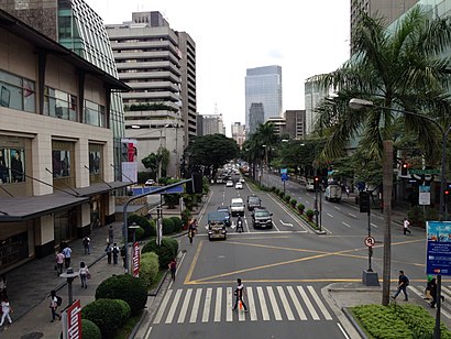
The Most Popular Urban Mobility App in Makati City.
All local mobility options in one app

Public Transit to Makati Avenue in Makati City

How to get to Makati Avenue in Makati City, Philippines?

It’s easy with Moovit. Type in your street address and Moovit’s route finder will locate the fastest way to get you there! Not sure where to get off on the street? Download the Moovit App to find live directions (including where to get off on Makati Avenue), see timetables and get the estimated arrival times for your favorite Bus or Train lines.

Looking for the nearest stop or station to Makati Avenue? Check out this list of closest stops available to your destination: Ayala Center; Makati Ave / A. Arnaiz Ave; Makati Ave / Ayala Avenue Intersection; Magellanes Mrt; Edsa Pnr; Ayala Uv Express Terminal; Greenbelt 5; Greenbelt 1; Landmark Makati; Makati Circuit Lane; Ayala Ave; Glorietta 3.

Bus:Train:

Download the Moovit App to see the current schedule and routes available for Makati City. No need to install a special bus app to check the bus time or a train app to get train time. Moovit is the only all-in-one transit app that helps you get where you need to go.

We make riding on public transit to Makati Avenue easy, which is why over 1.5 million users, including users in Makati City trust Moovit as the best app for public transit.

Use the app to navigate to popular places including to the airport, hospital, stadium, grocery store, mall, coffee shop, school, college, and university.

Location: Makati City, Manila

Makati Avenue, Makati City
Makati Avenue, Makati CityMakati Avenue (Filipino: Abenida Makati) is a major commercial thoroughfare in Makati, Metro Manila, Philippines. It forms the eastern border of Ayala Triangle and is one of the three main avenues of the Makati Central Business District. The avenue runs in a somewhat north–south diagonal direction almost parallel with Epifanio de los Santos Avenue (EDSA). It passes through two distinct neighborhoods of the city: the Makati CBD and the old Makati Población. At its northern end lies the older part of Makati starting from J.P. Rizal Avenue. It continues through Población to Gil Puyat Avenue, marking the southern edge of the old district. South of Gil Puyat onto the CBD, the avenue becomes more commercial and upscale. The shopping hub of Ayala Center and Arnaiz Avenue lie at its southern end. Makati Avenue has two lanes each way in the Poblacion area, widening to three or four in the CBD. It has a short extension into the gated San Lorenzo Village as San Lorenzo Drive.
How to get to Makati Avenue with public transit - About the place

Public transit lines with stations closest to Makati Avenue in Makati City

Train lines with stations closest to Makati Avenue in Makati City

Bus lines with stations closest to Makati Avenue in Makati City

Easier to get to Makati Avenue in…