Directions to City Of Lake Elsinore with public transportation
The following transit lines have routes that pass near City Of Lake Elsinore
How to get to City Of Lake Elsinore by bus?
Click on the bus route to see step by step directions with maps, line arrival times and updated time schedules.
Bus stops near City Of Lake Elsinore
- Spring FS Graham, 3 min walk,
Bus lines to City Of Lake Elsinore
- 8, Clckws to Wildomar & Lake Elsinore,
What are the closest stations to City Of Lake Elsinore?
The closest stations to City Of Lake Elsinore are:
- Spring FS Graham is 191 yards away, 3 min walk.
Which bus lines stop near City Of Lake Elsinore?
These bus lines stop near City Of Lake Elsinore: 8, 9.
What’s the nearest bus stop to City Of Lake Elsinore?
The nearest bus stop to City Of Lake Elsinore is Spring FS Graham. It’s a 3 min walk away.
What time is the first bus to City Of Lake Elsinore?
The 8 is the first bus that goes to City Of Lake Elsinore. It stops nearby at 6:15 AM.
What time is the last bus to City Of Lake Elsinore?
The 8 is the last bus that goes to City Of Lake Elsinore. It stops nearby at 7:26 PM.
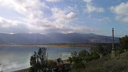
See City Of Lake Elsinore on the map
Public Transportation to City Of Lake Elsinore
Wondering how to get to City Of Lake Elsinore, United States? Moovit helps you find the best way to get to City Of Lake Elsinore with step-by-step directions from the nearest public transit station.
Moovit provides free maps and live directions to help you navigate through your city. View schedules, routes, timetables, and find out how long does it take to get to City Of Lake Elsinore in real time.
Looking for the nearest stop or station to City Of Lake Elsinore? Check out this list of stops closest to your destination: Spring FS Graham.
Bus: 8, 9.
Want to see if there’s another route that gets you there at an earlier time? Moovit helps you find alternative routes or times. Get directions from and directions to City Of Lake Elsinore easily from the Moovit App or Website.
We make riding to City Of Lake Elsinore easy, which is why over 1.5 million users, including users in Lake Elsinore, trust Moovit as the best app for public transit. You don’t need to download an individual bus app or train app, Moovit is your all-in-one transit app that helps you find the best bus time or train time available.
For information on prices of bus and train, costs and ride fares to City Of Lake Elsinore, please check the Moovit app.
Use the app to navigate to popular places including to the airport, hospital, stadium, grocery store, mall, coffee shop, school, college, and university.
Location: Lake Elsinore, Los Angeles
Popular routes to City Of Lake Elsinore
Attractions near City Of Lake Elsinore
Lake Elsinore, California,Rush Flooring Services,True Life Ministries,Water Heaters and More,Ieldc,Hale Insurance & Financial Solutions,Village Wood Shoppe,Pachanga Indian Casino,Cabalo Gerry MD,Starbucks,Cambern & Central Investors,Hallowseve Haunted House Lake Elsinore,One Jiu Jitsu,Knott's Berry Farm,Lake Elsinore Casino,Cmi Transportation,Socal Websites,Visionary Design Services,Rosetta Canyon Sports Park,Tasty TacosHow to get to popular attractions in Lake Elsinore with public transit
Friendship Auditorium, Griffith Park, La,Loma Linda Academy, Loma Linda,Walmart, San Buenaventura (Ventura),St John's Pleasant Valley Hospital, Camarillo,Theo Lacy Jail Facility, Orange,Baja Ranch Market, Covina,915 Wilshire, Downtown, La,Boysen Park, Anaheim,Sunset Boulevard & Alvarado Street, Echo Park, La,Megabus L.A. Union Station, Downtown, La,Santa Monica And Fairfax, West Hollywood,Florence And Crenshaw, Hyde Park, La,The Vitamin Shoppe, Pasadena,El Mercadito del Este, Boyle Heights, La,Savanna High School, Anaheim,I-210 at Azusa Ave, Azusa,Kaiser Permanente Diamond Bar Medical Offices, Diamond Bar,Valley View High School, Moreno Valley,Rancho Park DPSS, Sawtelle, La,Wilshire/Alvarado Metro Stop, Westlake, LaGet around Los Angeles by public transit!
Traveling around Los Angeles has never been so easy. See step by step directions as you travel to any attraction, street or major public transit station. View bus and train schedules, arrival times, service alerts and detailed routes on a map, so you know exactly how to get to anywhere in Los Angeles.
When traveling to any destination around Los Angeles use Moovit's Live Directions with Get Off Notifications to know exactly where and how far to walk, how long to wait for your line, and how many stops are left. Moovit will alert you when it's time to get off — no need to constantly re-check whether yours is the next stop.
Wondering how to use public transit in Los Angeles or how to pay for public transit in Los Angeles? Moovit public transit app can help you navigate your way with public transit easily, and at minimum cost. It includes public transit fees, ticket prices, and costs. Looking for a map of Los Angeles public transit lines? Moovit public transit app shows all public transit maps in Los Angeles with all Bus, Train, Subway, Light Rail, Ferry and Funicular routes and stops on an interactive map.
Los Angeles has 6 transit type(s), including: Bus, Train, Subway, Light Rail, Ferry and Funicular, operated by several transit agencies, including Metro - Los Angeles, Metrolink Trains, METRO, Long Beach Transit, LADOT, OCTA, Foothill Transit, Big Blue Bus, Riverside Transit Agency, LAX FlyAway, Airporter Shuttle, Playa Vista Shuttle, Amtrak, OMNITRANS, Pasadena Transit