See 寶蓮寺, 香港島 Islands, on the map
Directions to 寶蓮寺 (香港島 Islands) with public transportation
The following transit lines have routes that pass near 寶蓮寺
 Bus:
Bus: - Cable Car:
How to get to 寶蓮寺 by bus?
Click on the bus route to see step by step directions with maps, line arrival times and updated time schedules.
Bus stations near 寶蓮寺 in 香港島 Islands
- 昂坪市集 Ngong Ping Village,6 min walk,
- 昂坪 Ngong Ping,9 min walk,
Cable Car stations near 寶蓮寺 in 香港島 Islands
- 昂坪 Ngong Ping,10 min walk,
Bus lines to 寶蓮寺 in 香港島 Islands
- 21,昂坪 Ngong Ping,
- 23,東涌達東路 Tung Chung Tat Tung Road,
- 1R,昂平 Ngong Ping,
- 2,昂坪 Ngong Ping,
What are the closest stations to 寶蓮寺?
The closest stations to 寶蓮寺 are:
- 昂坪市集 Ngong Ping Village is 396 meters away, 6 min walk.
- 昂坪 Ngong Ping is 650 meters away, 9 min walk.
Which bus line stops near 寶蓮寺?
23
What’s the nearest bus stop to 寶蓮寺 in 香港島 Islands?
The nearest bus stop to 寶蓮寺 in 香港島 Islands is 昂坪市集 Ngong Ping Village. It’s a 6 min walk away.
What’s the nearest cable car station to 寶蓮寺 in 香港島 Islands?
The nearest cable car station to 寶蓮寺 in 香港島 Islands is 昂坪 Ngong Ping. It’s a 10 min walk away.
What time is the first bus to 寶蓮寺 in 香港島 Islands?
The 21 is the first bus that goes to 寶蓮寺 in 香港島 Islands. It stops nearby at 7:30 AM.
What time is the last bus to 寶蓮寺 in 香港島 Islands?
The 23 is the last bus that goes to 寶蓮寺 in 香港島 Islands. It stops nearby at 7:10 PM.
What time is the first cable car to 寶蓮寺 in 香港島 Islands?
The 昂坪360 is the first cable car that goes to 寶蓮寺 in 香港島 Islands. It stops nearby at 10:00 AM.
What time is the last cable car to 寶蓮寺 in 香港島 Islands?
The 昂坪360 is the last cable car that goes to 寶蓮寺 in 香港島 Islands. It stops nearby at 6:04 PM.
How much is the bus fare to 寶蓮寺?
The bus fare to 寶蓮寺 costs about $3.70 - $19.60.
See 寶蓮寺, 香港島 Islands, on the map
Public Transit to 寶蓮寺 in 香港島 Islands
Wondering how to get to 寶蓮寺 in 香港島 Islands, Hong Kong? Moovit helps you find the best way to get to 寶蓮寺 with step-by-step directions from the nearest public transit station.
Moovit provides free maps and live directions to help you navigate through your city. View schedules, routes, timetables, and find out how long does it take to get to 寶蓮寺 in real time.
Looking for the nearest stop or station to 寶蓮寺? Check out this list of stops closest to your destination: 昂坪市集 Ngong Ping Village; 昂坪 Ngong Ping.
Bus:Cable Car:
Want to see if there’s another route that gets you there at an earlier time? Moovit helps you find alternative routes or times. Get directions from and directions to 寶蓮寺 easily from the Moovit App or Website.
We make riding to 寶蓮寺 easy, which is why over 1.5 million users, including users in 香港島 Islands, trust Moovit as the best app for public transit. You don’t need to download an individual bus app or train app, Moovit is your all-in-one transit app that helps you find the best bus time or train time available.
For information on prices of bus, costs and ride fares to 寶蓮寺, please check the Moovit app.
Use the app to navigate to popular places including to the airport, hospital, stadium, grocery store, mall, coffee shop, school, college, and university.
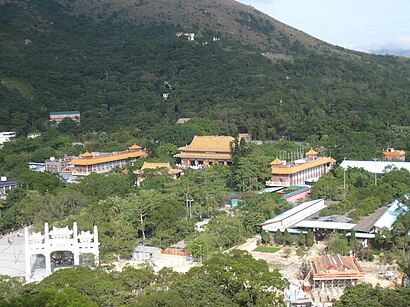
寶蓮寺 Address: 香港大嶼山昂平昂平路寶蓮寺 street in 香港島 Islands
Attractions near 寶蓮寺
筏可療養院,寶蓮禪寺,大雄寶殿 Hall Of Great Hero,Po Lin Monastery,寶蓮寺小食亭,志致蓮若,淨悟林,Wayglory Corporation L,昂坪大佛停車場,龍輝士多 Lung Fai Store,Burger Cafe,寶蓮禪寺華嚴塔 Po Lin Monastery Hua Yan Pagoda,Chopstick Gallery,大嶼山昂坪,昂坪戴維斯青年旅舍 Ngong Ping S. G. Davis Youth Hostel,竹林淨苑,寶蓮禪寺 Po Lin Monastery,昂平路公廁 Ngong Ping Road Public Toilet,Lotus Pond Temple 池蓮寺,Nong Ping Big BuddhaHow to get to popular attractions in 香港島 Islands with public transit
Aji Ichiban 優の良品, 香港島 Islands,海洋公园, 南區 Southern,Green Green Club 綠色會所, 荃灣 Tsuen Wan,廉政公署總部, 東區 Eastern,Evergreen Hotel 萬年青酒店, 油尖旺 Yau Tsim Mong,Asia Golf Club 亞洲高爾夫球會, 深水埗 Sham Shui Po,Chip and Dale Rehearsal Hall,Facesss, 油尖旺 Yau Tsim Mong,9GAG HQ, 荃灣 Tsuen Wan,JD Mall 佐敦薈, 油尖旺 Yau Tsim Mong,SK Beach Club 海灣會, 西貢 Sai Kung,Wellcome Superstore 惠康超級廣場, 沙田 Sha Tin,馬家莊清真館, 油尖旺 Yau Tsim Mong,Pixel Magic Systems Ltd,Pacific Place, 中西區 Central And Western,置地廣塲, 中西區 Central And Western,龍寶酒家, 深水埗 Sham Shui Po,旦王花, 元朗 Yuen Long,星光大道, 油尖旺 Yau Tsim Mong,翠華餐廳, 香港島 IslandsGet around 香港島 Islands by public transit!
Traveling around 香港島 Islands has never been so easy. See step by step directions as you travel to any attraction, street or major public transit station. View bus and train schedules, arrival times, service alerts and detailed routes on a map, so you know exactly how to get to anywhere in 香港島 Islands.
When traveling to any destination around 香港島 Islands use Moovit's Live Directions with Get Off Notifications to know exactly where and how far to walk, how long to wait for your line, and how many stops are left. Moovit will alert you when it's time to get off — no need to constantly re-check whether yours is the next stop.
Wondering how to use public transit in 香港島 Islands or how to pay for public transit in 香港島 Islands? Moovit public transit app can help you navigate your way with public transit easily, and at minimum cost. It includes public transit fees, ticket prices, and costs. Looking for a map of 香港島 Islands public transit lines? Moovit public transit app shows all public transit maps in 香港島 Islands with all bus routes and stops on an interactive map.
香港島 Islands has 1 transit type(s), including: bus, operated by several transit agencies, including 港鐵 MTR, 港鐵 MTR, 天星小輪 Star Ferry, 九巴 KMB, 城巴 Citybus, 城巴機場快線 Cityflyer, 龍運巴士 LWB, 九巴 KMB / 城巴 CTB, 龍運巴士 LWB / 城巴 CTB, 新大嶼山巴士 NLB, 愉景灣巴士 DB, 香港電車 Hong Kong Tramways, 港鐵 MTR, 香港中文大學 The Chinese University of Hong Kong and 港島區專線小巴 GMB HK Island