See 明雅苑, 大埔 Tai Po, on the map
Directions to 明雅苑 (大埔 Tai Po) with public transportation
The following transit lines have routes that pass near 明雅苑
 Bus:
Bus: - Subway:
How to get to 明雅苑 by bus?
Click on the bus route to see step by step directions with maps, line arrival times and updated time schedules.
How to get to 明雅苑 by subway?
Click on the subway route to see step by step directions with maps, line arrival times and updated time schedules.
Bus stations near 明雅苑 in 大埔 Tai Po
- 新興花園 Sun Hing Garden,4 min walk,
- 富善邨 Fu Shin Estate,4 min walk,
- 大埔中心第五期 Tai Po Central Phase 5,4 min walk,
- 怡雅苑 Yee Nga Court,5 min walk,
- 大埔海濱公園 Tai Po Waterfront Park,6 min walk,
- 南運路, 近廣智樓 Nam Wan Road, Near Kwong Chi House,7 min walk,
- 廣福邨廣智樓 Kwong Chi House Kwong Fuk Estate,7 min walk,
Subway stations near 明雅苑 in 大埔 Tai Po
- 大埔墟 Tai Po Market,17 min walk,
Bus lines to 明雅苑 in 大埔 Tai Po
- 20P,鳳園 Fung Yuen - 大埔墟站(循環線) Tai Po Market Station (Circular),
- 20X,大埔墟站專線小巴總站 Tai Po Market Station - 雅麗氏何妙齡那打素醫院 Tai Po Nethersole Hospital,
- 24,大埔 (富蝶邨) Tai Po (Fu Tip Estate) - 大埔 (廣福道) (循環線) Tai Po (Kwong Fuk Road) (Circular),
- 26,香港教育大學 THE EDUCATION UNIVERSITY OF HONG KONG - 馬鞍山海栢花園 Bayshore Towers, Ma On Shan,
- 26A,香港教育大學 THE EDUCATION UNIVERSITY OF HONG KONG - 大埔墟(廣福道) (循環線) TAI PO MARKET (KWONG FUK ROAD) (CIRCULAR),
- 502,大埔那打素醫院 Tai Pon Nethersole Hospital - 清河邨 Ching Ho Estate,
- A47X,大埔(太和) Tai Po (Tai Wo) - 機場 Airport,
- NA47,機場/港珠澳大橋香港口岸 Airport / HZMB Hong Kong Port - 大埔(太和) Tai Po (Tai Wo),
- 71A,富亨 Fu Heng - 大埔墟站 Tai Po Market Station,
- 71K,太和 Tai Wo - 大埔墟站 Tai Po Market Station,
- 71S,富善邨 Fu Shin Estate - 廣福邨(循環線) Kwong Fuk Estate (Circular),
- 72C,大美督 Tai Mei Tuk - 大埔墟站 Tai Po Market Station,
- 73,粉嶺(華明) Fanling (Wah Ming) - 大埔工業邨 / 大埔中心 Tai Po Ind. Estate / Tai Po Central,
- 73P,大美督 Tai Mei Tuk - 荃灣(如心廣場) Tsuen Wan (Nina Tower),
- 74C,九龍坑 Kau Lung Hang - 觀塘碼頭 Kwun Tong Ferry,
- 74P,觀塘碼頭 Kwun Tong Ferry - 大埔中心 Tai Po Central,
- 307A,大埔頭 Tai Po Tau - 上環 Sheung Wan,
- 307P,大埔(汀太路) Tai Po (Ting Tai Road) - 銅鑼灣(天后) Causeway Bay (Tin Hau),
- 907C,大埔頭 Tai Po Tau - 灣仔(會展) / 金鐘站 Wan Chai (HKCEC) / Admiralty Station,
- K17,大埔墟站 Tai Po Market Station,
What are the closest stations to 明雅苑?
The closest stations to 明雅苑 are:
- 新興花園 Sun Hing Garden is 251 meters away, 4 min walk.
- 富善邨 Fu Shin Estate is 279 meters away, 4 min walk.
- 大埔中心第五期 Tai Po Central Phase 5 is 290 meters away, 4 min walk.
- 怡雅苑 Yee Nga Court is 313 meters away, 5 min walk.
- 大埔海濱公園 Tai Po Waterfront Park is 452 meters away, 6 min walk.
- 南運路, 近廣智樓 Nam Wan Road, Near Kwong Chi House is 518 meters away, 7 min walk.
- 廣福邨廣智樓 Kwong Chi House Kwong Fuk Estate is 526 meters away, 7 min walk.
- 大埔墟 Tai Po Market is 1240 meters away, 17 min walk.
Which bus lines stop near 明雅苑?
These bus lines stop near 明雅苑: 20P, 26, 502, 72, 73X, 75K.
Which subway line stops near 明雅苑?
東鐵綫 EAST RAIL LINE
What’s the nearest subway station to 明雅苑 in 大埔 Tai Po?
The nearest subway station to 明雅苑 in 大埔 Tai Po is 大埔墟 Tai Po Market. It’s a 17 min walk away.
What’s the nearest bus stop to 明雅苑 in 大埔 Tai Po?
The nearest bus stops to 明雅苑 in 大埔 Tai Po are 新興花園 Sun Hing Garden, 富善邨 Fu Shin Estate and 大埔中心第五期 Tai Po Central Phase 5. The closest one is a 4 min walk away.
What time is the first subway to 明雅苑 in 大埔 Tai Po?
The 東鐵綫 EAST RAIL LINE is the first subway that goes to 明雅苑 in 大埔 Tai Po. It stops nearby at 5:47 AM.
What time is the last subway to 明雅苑 in 大埔 Tai Po?
The 東鐵綫 EAST RAIL LINE is the last subway that goes to 明雅苑 in 大埔 Tai Po. It stops nearby at 1:07 AM.
What time is the first bus to 明雅苑 in 大埔 Tai Po?
The N271 is the first bus that goes to 明雅苑 in 大埔 Tai Po. It stops nearby at 3:14 AM.
What time is the last bus to 明雅苑 in 大埔 Tai Po?
The N271 is the last bus that goes to 明雅苑 in 大埔 Tai Po. It stops nearby at 3:46 AM.
How much is the subway fare to 明雅苑?
The subway fare to 明雅苑 costs about $4.80 - $50.80.
How much is the bus fare to 明雅苑?
The bus fare to 明雅苑 costs about $5.00 - $14.40.
See 明雅苑, 大埔 Tai Po, on the map
Public Transit to 明雅苑 in 大埔 Tai Po
Wondering how to get to 明雅苑 in 大埔 Tai Po, Hong Kong? Moovit helps you find the best way to get to 明雅苑 with step-by-step directions from the nearest public transit station.
Moovit provides free maps and live directions to help you navigate through your city. View schedules, routes, timetables, and find out how long does it take to get to 明雅苑 in real time.
Looking for the nearest stop or station to 明雅苑? Check out this list of stops closest to your destination: 新興花園 Sun Hing Garden; 富善邨 Fu Shin Estate; 大埔中心第五期 Tai Po Central Phase 5; 怡雅苑 Yee Nga Court; 大埔海濱公園 Tai Po Waterfront Park; 南運路; 廣福邨廣智樓 Kwong Chi House Kwong Fuk Estate; 大埔墟 Tai Po Market.
Bus:Subway:
Want to see if there’s another route that gets you there at an earlier time? Moovit helps you find alternative routes or times. Get directions from and directions to 明雅苑 easily from the Moovit App or Website.
We make riding to 明雅苑 easy, which is why over 1.5 million users, including users in 大埔 Tai Po, trust Moovit as the best app for public transit. You don’t need to download an individual bus app or train app, Moovit is your all-in-one transit app that helps you find the best bus time or train time available.
For information on prices of bus and subway, costs and ride fares to 明雅苑, please check the Moovit app.
Use the app to navigate to popular places including to the airport, hospital, stadium, grocery store, mall, coffee shop, school, college, and university.
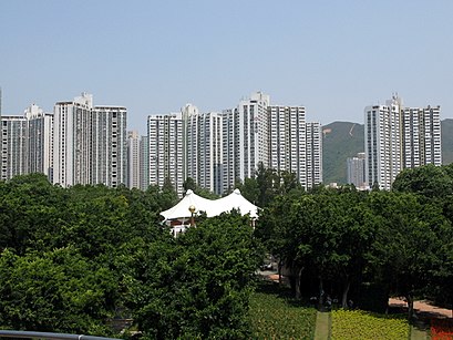
明雅苑 Address: 明雅苑 大埔区, 新界 street in 大埔 Tai Po
Attractions near 明雅苑
新界北總區警察總部,大埔電話機房 Tai Po Telephone Exchange,PCCW TPC Site,報案室-大埔分區警署,明雅苑停車場 Ming Nga Court Car,新界北總區警察總部 New Territories North Regional Police Headquarters,明雅苑 Ming Nga Court,基督教香港崇真會安仁幼兒學校,創奇教育中心,明雅苑停車場,善鄰樓,大埔區警察總部暨大埔警署,大埔警署 Tai Po Police Station,善鄰樓 Shin Lun House,富善邨善美樓,新興商場 Sun Hing Shopping Mall,富善邨社區會堂,富善郵政局 Fu Shin Post Office,新興商場,新興花園 Sun Hing GardenHow to get to popular attractions in 大埔 Tai Po with public transit
香辣軒, 南區 Southern,美麗華商場, 油尖旺 Yau Tsim Mong,The Peak, 中西區 Central And Western,Hysan Place, 灣仔 Wan Chai,田舍屋, 油尖旺 Yau Tsim Mong,Stanley Market, 南區 Southern,Ammo Restaurant & Bar, 中西區 Central And Western,Isquare, 油尖旺 Yau Tsim Mong,Lotus Café 榮昌茶座, 北區 North,Jadewater 南灣御園, 南區 Southern,Starbucks 星巴克, 南區 Southern,小白鷺餐廳, 大埔 Tai Po,旦王花, 元朗 Yuen Long,Saizeriya 薩莉亞, 黃大仙 Wong Tai Sin,NVIDIA Hong Kong,K11, 油尖旺 Yau Tsim Mong,浚湖樓,新城市广场, 沙田 Sha Tin,Avenue Of Stars, 油尖旺 Yau Tsim Mong,廉政公署總部, 東區 EasternGet around 大埔 Tai Po by public transit!
Traveling around 大埔 Tai Po has never been so easy. See step by step directions as you travel to any attraction, street or major public transit station. View bus and train schedules, arrival times, service alerts and detailed routes on a map, so you know exactly how to get to anywhere in 大埔 Tai Po.
When traveling to any destination around 大埔 Tai Po use Moovit's Live Directions with Get Off Notifications to know exactly where and how far to walk, how long to wait for your line, and how many stops are left. Moovit will alert you when it's time to get off — no need to constantly re-check whether yours is the next stop.
Wondering how to use public transit in 大埔 Tai Po or how to pay for public transit in 大埔 Tai Po? Moovit public transit app can help you navigate your way with public transit easily, and at minimum cost. It includes public transit fees, ticket prices, and costs. Looking for a map of 大埔 Tai Po public transit lines? Moovit public transit app shows all public transit maps in 大埔 Tai Po with all bus or subway routes and stops on an interactive map.
大埔 Tai Po has 2 transit type(s), including: bus or subway, operated by several transit agencies, including 港鐵 MTR, 港鐵 MTR, 天星小輪 Star Ferry, 九巴 KMB, 城巴 Citybus, 城巴機場快線 Cityflyer, 龍運巴士 LWB, 九巴 KMB / 城巴 CTB, 龍運巴士 LWB / 城巴 CTB, 新大嶼山巴士 NLB, 愉景灣巴士 DB, 香港電車 Hong Kong Tramways, 港鐵 MTR, 香港中文大學 The Chinese University of Hong Kong and 港島區專線小巴 GMB HK Island