The Most Popular Urban Mobility App in 東區 Eastern.
All local mobility options in one app
The following transit lines have routes that pass near 歌連臣角火葬場
Click on the bus route to see step by step directions with maps, line arrival times and updated time schedules.
Click on the subway route to see step by step directions with maps, line arrival times and updated time schedules.
The closest stations to 歌連臣角火葬場 are:
These bus lines stop near 歌連臣角火葬場: 14, 9, 筲箕灣 - 石澳/大浪灣
These subway lines stop near 歌連臣角火葬場: 港島綫 ISLAND LINE
The nearest subway station to 歌連臣角火葬場 in 東區 Eastern is 柴灣 Chai Wan. It’s a 18 min walk away.
The nearest bus stop to 歌連臣角火葬場 in 東區 Eastern is 歌連臣角 Cape Collinson. It’s a 4 min walk away.
The 港島綫 ISLAND LINE is the first subway that goes to 歌連臣角火葬場 in 東區 Eastern. It stops nearby at 5:55 AM.
The 港島綫 ISLAND LINE is the last subway that goes to 歌連臣角火葬場 in 東區 Eastern. It stops nearby at 1:21 AM.
The 16X is the first bus that goes to 歌連臣角火葬場 in 東區 Eastern. It stops nearby at 5:34 AM.
The 43M is the last bus that goes to 歌連臣角火葬場 in 東區 Eastern. It stops nearby at 1:24 AM.
The bus fare to 歌連臣角火葬場 costs about $3.50 - $12.10.
The subway fare to 歌連臣角火葬場 costs about $4.80 - $15.30.
Wondering how to get to 歌連臣角火葬場 in 東區 Eastern, Hong Kong? Moovit helps you find the best way to get to 歌連臣角火葬場 with step-by-step directions from the nearest public transit station.
Moovit provides free maps and live directions to help you navigate through your city. View schedules, routes, timetables, and find out how long does it take to get to 歌連臣角火葬場 in real time.
Looking for the nearest stop or station to 歌連臣角火葬場? Check out this list of stops closest to your destination: 歌連臣角 Cape Collinson; 大潭峽 Tai Tam Gap; 石澳道 Shek O Rd.; 峰華邨 Fung Wah Estate; 峰霞道; 柴灣 Chai Wan.
Bus:Subway:
Want to see if there’s another route that gets you there at an earlier time? Moovit helps you find alternative routes or times. Get directions from and directions to 歌連臣角火葬場 easily from the Moovit App or Website.
We make riding to 歌連臣角火葬場 easy, which is why over 1.5 million users, including users in 東區 Eastern, trust Moovit as the best app for public transit. You don’t need to download an individual bus app or train app, Moovit is your all-in-one transit app that helps you find the best bus time or train time available.
For information on prices of bus and subway, costs and ride fares to 歌連臣角火葬場, please check the Moovit app.
Use the app to navigate to popular places including to the airport, hospital, stadium, grocery store, mall, coffee shop, school, college, and university.
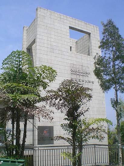
歌連臣角火葬場 Address: 9 Cape Collinson Rd street in 東區 Eastern
Traveling around 東區 Eastern has never been so easy. See step by step directions as you travel to any attraction, street or major public transit station. View bus and train schedules, arrival times, service alerts and detailed routes on a map, so you know exactly how to get to anywhere in 東區 Eastern.
When traveling to any destination around 東區 Eastern use Moovit's Live Directions with Get Off Notifications to know exactly where and how far to walk, how long to wait for your line, and how many stops are left. Moovit will alert you when it's time to get off — no need to constantly re-check whether yours is the next stop.
Wondering how to use public transit in 東區 Eastern or how to pay for public transit in 東區 Eastern? Moovit public transit app can help you navigate your way with public transit easily, and at minimum cost. It includes public transit fees, ticket prices, and costs. Looking for a map of 東區 Eastern public transit lines? Moovit public transit app shows all public transit maps in 東區 Eastern with all bus or subway routes and stops on an interactive map.
東區 Eastern has 2 transit type(s), including: bus or subway, operated by several transit agencies, including 港鐵 MTR, 港鐵 MTR, 天星小輪 Star Ferry, 九巴 KMB, 城巴 Citybus, 城巴機場快線 Cityflyer, 龍運巴士 LWB, 九巴 KMB / 城巴 CTB, 龍運巴士 LWB / 城巴 CTB, 新大嶼山巴士 NLB, 愉景灣巴士 DB, 香港電車 Hong Kong Tramways, 港鐵 MTR, 香港中文大學 The Chinese University of Hong Kong and 港島區專線小巴 GMB HK Island