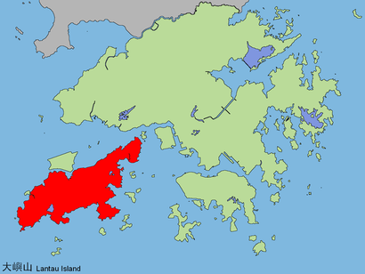
See 爛頭營, 香港島 Islands, on the map
Directions to 爛頭營 (香港島 Islands) with public transportation
The following transit lines have routes that pass near 爛頭營
 Bus:
Bus:
How to get to 爛頭營 by bus?
Click on the bus route to see step by step directions with maps, line arrival times and updated time schedules.
Bus stations near 爛頭營 in 香港島 Islands
- 伯公坳 Pak Kung Au,31 min walk,
- 羅屋村 Lo Uk Tsuen,42 min walk,
- 女青年會梁紹榮度假村 Ywca Sydney Leong Holiday Lodge,58 min walk,
Bus lines to 爛頭營 in 香港島 Islands
- 3M,東涌站(經北大嶼山醫院) Tung Chung Station (Via N Lantau Hospital),
- 11,東涌站(沙咀開出,經塘福懲教所) Tung Chung Station (From Sha Tsui, Via Tong Fuk Corr Inst),
- 11A,東涌站 Tung Chung Station,
- 11R,東涌站 Tung Chung Station,
- X11R,東涌世茂喜來登酒店 Sheraton Hong Kong Tung Chung Hotel,
- 23,東涌達東路 Tung Chung Tat Tung Road,
- A35,梅窩 Mui Wo,
- N35,機場/港珠澳大橋香港口岸 Airport / Hzmb Hong Kong Port,
- 1,大澳(經塘福懲教所) Tai O (Via Tong Fuk Corr Inst),
- 2,昂坪 Ngong Ping,
- 4,梅窩碼頭 Mui Wo Ferry Pier,
- N1,大澳 Tai O,
What are the closest stations to 爛頭營?
The closest stations to 爛頭營 are:
- 伯公坳 Pak Kung Au is 2410 meters away, 31 min walk.
- 羅屋村 Lo Uk Tsuen is 3250 meters away, 42 min walk.
- 女青年會梁紹榮度假村 Ywca Sydney Leong Holiday Lodge is 4490 meters away, 58 min walk.
Which bus lines stop near 爛頭營?
These bus lines stop near 爛頭營: 11, 23, 3M, A35.
See 爛頭營, 香港島 Islands, on the map
Public Transit to 爛頭營 in 香港島 Islands
Wondering how to get to 爛頭營 in 香港島 Islands, Hong Kong? Moovit helps you find the best way to get to 爛頭營 with step-by-step directions from the nearest public transit station.
Moovit provides free maps and live directions to help you navigate through your city. View schedules, routes, timetables, and find out how long does it take to get to 爛頭營 in real time.
Looking for the nearest stop or station to 爛頭營? Check out this list of stops closest to your destination: 伯公坳 Pak Kung Au; 羅屋村 Lo Uk Tsuen; 女青年會梁紹榮度假村 Ywca Sydney Leong Holiday Lodge.
Bus:
Want to see if there’s another route that gets you there at an earlier time? Moovit helps you find alternative routes or times. Get directions from and directions to 爛頭營 easily from the Moovit App or Website.
We make riding to 爛頭營 easy, which is why over 1.5 million users, including users in 香港島 Islands, trust Moovit as the best app for public transit. You don’t need to download an individual bus app or train app, Moovit is your all-in-one transit app that helps you find the best bus time or train time available.
For information on prices of bus and subway, costs and ride fares to 爛頭營, please check the Moovit app.
Use the app to navigate to popular places including to the airport, hospital, stadium, grocery store, mall, coffee shop, school, college, and university.
爛頭營 Address: 大東山,大嶼山 street in 香港島 Islands
Attractions near 爛頭營
鳳凰徑2段,大東山,凤凰径,Islands Area,離島區,Southern District,Islands District,1,二东山,离岛区,大東山,Tai Tung Shan,Dadong Shan,大东山,Sheung Tung Au,大东山,黃龍坑郊遊徑,Lin Fa Shan,蓮花山,Sichuan Back GardenHow to get to popular attractions in 香港島 Islands with public transit
Avon Mall 碧湖商場, 北區 North,Watami 和民居食屋, 香港島 Islands,一粥麵,黃埔新天地, 九龍 Kowloon City,Saizeriya 薩莉亞, 黃大仙 Wong Tai Sin,Times Square, 灣仔 Wan Chai,麥當勞, 大埔 Tai Po,KFC 肯德基, 黃大仙 Wong Tai Sin,花見月,Kau To Shan 九肚山, 沙田 Sha Tin,Ming Kee Seafood Restaurant 明記海鮮酒家, 香港島 Islands,Lotus Café 榮昌茶座, 北區 North,海王漁港, 沙田 Sha Tin,Facesss, 油尖旺 Yau Tsim Mong,Kubrick Café, 油尖旺 Yau Tsim Mong,Pacific Coffee 太平洋咖啡, 南區 Southern,Pacific Coffee 太平洋咖啡, 中西區 Central And Western,Aqua 33, 南區 Southern,Hong Kong School of Motoring 香港駕駛學院, 南區 Southern,宜家家居餐廳, 沙田 Sha TinGet around 香港島 Islands by public transit!
Traveling around 香港島 Islands has never been so easy. See step by step directions as you travel to any attraction, street or major public transit station. View bus and train schedules, arrival times, service alerts and detailed routes on a map, so you know exactly how to get to anywhere in 香港島 Islands.
When traveling to any destination around 香港島 Islands use Moovit's Live Directions with Get Off Notifications to know exactly where and how far to walk, how long to wait for your line, and how many stops are left. Moovit will alert you when it's time to get off — no need to constantly re-check whether yours is the next stop.
Wondering how to use public transit in 香港島 Islands or how to pay for public transit in 香港島 Islands? Moovit public transit app can help you navigate your way with public transit easily, and at minimum cost. It includes public transit fees, ticket prices, and costs. Looking for a map of 香港島 Islands public transit lines? Moovit public transit app shows all public transit maps in 香港島 Islands with all bus or subway routes and stops on an interactive map.
香港島 Islands has 2 transit type(s), including: bus or subway, operated by several transit agencies, including 港鐵 MTR, 港鐵 MTR, 天星小輪 Star Ferry, 九巴 KMB, 城巴 Citybus, 城巴機場快線 Cityflyer, 龍運巴士 LWB, 九巴 KMB / 城巴 CTB, 龍運巴士 LWB / 城巴 CTB, 新大嶼山巴士 NLB, 愉景灣巴士 DB, 香港電車 Hong Kong Tramways, 港鐵 MTR, 香港中文大學 The Chinese University of Hong Kong and 港島區專線小巴 GMB HK Island