The Most Popular Urban Mobility App in 九龍 Kowloon City.
All local mobility options in one app
The following transit lines have routes that pass near 真善美村
Click on the bus route to see step by step directions with maps, line arrival times and updated time schedules.
Click on the subway route to see step by step directions with maps, line arrival times and updated time schedules.
The closest stations to 真善美村 are:
These bus lines stop near 真善美村: 101, 107, 111, 85, 佐敦道(經土瓜灣)(上路)— 油塘/鯉魚門, 土瓜灣(欣榮花園) — 荃灣(福來邨), 西環(修打蘭街) — 觀塘(宜安街).
屯馬綫 TUEN MA LINE
The nearest subway station to 真善美村 in 九龍 Kowloon City is 宋皇臺 Sung Wong Toi. It’s a 9 min walk away.
The nearest bus stops to 真善美村 in 九龍 Kowloon City are 馬頭涌道, 近亞皆老街遊樂場 MA Tau Chung Road, Near Argyle Street Playground and 亞皆老街球場 Argyle Street Playground. The closest one is a 2 min walk away.
The nearest ferry station to 真善美村 in 九龍 Kowloon City is 九龍城渡輪碼頭 Kowloon City Ferry Pier. It’s a 17 min walk away.
The 屯馬綫 TUEN MA LINE is the first subway that goes to 真善美村 in 九龍 Kowloon City. It stops nearby at 6:24 AM.
The 屯馬綫 TUEN MA LINE is the last subway that goes to 真善美村 in 九龍 Kowloon City. It stops nearby at 12:59 AM.
The 銅鑼灣(鵝頸橋) - 牛頭角/觀塘 is the first bus that goes to 真善美村 in 九龍 Kowloon City. It stops nearby at 3:02 AM.
The N796 is the last bus that goes to 真善美村 in 九龍 Kowloon City. It stops nearby at 3:56 AM.
The 北角 - 九龍城 is the first ferry that goes to 真善美村 in 九龍 Kowloon City. It stops nearby at 7:31 AM.
The 北角 - 九龍城 is the last ferry that goes to 真善美村 in 九龍 Kowloon City. It stops nearby at 7:35 PM.
The bus fare to 真善美村 costs about $3.50 - $13.80.
The subway fare to 真善美村 costs about $3.90 - $50.80.
Wondering how to get to 真善美村 in 九龍 Kowloon City, Hong Kong? Moovit helps you find the best way to get to 真善美村 with step-by-step directions from the nearest public transit station.
Moovit provides free maps and live directions to help you navigate through your city. View schedules, routes, timetables, and find out how long does it take to get to 真善美村 in real time.
Looking for the nearest stop or station to 真善美村? Check out this list of stops closest to your destination: 馬頭涌道; 亞皆老街球場 Argyle Street Playground; 宋皇臺道 Sung Wong Toi Road; 香港家庭計劃指導會 Hong Kong Family Planning Association; 真善美邨 Chun Seen Mei Chuen; 宋皇臺公園 Sung Wong Toi Park; 亞皆老街; 播道醫院 Evangel Hospital; 宋皇臺 Sung Wong Toi; 九龍城渡輪碼頭 Kowloon City Ferry Pier.
Bus:Subway:Ferry:
Want to see if there’s another route that gets you there at an earlier time? Moovit helps you find alternative routes or times. Get directions from and directions to 真善美村 easily from the Moovit App or Website.
We make riding to 真善美村 easy, which is why over 1.5 million users, including users in 九龍 Kowloon City, trust Moovit as the best app for public transit. You don’t need to download an individual bus app or train app, Moovit is your all-in-one transit app that helps you find the best bus time or train time available.
For information on prices of bus and subway, costs and ride fares to 真善美村, please check the Moovit app.
Use the app to navigate to popular places including to the airport, hospital, stadium, grocery store, mall, coffee shop, school, college, and university.
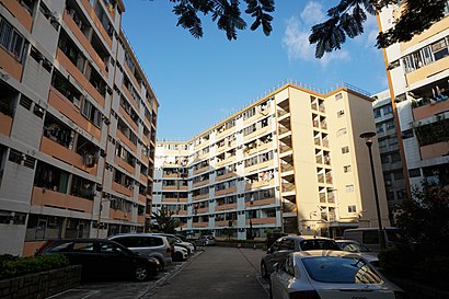
真善美村 Address: 九龙城区, 九龙 street in 九龍 Kowloon City
Traveling around 九龍 Kowloon City has never been so easy. See step by step directions as you travel to any attraction, street or major public transit station. View bus and train schedules, arrival times, service alerts and detailed routes on a map, so you know exactly how to get to anywhere in 九龍 Kowloon City.
When traveling to any destination around 九龍 Kowloon City use Moovit's Live Directions with Get Off Notifications to know exactly where and how far to walk, how long to wait for your line, and how many stops are left. Moovit will alert you when it's time to get off — no need to constantly re-check whether yours is the next stop.
Wondering how to use public transit in 九龍 Kowloon City or how to pay for public transit in 九龍 Kowloon City? Moovit public transit app can help you navigate your way with public transit easily, and at minimum cost. It includes public transit fees, ticket prices, and costs. Looking for a map of 九龍 Kowloon City public transit lines? Moovit public transit app shows all public transit maps in 九龍 Kowloon City with all bus or subway routes and stops on an interactive map.
九龍 Kowloon City has 2 transit type(s), including: bus or subway, operated by several transit agencies, including 港鐵 MTR, 港鐵 MTR, 天星小輪 Star Ferry, 九巴 KMB, 城巴 Citybus, 城巴機場快線 Cityflyer, 龍運巴士 LWB, 九巴 KMB / 城巴 CTB, 龍運巴士 LWB / 城巴 CTB, 新大嶼山巴士 NLB, 愉景灣巴士 DB, 香港電車 Hong Kong Tramways, 港鐵 MTR, 香港中文大學 The Chinese University of Hong Kong and 港島區專線小巴 GMB HK Island