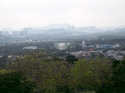
See 石崗機場, 元朗 Yuen Long, on the map
Directions to 石崗機場 (元朗 Yuen Long) with public transportation
The following transit lines have routes that pass near 石崗機場
 Bus:
Bus:
How to get to 石崗機場 by bus?
Click on the bus route to see step by step directions with maps, line arrival times and updated time schedules.
Bus stations near 石崗機場 in 元朗 Yuen Long
- 錦田公路, 石崗軍營 Kam Tin Road, Shek Kong Barracks,12 min walk,
- 七星崗 Tsat Sing Kong,14 min walk,
- 石崗菜站 Vegetable Station,16 min walk,
Bus lines to 石崗機場 in 元朗 Yuen Long
- 608,橫台山村公所, 橫台山遊樂場外 Wang Toi Shan Playground,
- 元朗(裕景坊) - 上水(新運里) [18],Yuen Long (Yu King St) - Sheung Shui (San Wan Lane),
- 54,元朗(西) Yuen Long (West) - 上村(循環線) Sheung Tsuen (Circular),
- 77K,上水 Sheung Shui - 元朗(鳳翔路) Yuen Long (Fung Cheung Road),
- 251B,八鄉路(大欖轉車站) Pat Heung Road (Tai Lam Bus Interchange) - 上村(循環線) Sheung Tsuen (Circular),
- 251M,荃灣站 Tsuen Wan Station,
What are the closest stations to 石崗機場?
The closest stations to 石崗機場 are:
- 錦田公路, 石崗軍營 Kam Tin Road, Shek Kong Barracks is 753 meters away, 12 min walk.
- 七星崗 Tsat Sing Kong is 919 meters away, 14 min walk.
- 石崗菜站 Vegetable Station is 1093 meters away, 16 min walk.
Which bus lines stop near 石崗機場?
These bus lines stop near 石崗機場: 251B, 251M, 54, 608, 77K, 元朗(裕景坊) - 上水(新運里) [18].
What’s the nearest bus stop to 石崗機場 in 元朗 Yuen Long?
The nearest bus stop to 石崗機場 in 元朗 Yuen Long is 錦田公路, 石崗軍營 Kam Tin Road, Shek Kong Barracks. It’s a 12 min walk away.
What time is the first bus to 石崗機場 in 元朗 Yuen Long?
The 元朗(裕景坊) - 上水(新運里) [18] is the first bus that goes to 石崗機場 in 元朗 Yuen Long. It stops nearby at 4:57 AM.
What time is the last bus to 石崗機場 in 元朗 Yuen Long?
The 251B is the last bus that goes to 石崗機場 in 元朗 Yuen Long. It stops nearby at 1:40 AM.
How much is the subway fare to 石崗機場?
The subway fare to 石崗機場 costs about $3.90 - $50.80.
How much is the bus fare to 石崗機場?
The bus fare to 石崗機場 costs about $4.90 - $11.10.
How much is the light rail fare to 石崗機場?
The light rail fare to 石崗機場 costs about $4.60.
See 石崗機場, 元朗 Yuen Long, on the map
Public Transit to 石崗機場 in 元朗 Yuen Long
Wondering how to get to 石崗機場 in 元朗 Yuen Long, Hong Kong? Moovit helps you find the best way to get to 石崗機場 with step-by-step directions from the nearest public transit station.
Moovit provides free maps and live directions to help you navigate through your city. View schedules, routes, timetables, and find out how long does it take to get to 石崗機場 in real time.
Looking for the nearest stop or station to 石崗機場? Check out this list of stops closest to your destination: 錦田公路; 七星崗 Tsat Sing Kong; 石崗菜站 Vegetable Station.
Bus:
Want to see if there’s another route that gets you there at an earlier time? Moovit helps you find alternative routes or times. Get directions from and directions to 石崗機場 easily from the Moovit App or Website.
We make riding to 石崗機場 easy, which is why over 1.5 million users, including users in 元朗 Yuen Long, trust Moovit as the best app for public transit. You don’t need to download an individual bus app or train app, Moovit is your all-in-one transit app that helps you find the best bus time or train time available.
For information on prices of bus, subway and light rail, costs and ride fares to 石崗機場, please check the Moovit app.
Use the app to navigate to popular places including to the airport, hospital, stadium, grocery store, mall, coffee shop, school, college, and university.
石崗機場 Address: 石崗機場 號, 183 Kam Tin Rd, 香港 street in 元朗 Yuen Long
Popular routes to 石崗機場, 元朗 Yuen Long
Attractions near 石崗機場
Sheung Tsuen Lai Ka Tsz,Yau Uk Tsuen,石崗停車側綫及緊急救援站 Shek Kong Stabling Sidings And Emergency Rescue Sidings,水流田村,水流田村公廁 Shui Lau Tin Tsuen Public Toilet,石崗機場路,水流田 Shui Lau Tin,Shek Kong,Shek Kong Airfield (石崗機場),石岗军营,廣輝苑,富豪花園,八鄉古廟公園,梁屋村,梁屋村 Leung Uk Tsuen,橫台山菜園村(南) Wang Toi Shan Tsoi Yuen Tsuen (South),八鄉中心小學,新成集團,森威印刷器材有限公司,蓮花地How to get to popular attractions in 元朗 Yuen Long with public transit
香辣軒, 南區 Southern,New Town Plaza, 沙田 Sha Tin,Classified, 南區 Southern,Chip and Dale Rehearsal Hall,亞洲電視, 大埔 Tai Po,Aji Ichiban 優の良品, 香港島 Islands,Lotus Café 榮昌茶座, 北區 North,Aberdeen 香港仔, 南區 Southern,China Bear 中國熊, 香港島 Islands,花見月,Ifc Mall, 中西區 Central And Western,Eu Yan Sang 余仁生, 沙田 Sha Tin,Kau To Shan 九肚山, 沙田 Sha Tin,Saizeriya 薩莉亞, 黃大仙 Wong Tai Sin,Pacific Coffee 太平洋咖啡, 南區 Southern,銀礦灣泳灘, 香港島 Islands,Maxim's Cakes 美心西餅, 沙田 Sha Tin,好彩海鮮酒家, 油尖旺 Yau Tsim Mong,Isquare, 油尖旺 Yau Tsim Mong,Pacific Coffee 太平洋咖啡, 中西區 Central And WesternGet around 元朗 Yuen Long by public transit!
Traveling around 元朗 Yuen Long has never been so easy. See step by step directions as you travel to any attraction, street or major public transit station. View bus and train schedules, arrival times, service alerts and detailed routes on a map, so you know exactly how to get to anywhere in 元朗 Yuen Long.
When traveling to any destination around 元朗 Yuen Long use Moovit's Live Directions with Get Off Notifications to know exactly where and how far to walk, how long to wait for your line, and how many stops are left. Moovit will alert you when it's time to get off — no need to constantly re-check whether yours is the next stop.
Wondering how to use public transit in 元朗 Yuen Long or how to pay for public transit in 元朗 Yuen Long? Moovit public transit app can help you navigate your way with public transit easily, and at minimum cost. It includes public transit fees, ticket prices, and costs. Looking for a map of 元朗 Yuen Long public transit lines? Moovit public transit app shows all public transit maps in 元朗 Yuen Long with all bus, subway or light rail routes and stops on an interactive map.
元朗 Yuen Long has 3 transit type(s), including: bus, subway or light rail, operated by several transit agencies, including 港鐵 MTR, 港鐵 MTR, 天星小輪 Star Ferry, 九巴 KMB, 城巴 Citybus, 城巴機場快線 Cityflyer, 龍運巴士 LWB, 九巴 KMB / 城巴 CTB, 龍運巴士 LWB / 城巴 CTB, 新大嶼山巴士 NLB, 愉景灣巴士 DB, 香港電車 Hong Kong Tramways, 港鐵 MTR, 香港中文大學 The Chinese University of Hong Kong and 港島區專線小巴 GMB HK Island