See 葵兴站, 葵興 Kwai Tsing, on the map
Directions to 葵兴站 (葵興 Kwai Tsing) with public transportation
The following transit lines have routes that pass near 葵兴站
 Bus:
Bus: - Subway:
How to get to 葵兴站 by bus?
Click on the bus route to see step by step directions with maps, line arrival times and updated time schedules.
How to get to 葵兴站 by subway?
Click on the subway route to see step by step directions with maps, line arrival times and updated time schedules.
Bus stations near 葵兴站 in 葵興 Kwai Tsing
- 葵俊苑 Kwai Chun Court,3 min walk,
- 新葵興花園 Sun Kwai Hing Gardens,3 min walk,
- 葵康苑 Kwai Hong Court,3 min walk,
- 葵盛圍葵康苑 Kwai Hong Court Kwai Shing Circuit,6 min walk,
- 林護紀念中學 Lam Woo Memorial Secondary School,9 min walk,
Subway stations near 葵兴站 in 葵興 Kwai Tsing
- 大窩口 Tai Wo Hau,22 min walk,
- 荔景 Lai King,31 min walk,
Bus lines to 葵兴站 in 葵興 Kwai Tsing
- 上環(修打蘭街) — 荃灣(荃灣街市街),荃灣街市街(不停美孚) Tsuen Wan Market St (Omit Mei Foo),
- 土瓜灣(欣榮花園) — 荃灣(福來邨),荃灣川龍街 Tsuen Wan Chuen Lung Street,
- 灣仔站 — 荃灣(福來邨),荃灣福來邨(經泓景臺,葵涌邨) Tsuen Wan Fuk Loi Est (Via Banyan Garden & Kwai Chung Est),
- 荃灣(荃灣街市街) — 油塘/鯉魚門,油塘及鯉魚門(循環線) Yau Tong & Lei Yue Mun (Circular),
- 西環(水街) > 荃灣(福來邨),荃灣(福來邨) Tsuen Wan (Fuk Loi Estate),
- 觀塘(宜安街) — 荃灣(福來邨) / 荃灣(街市街),荃灣街市 [通宵時段] Tsuen Wan Market [Midnight],
- 觀塘(駿業街) > 荃灣(荃灣街市街),荃灣(荃灣街市街) Tsuen Wan (Tsuen Wan Market St),
- 33A,旺角(柏景灣) Mong Kok (Park Avenue),
- 43,青衣(長康邨) Tsing Yi (Cheung Hong Estate),
- 44M,青衣站 Tsing Yi Station,
- 32H,象山 Cheung Shan,
- 37,奧運站 Olympic Station,
- 37M,葵盛中(循環線) Kwai Shing Central (Circular),
- 38,平田 Ping Tin,
- 38P,葵盛(中) Kwai Shing (Central),
- 40X,葵涌邨 Kwai Chung Estate,
- 47X,葵盛(東) Kwai Shing (East),
- 930,荃灣西站 Tsuen Wan West Station,
- N930,荃灣(愉景新城) Tsuen Wan (Discovery Park),
- 旺角(豉油街) — 荔景/葵盛,旺角(豉油街) Mong Kok (Soy St),
What are the closest stations to 葵兴站?
The closest stations to 葵兴站 are:
- 葵俊苑 Kwai Chun Court is 146 meters away, 3 min walk.
- 新葵興花園 Sun Kwai Hing Gardens is 190 meters away, 3 min walk.
- 葵康苑 Kwai Hong Court is 200 meters away, 3 min walk.
- 葵盛圍葵康苑 Kwai Hong Court Kwai Shing Circuit is 403 meters away, 6 min walk.
- 林護紀念中學 Lam Woo Memorial Secondary School is 639 meters away, 9 min walk.
- 大窩口 Tai Wo Hau is 1634 meters away, 22 min walk.
- 荔景 Lai King is 2365 meters away, 31 min walk.
Which bus lines stop near 葵兴站?
These bus lines stop near 葵兴站: 40X, 930, 土瓜灣(欣榮花園) — 荃灣(福來邨).
Which subway line stops near 葵兴站?
荃灣綫 TSUEN WAN LINE
What’s the nearest subway station to 葵兴站 in 葵興 Kwai Tsing?
The nearest subway station to 葵兴站 in 葵興 Kwai Tsing is 大窩口 Tai Wo Hau. It’s a 22 min walk away.
What’s the nearest bus stop to 葵兴站 in 葵興 Kwai Tsing?
The nearest bus stops to 葵兴站 in 葵興 Kwai Tsing are 葵俊苑 Kwai Chun Court, 新葵興花園 Sun Kwai Hing Gardens and 葵康苑 Kwai Hong Court. The closest one is a 3 min walk away.
What time is the first subway to 葵兴站 in 葵興 Kwai Tsing?
The 東涌綫 TUNG CHUNG LINE is the first subway that goes to 葵兴站 in 葵興 Kwai Tsing. It stops nearby at 6:03 AM.
What time is the last subway to 葵兴站 in 葵興 Kwai Tsing?
The 荃灣綫 TSUEN WAN LINE is the last subway that goes to 葵兴站 in 葵興 Kwai Tsing. It stops nearby at 1:24 AM.
What time is the first bus to 葵兴站 in 葵興 Kwai Tsing?
The N237 is the first bus that goes to 葵兴站 in 葵興 Kwai Tsing. It stops nearby at 3:02 AM.
What time is the last bus to 葵兴站 in 葵興 Kwai Tsing?
The N260 is the last bus that goes to 葵兴站 in 葵興 Kwai Tsing. It stops nearby at 3:47 AM.
How much is the subway fare to 葵兴站?
The subway fare to 葵兴站 costs about $4.40 - $47.10.
How much is the bus fare to 葵兴站?
The bus fare to 葵兴站 costs about $1.30 - $10.90.
See 葵兴站, 葵興 Kwai Tsing, on the map
Public Transit to 葵兴站 in 葵興 Kwai Tsing
Wondering how to get to 葵兴站 in 葵興 Kwai Tsing, Hong Kong? Moovit helps you find the best way to get to 葵兴站 with step-by-step directions from the nearest public transit station.
Moovit provides free maps and live directions to help you navigate through your city. View schedules, routes, timetables, and find out how long does it take to get to 葵兴站 in real time.
Looking for the nearest stop or station to 葵兴站? Check out this list of stops closest to your destination: 葵俊苑 Kwai Chun Court; 新葵興花園 Sun Kwai Hing Gardens; 葵康苑 Kwai Hong Court; 葵盛圍葵康苑 Kwai Hong Court Kwai Shing Circuit; 林護紀念中學 Lam Woo Memorial Secondary School; 大窩口 Tai Wo Hau; 荔景 Lai King.
Bus:Subway:
Want to see if there’s another route that gets you there at an earlier time? Moovit helps you find alternative routes or times. Get directions from and directions to 葵兴站 easily from the Moovit App or Website.
We make riding to 葵兴站 easy, which is why over 1.5 million users, including users in 葵興 Kwai Tsing, trust Moovit as the best app for public transit. You don’t need to download an individual bus app or train app, Moovit is your all-in-one transit app that helps you find the best bus time or train time available.
For information on prices of subway and bus, costs and ride fares to 葵兴站, please check the Moovit app.
Use the app to navigate to popular places including to the airport, hospital, stadium, grocery store, mall, coffee shop, school, college, and university.
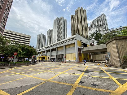
葵兴站 Address: 香港葵涌葵兴站 street in 葵興 Kwai Tsing
Attractions near 葵兴站
茗苑宴會廳,茗苑宴會廳 Ming Yuen Banquet Hall,葵興 Kwai Hing,South Kwai Chung Public Library 南葵涌公共圖書館,新葵兴广场,新葵興廣場 Sun Kwai Hing Plaza,港铁葵兴站,葵興政府合署 Kwai Hing Government Offices,新葵興花園 Sun Kwai Hing Gardens,Wonderful Factory Cafe,扶康會葵興職業發展中心,太陽島英文幼稚園,中國銀行,South Kwai Chung Public Library,Kwai Hing Government Offices,點得喜小廚,學生資助辦事處,新來港人士樂聚軒,家訪調查組,勞工視察科How to get to popular attractions in 葵興 Kwai Tsing with public transit
Elm Tree Towers 愉富大廈, 灣仔 Wan Chai,星光大道, 油尖旺 Yau Tsim Mong,Zaks Restaurant,Man Ho Restaurant 萬豪, 香港島 Islands,巴希雅重慶燒烤, 大埔 Tai Po,Starbucks 星巴克, 南區 Southern,海洋公园, 南區 Southern,麥當勞, 大埔 Tai Po,花見月,Classified, 南區 Southern,Café de Coral 大家樂, 沙田 Sha Tin,德福廣場, 觀塘 Kwun Tong,Maxim's Cakes 美心西餅, 沙田 Sha Tin,摩斯漢堡, 屯門 Tuen Mun,Isquare, 油尖旺 Yau Tsim Mong,Hermès, 香港島 Islands,Aberdeen 香港仔, 南區 Southern,廉政公署總部, 東區 Eastern,龍寶酒家, 深水埗 Sham Shui Po,Sea and Sky Court 海天別墅, 南區 SouthernGet around 葵興 Kwai Tsing by public transit!
Traveling around 葵興 Kwai Tsing has never been so easy. See step by step directions as you travel to any attraction, street or major public transit station. View bus and train schedules, arrival times, service alerts and detailed routes on a map, so you know exactly how to get to anywhere in 葵興 Kwai Tsing.
When traveling to any destination around 葵興 Kwai Tsing use Moovit's Live Directions with Get Off Notifications to know exactly where and how far to walk, how long to wait for your line, and how many stops are left. Moovit will alert you when it's time to get off — no need to constantly re-check whether yours is the next stop.
Wondering how to use public transit in 葵興 Kwai Tsing or how to pay for public transit in 葵興 Kwai Tsing? Moovit public transit app can help you navigate your way with public transit easily, and at minimum cost. It includes public transit fees, ticket prices, and costs. Looking for a map of 葵興 Kwai Tsing public transit lines? Moovit public transit app shows all public transit maps in 葵興 Kwai Tsing with all subway or bus routes and stops on an interactive map.
葵興 Kwai Tsing has 2 transit type(s), including: subway or bus, operated by several transit agencies, including 港鐵 MTR, 港鐵 MTR, 天星小輪 Star Ferry, 九巴 KMB, 城巴 Citybus, 城巴機場快線 Cityflyer, 龍運巴士 LWB, 九巴 KMB / 城巴 CTB, 龍運巴士 LWB / 城巴 CTB, 新大嶼山巴士 NLB, 愉景灣巴士 DB, 香港電車 Hong Kong Tramways, 港鐵 MTR, 香港中文大學 The Chinese University of Hong Kong and 港島區專線小巴 GMB HK Island