Directions to 西九龍薈 (深水埗 Sham Shui Po) with public transportation
The following transit lines have routes that pass near 西九龍薈
How to get to 西九龍薈 by bus?
Click on the bus route to see step by step directions with maps, line arrival times and updated time schedules.
How to get to 西九龍薈 by subway?
Click on the subway route to see step by step directions with maps, line arrival times and updated time schedules.
Bus stops near 西九龍薈 in 深水埗 Sham Shui Po
- 深盛道, 深水埗官立小學對面 Sham Shing Road, Opposite Sham Shui Po Government Primary School, 1 min walk,
- 泓景臺 Banyan Garden, 2 min walk,
- 深盛路, 近泓景臺第五座 Sham Shing Road, Near Banyan Garden Tower 5, 2 min walk,
- 海麗邨公共交通交匯處 Hoi Lai Estate Pti, 4 min walk,
- 海麗邨 Hoi Lai Estate, 4 min walk,
- 海麗邨總站 Hoi Lai Estate Bus Terminus, 4 min walk,
- 長順街 Cheung Shun Street, 4 min walk,
- 長順街遊樂場 Cheung Shun Street Playground, 7 min walk,
- 泓景臺 Banyan Gardens, 7 min walk,
Subway stations near 西九龍薈 in 深水埗 Sham Shui Po
- 荔枝角 Lai Chi Kok, 6 min walk,
- 美孚 Mei Foo, 12 min walk,
- 南昌 Nam Cheong, 13 min walk,
Bus lines to 西九龍薈 in 深水埗 Sham Shui Po
- 44A, 長沙灣廣場 Cheung Sha Wan Plaza - 海麗邨 Hoi Lai Estate,
- 81K, 深水埗海麗邨 Sham Shui Po (Hoi Lai Estate) - 美孚站(循環線) Mei Foo Staion (Circular),
- 702A, 白田 Pak Tin,
- 702S, 長沙灣(深盛路)(循環線) Cheung Sha Wan (Sham Shing Road) (Circular),
- 12, 長沙灣(海麗邨) Cheung Sha Wan (Hoi Lai Estate),
- 12P, 紅磡站 Hung Hom Station,
- 701A, 旺角(循環線) Mong Kok (Circular),
- 702, 又一村(循環線) Yau Yat Tsuen (Circular),
- 702B, 海盈邨(循環線) Hoi Ying Estate (Circular),
- 905P, 灣仔(港灣道) Wan Chai (Harbour Road),
- 44S, 海麗邨 Hoi Lai Estate,
- 44, 東京街, 恒順大廈外 Tonkin Street Outside Hang Shun Building,
- A21, 機場 Airport,
- 701, 旺角(循環線) Mong Kok (Circular),
- 701S, 旺角(循環線) Mong Kok (Circular),
- 914, 海麗邨 Hoi Lai Estate,
- 914P, 銅鑼灣(天后) Causeway Bay (Tin Hau),
- 914X, 銅鑼灣(天后) Causeway Bay (Tin Hau),
- 971, 香港仔(石排灣) Aberdeen (Shek Pai Wan),
- NR104, 天平邨 Tin Ping Estate - 長沙灣 Cheung Sha Wan,
What are the closest stations to 西九龍薈?
The closest stations to 西九龍薈 are:
- 深盛道, 深水埗官立小學對面 Sham Shing Road, Opposite Sham Shui Po Government Primary School is 17 meters away, 1 min walk.
- 泓景臺 Banyan Garden is 76 meters away, 2 min walk.
- 深盛路, 近泓景臺第五座 Sham Shing Road, Near Banyan Garden Tower 5 is 94 meters away, 2 min walk.
- 海麗邨公共交通交匯處 Hoi Lai Estate Pti is 218 meters away, 4 min walk.
- 海麗邨 Hoi Lai Estate is 241 meters away, 4 min walk.
- 海麗邨總站 Hoi Lai Estate Bus Terminus is 255 meters away, 4 min walk.
- 長順街 Cheung Shun Street is 301 meters away, 4 min walk.
- 荔枝角 Lai Chi Kok is 393 meters away, 6 min walk.
- 長順街遊樂場 Cheung Shun Street Playground is 443 meters away, 7 min walk.
- 泓景臺 Banyan Gardens is 461 meters away, 7 min walk.
- 美孚 Mei Foo is 893 meters away, 12 min walk.
- 南昌 Nam Cheong is 952 meters away, 13 min walk.
Which bus lines stop near 西九龍薈?
These bus lines stop near 西九龍薈: 40, 72, 上環(修打蘭街) — 荃灣(荃灣街市街), 土瓜灣(欣榮花園) — 美孚.
Which subway line stops near 西九龍薈?
荃灣綫 TSUEN WAN LINE
What’s the nearest subway station to 西九龍薈 in 深水埗 Sham Shui Po?
The nearest subway station to 西九龍薈 in 深水埗 Sham Shui Po is 荔枝角 Lai Chi Kok. It’s a 6 min walk away.
What’s the nearest bus stop to 西九龍薈 in 深水埗 Sham Shui Po?
The nearest bus stop to 西九龍薈 in 深水埗 Sham Shui Po is 深盛道, 深水埗官立小學對面 Sham Shing Road, Opposite Sham Shui Po Government Primary School. It’s a 1 min walk away.
What time is the first subway to 西九龍薈 in 深水埗 Sham Shui Po?
The 東涌綫 TUNG CHUNG LINE is the first subway that goes to 西九龍薈 in 深水埗 Sham Shui Po. It stops nearby at 6:07 AM.
What time is the last subway to 西九龍薈 in 深水埗 Sham Shui Po?
The 荃灣綫 TSUEN WAN LINE is the last subway that goes to 西九龍薈 in 深水埗 Sham Shui Po. It stops nearby at 1:14 AM.
What time is the first bus to 西九龍薈 in 深水埗 Sham Shui Po?
The 12 is the first bus that goes to 西九龍薈 in 深水埗 Sham Shui Po. It stops nearby at 5:40 AM.
What time is the last bus to 西九龍薈 in 深水埗 Sham Shui Po?
The 701S is the last bus that goes to 西九龍薈 in 深水埗 Sham Shui Po. It stops nearby at 2:43 AM.
See 西九龍薈, 深水埗 Sham Shui Po, on the map
Public Transit to 西九龍薈 in 深水埗 Sham Shui Po
Wondering how to get to 西九龍薈 in 深水埗 Sham Shui Po, Hong Kong? Moovit helps you find the best way to get to 西九龍薈 with step-by-step directions from the nearest public transit station.
Moovit provides free maps and live directions to help you navigate through your city. View schedules, routes, timetables, and find out how long does it take to get to 西九龍薈 in real time.
Looking for the nearest stop or station to 西九龍薈? Check out this list of stops closest to your destination: 深盛道; 泓景臺 Banyan Garden; 深盛路; 海麗邨公共交通交匯處 Hoi Lai Estate Pti; 海麗邨 Hoi Lai Estate; 海麗邨總站 Hoi Lai Estate Bus Terminus; 長順街 Cheung Shun Street; 荔枝角 Lai Chi Kok; 長順街遊樂場 Cheung Shun Street Playground; 泓景臺 Banyan Gardens; 美孚 Mei Foo; 南昌 Nam Cheong.
Bus: 40, 72, 上環(修打蘭街) — 荃灣(荃灣街市街), 土瓜灣(欣榮花園) — 美孚, 44A, 81K, 702A, 702S, 12, 12P, 701A, 702, 702B.Subway: 荃灣綫 TSUEN WAN LINE, 屯馬綫 TUEN MA LINE, 東涌綫 TUNG CHUNG LINE.
Want to see if there’s another route that gets you there at an earlier time? Moovit helps you find alternative routes or times. Get directions from and directions to 西九龍薈 easily from the Moovit App or Website.
We make riding to 西九龍薈 easy, which is why over 1.5 million users, including users in 深水埗 Sham Shui Po, trust Moovit as the best app for public transit. You don’t need to download an individual bus app or train app, Moovit is your all-in-one transit app that helps you find the best bus time or train time available.
For information on prices of subway and bus, costs and ride fares to 西九龍薈, please check the Moovit app.
Use the app to navigate to popular places including to the airport, hospital, stadium, grocery store, mall, coffee shop, school, college, and university.
西九龍薈 Address: 荔枝角道 深水埗区, 九龙 street in 深水埗 Sham Shui Po
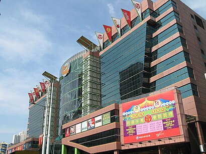
Dragon Centre is a nine-storey shopping centre in the Sham Shui Po area of Kowloon, Hong Kong. It was the largest in West Kowloon until the Elements opened above the Kowloon MTR station.Wiki
Attractions near 西九龍薈
How to get to popular places in Hong Kong with public transit
Get around Hong Kong by public transit!
Traveling around Hong Kong has never been so easy. See step by step directions as you travel to any attraction, street or major public transit station. View bus and train schedules, arrival times, service alerts and detailed routes on a map, so you know exactly how to get to anywhere in Hong Kong.
When traveling to any destination around Hong Kong use Moovit's Live Directions with Get Off Notifications to know exactly where and how far to walk, how long to wait for your line, and how many stops are left. Moovit will alert you when it's time to get off — no need to constantly re-check whether yours is the next stop.
Wondering how to use public transit in Hong Kong or how to pay for public transit in Hong Kong? Moovit public transit app can help you navigate your way with public transit easily, and at minimum cost. It includes public transit fees, ticket prices, and costs. Looking for a map of Hong Kong public transit lines? Moovit public transit app shows all public transit maps in Hong Kong with all Bus, Subway, Light Rail, Ferry, Cable Car and Funicular routes and stops on an interactive map.
Hong Kong has 6 transit type(s), including: Bus, Subway, Light Rail, Ferry, Cable Car and Funicular, operated by several transit agencies, including 港鐵 MTR, 天星小輪 Star Ferry, 九巴 KMB, 城巴 Citybus, 城巴機場快線 Cityflyer, 龍運巴士 LWB, 九巴 KMB / 城巴 CTB, 龍運巴士 LWB / 城巴 CTB, 新大嶼山巴士 NLB, 愉景灣巴士 DB, 香港電車 Hong Kong Tramways, 香港中文大學 The Chinese University of Hong Kong, 港島區專線小巴 GMB HK Island, 九龍區專線小巴 GMB Kowloon, 新界區專線小巴 GMB New Territories