Directions to Burlington Canal Lift Bridge with public transportation
The following transit lines have routes that pass near Burlington Canal Lift Bridge
How to get to Burlington Canal Lift Bridge by bus?
Click on the bus route to see step by step directions with maps, line arrival times and updated time schedules.
Bus stops near Burlington Canal Lift Bridge
- Eastport at Lakeshore, 6 min walk,
Bus lines to Burlington Canal Lift Bridge
- 11, Burlington Terminal,
What are the closest stations to Burlington Canal Lift Bridge?
The closest stations to Burlington Canal Lift Bridge are:
- Eastport at Lakeshore is 461 meters away, 6 min walk.
Which bus line stops near Burlington Canal Lift Bridge?
11
What’s the nearest bus stop to Burlington Canal Lift Bridge?
The nearest bus stop to Burlington Canal Lift Bridge is Eastport at Lakeshore. It’s a 6 min walk away.
What time is the first bus to Burlington Canal Lift Bridge?
The 11 is the first bus that goes to Burlington Canal Lift Bridge. It stops nearby at 5:47 AM.
What time is the last bus to Burlington Canal Lift Bridge?
The 11 is the last bus that goes to Burlington Canal Lift Bridge. It stops nearby at 1:20 AM.
How much is the bus fare to Burlington Canal Lift Bridge?
The bus fare to Burlington Canal Lift Bridge costs about $2.50.
How much is the train fare to Burlington Canal Lift Bridge?
The train fare to Burlington Canal Lift Bridge costs about $3.70 - $11.46.
See Burlington Canal Lift Bridge on the map
Public Transportation to Burlington Canal Lift Bridge
Wondering how to get to Burlington Canal Lift Bridge, Canada? Moovit helps you find the best way to get to Burlington Canal Lift Bridge with step-by-step directions from the nearest public transit station.
Moovit provides free maps and live directions to help you navigate through your city. View schedules, routes, timetables, and find out how long does it take to get to Burlington Canal Lift Bridge in real time.
Looking for the nearest stop or station to Burlington Canal Lift Bridge? Check out this list of stops closest to your destination: Eastport at Lakeshore.
Bus: 11.
Want to see if there’s another route that gets you there at an earlier time? Moovit helps you find alternative routes or times. Get directions from and directions to Burlington Canal Lift Bridge easily from the Moovit App or Website.
We make riding to Burlington Canal Lift Bridge easy, which is why over 1.5 million users, including users in Burlington, trust Moovit as the best app for public transit. You don’t need to download an individual bus app or train app, Moovit is your all-in-one transit app that helps you find the best bus time or train time available.
For information on prices of bus and train, costs and ride fares to Burlington Canal Lift Bridge, please check the Moovit app.
Use the app to navigate to popular places including to the airport, hospital, stadium, grocery store, mall, coffee shop, school, college, and university.
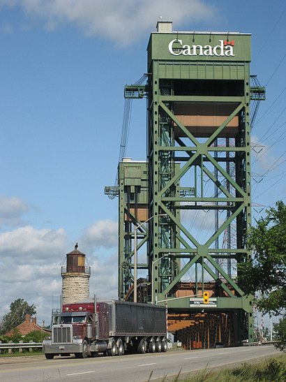
Burlington Canal Lift Bridge Address: Beach Front street in Burlington
Attractions near Burlington Canal Lift Bridge
Burlington Bay James N. Allan Skyway,Canada Centre For Inland Waters,Canada Centre for Inland Waters,Eastport Dr,867 Lakeshore Road,Jimmy Lomax Park,Burlington Beach,Burlingtongreen Environmental Association,Dunky's Beach Shack,Exit 97 / North Shore Boulevard / N,Ch2m Hill Canada Ltd,Hamilton Beach,Bby Express Zoom 867,Exit 93/Eastport Drive/N,Scott W A & Son Sheet Metal,Burlington 2020 Lakeshore,ChargePoint,Lakeview Executive Rentals,Halton Mississauga Base Hospital Program,Covid-19 Testing SiteHow to get to popular attractions in Burlington with public transit
Casa Loma, Toronto,1929 Bayview Avenue, Toronto,TTC 192 Airport Rocket, Toronto,The Marilyn Denis Show, Toronto,790 Bay St - Suite 940, Toronto,Georgian Downs, Innisfil,20 Dundas Street West, Toronto,Woodbridge, Ontario, Vaughan,Bloor and Yonge, Toronto,Hwy 401 at Avenue Road, Toronto,21 Iceboat Ter, Toronto,Ontario Place, Toronto,Scarborough Town Centre, Toronto,Jane Street, Toronto,Seneca College King Campus, King,IKEA, Toronto,Sunnybrook Health Sciences Centre, Toronto,George Brown St. James Campus, Toronto,Baycrest Hospital, Toronto,Square One Shopping Centre, MississaugaGet around Toronto by public transit!
Traveling around Toronto has never been so easy. See step by step directions as you travel to any attraction, street or major public transit station. View bus and train schedules, arrival times, service alerts and detailed routes on a map, so you know exactly how to get to anywhere in Toronto.
When traveling to any destination around Toronto use Moovit's Live Directions with Get Off Notifications to know exactly where and how far to walk, how long to wait for your line, and how many stops are left. Moovit will alert you when it's time to get off — no need to constantly re-check whether yours is the next stop.
Wondering how to use public transit in Toronto or how to pay for public transit in Toronto? Moovit public transit app can help you navigate your way with public transit easily, and at minimum cost. It includes public transit fees, ticket prices, and costs. Looking for a map of Toronto public transit lines? Moovit public transit app shows all public transit maps in Toronto with all Bus, Train, Subway, Streetcar and Ferry routes and stops on an interactive map.
Toronto has 5 transit type(s), including: Bus, Train, Subway, Streetcar and Ferry, operated by several transit agencies, including TTC, TTC Streetcar, Toronto Subway, Brampton Transit, MiWay, York Region Transit, GO Transit Bus, GO Transit, Durham Region Transit, UP Express, Grand River Transit, Guelph Transit, grt, Hamilton Street Railway, Burlington Transit