Gresham City Hall station - Saturday schedule
| Line | Direction | Time |
|---|---|---|
| BLUE | Cleveland Ave Max Station (West) | 5:26 AM |
| BLUE | Hatfield Government Center Max Station (South) | 5:39 AM |
| BLUE | Cleveland Ave Max Station (West) | 5:58 AM |
| BLUE | Hatfield Government Center Max Station (South) | 6:10 AM |
| BLUE | Cleveland Ave Max Station (West) | 6:28 AM |
| BLUE | Hatfield Government Center Max Station (South) | 6:40 AM |
| BLUE | Cleveland Ave Max Station (West) | 6:51 AM |
| BLUE | Cleveland Ave Max Station (West) | 6:55 AM |
| BLUE | Hatfield Government Center Max Station (South) | 7:09 AM |
| BLUE | Cleveland Ave Max Station (West) | 7:25 AM |
| BLUE | Hatfield Government Center Max Station (South) | 7:40 AM |
| BLUE | Cleveland Ave Max Station (West) | 7:55 AM |
| BLUE | Hatfield Government Center Max Station (South) | 8:10 AM |
| BLUE | Cleveland Ave Max Station (West) | 8:23 AM |
| BLUE | Hatfield Government Center Max Station (South) | 8:25 AM |
| BLUE | Cleveland Ave Max Station (West) | 8:26 AM |
| BLUE | Hatfield Government Center Max Station (South) | 8:40 AM |
| BLUE | Cleveland Ave Max Station (West) | 8:51 AM |
| BLUE | Cleveland Ave Max Station (West) | 8:55 AM |
| BLUE | Hatfield Government Center Max Station (South) | 8:55 AM |
| BLUE | Hatfield Government Center Max Station (South) | 9:10 AM |
| BLUE | Cleveland Ave Max Station (West) | 9:17 AM |
| BLUE | Cleveland Ave Max Station (West) | 9:23 AM |
| BLUE | Hatfield Government Center Max Station (South) | 9:25 AM |
| BLUE | Hatfield Government Center Max Station (South) | 9:40 AM |
Directions to Gresham City Hall with public transportation
The following transit lines have routes that pass near Gresham City Hall
How to get to Gresham City Hall by bus?
Click on the bus route to see step by step directions with maps, line arrival times and updated time schedules.
Bus stops near Gresham City Hall
- NW Division & Miller (West), 2 min walk,
- NW Division & Victoria (East), 3 min walk,
- NW Division & Eastman Pkwy (East), 4 min walk,
Light Rail stations near Gresham City Hall
- Rockwood/E 188th Ave, 12 min walk,
Bus lines to Gresham City Hall
- 21, Gresham Central Transit Center (East),
- 82, SE 1st & 3rd (South),
- BLUE, SW 18th & Goose Hollow Max Station (East),
- FX2, Cleveland Ave Park & Ride (East),
What are the closest stations to Gresham City Hall?
The closest stations to Gresham City Hall are:
- NW Division & Miller (West) is 116 yards away, 2 min walk.
- NW Division & Victoria (East) is 209 yards away, 3 min walk.
- NW Division & Eastman Pkwy (East) is 262 yards away, 4 min walk.
- Rockwood/E 188th Ave is 950 yards away, 12 min walk.
Which bus lines stop near Gresham City Hall?
These bus lines stop near Gresham City Hall: 21, 9, FX2.
Which light rail line stops near Gresham City Hall?
BLUE
What’s the nearest light rail station to Gresham City Hall?
The nearest light rail station to Gresham City Hall is Rockwood/E 188th Ave. It’s a 12 min walk away.
What’s the nearest bus stop to Gresham City Hall?
The nearest bus stop to Gresham City Hall is NW Division & Miller (West). It’s a 2 min walk away.
What time is the first light rail to Gresham City Hall?
The BLUE is the first light rail that goes to Gresham City Hall. It stops nearby at 3:01 AM.
What time is the last light rail to Gresham City Hall?
The BLUE is the last light rail that goes to Gresham City Hall. It stops nearby at 3:01 AM.
What time is the first bus to Gresham City Hall?
The FX2 is the first bus that goes to Gresham City Hall. It stops nearby at 4:08 AM.
What time is the last bus to Gresham City Hall?
The BLUE is the last bus that goes to Gresham City Hall. It stops nearby at 2:48 AM.
See Gresham City Hall on the map
Public transit to Gresham City Hall station
Looking for directions to Gresham City Hall in Gresham, United States?
Download the Moovit App to find the current schedule and step-by-step directions for Light Rail or Bus routes that pass through Gresham City Hall.
Looking for the nearest stops closest to Gresham City Hall ? Check out this list of closest stops to your destination: NW Division & Miller (West); NW Division & Victoria (East); NW Division & Eastman Pkwy (East); Rockwood/E 188th Ave.
Bus: 21, 9, FX2, 82, BLUE.Light Rail: BLUE.
We make riding on public transit to Gresham City Hall easy, which is why over 1.5 million users, including users in Gresham trust Moovit as the best app for public transit.
Use the app to navigate to popular places including to the airport, hospital, stadium, grocery store, mall, coffee shop, school, college, and university.
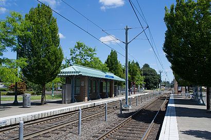
The station has the following entrances: NW Eastman Pkwy, Parking Lot, NW Eastman Pkwy and Grasham City Hall
The first line to this station is BLUE, at 5:26 AM, and the last line is BLUE at 12:11 AM.
Gresham City Hall, Gresham, OR, USA
This station serves TriMet’s lines
Popular routes from Gresham City Hall
Bus stops near Gresham City Hall
NW Division & Miller (West),NW Division & Victoria (East),NW Division & Eastman Pkwy (East)Light Rail station near Gresham City Hall
Rockwood/E 188th AvePopular public transit stations in Gresham
SE Hawthorne & 19th (West),SE 82nd & Hawthorne (South),Hwy 213 & S Barnards Rd,Koa / Fort Stevens,SE 82nd & Sunnyside Rd,NE Dekum & 33rd (East),SW Lombard & Allen (North),NE Broadway & Ross (Streetcar) (West),SE 82nd & Woodstock (South),NW 185th & Sunset Square (South),NE 24th & Fremont (North),NE Sandy & 52nd (West),SE Division & 174th Ave (West),NE Sandy & 148th (East),N Albina & Lombard St (North),Hillsboro Health District Max Station,W Powell & SW Birdsdale (East),SE Flavel & 52nd (West),9200 Block SE Foster (West),NE 102nd & Pacific (South)Get around Portland, OR by public transit!
Traveling around Portland, OR has never been so easy. See step by step directions as you travel to any attraction, street or major public transit station. View bus and train schedules, arrival times, service alerts and detailed routes on a map, so you know exactly how to get to anywhere in Portland, OR.
When traveling to any destination around Portland, OR use Moovit's Live Directions with Get Off Notifications to know exactly where and how far to walk, how long to wait for your line, and how many stops are left. Moovit will alert you when it's time to get off — no need to constantly re-check whether yours is the next stop.
Wondering how to use public transit in Portland, OR or how to pay for public transit in Portland, OR? Moovit public transit app can help you navigate your way with public transit easily, and at minimum cost. It includes public transit fees, ticket prices, and costs. Looking for a map of Portland, OR public transit lines? Moovit public transit app shows all public transit maps in Portland, OR with all Bus, Train, Light Rail, Ferry, Streetcar and Gondola routes and stops on an interactive map.
Portland, OR has 6 transit type(s), including: Bus, Train, Light Rail, Ferry, Streetcar and Gondola, operated by several transit agencies, including Mount Adams Transportation Service, RiverCities Transit, TriMet , TriMet , TriMet, Portland Streetcar, Portland Aerial Tram, C-TRAN, Multnomah County Job Connector Shuttles, Washington Park Shuttle, SMART, Canby Area Transit, South Clackamas Transportation District, The Wave, Lincoln County Transit