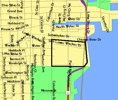
See Lakeshore East, Chicago, on the map
Directions to Lakeshore East (Chicago) with public transportation
The following transit lines have routes that pass near Lakeshore East
Bus:
Train:
Chicago 'L':
How to get to Lakeshore East by Bus?
Click on the Bus route to see step by step directions with maps, line arrival times and updated time schedules.
How to get to Lakeshore East by Train?
Click on the Train route to see step by step directions with maps, line arrival times and updated time schedules.
How to get to Lakeshore East by Chicago 'L'?
Click on the Chicago 'L' route to see step by step directions with maps, line arrival times and updated time schedules.
Bus stations near Lakeshore East in Chicago
- Harbor Drive & Randolph (North),1 min walk,
Bus lines to Lakeshore East in Chicago
- 60,54th/Cermak Pink Line Station (West),
What are the closest stations to Lakeshore East?
The closest stations to Lakeshore East are:
- Harbor Drive & Randolph (North) is 45 yards away, 1 min walk.
Which Bus lines stop near Lakeshore East?
These Bus lines stop near Lakeshore East: 60
Which Train lines stop near Lakeshore East?
These Train lines stop near Lakeshore East: METRA ELECTRIC DISTRICT, MILWAUKEE DISTRICT NORTH, UNION PACIFIC NORTH
Which Chicago 'L' lines stop near Lakeshore East?
These Chicago 'L' lines stop near Lakeshore East: BROWN LINE, GREEN LINE, ORANGE LINE, RED LINE
What’s the nearest bus stop to Lakeshore East in Chicago?
The nearest bus stop to Lakeshore East in Chicago is Harbor Drive & Randolph (North). It’s a 1 min walk away.
See Lakeshore East, Chicago, on the map

Public Transit to Lakeshore East in Chicago
Wondering how to get to Lakeshore East in Chicago, United States? Moovit helps you find the best way to get to Lakeshore East with step-by-step directions from the nearest public transit station.
Moovit provides free maps and live directions to help you navigate through your city. View schedules, routes, timetables, and find out how long does it take to get to Lakeshore East in real time.
Looking for the nearest stop or station to Lakeshore East? Check out this list of stops closest to your destination: Harbor Drive & Randolph (North).
Bus:Train:Chicago 'L':
Want to see if there’s another route that gets you there at an earlier time? Moovit helps you find alternative routes or times. Get directions from and directions to Lakeshore East easily from the Moovit App or Website.
We make riding to Lakeshore East easy, which is why over 1.5 million users, including users in Chicago, trust Moovit as the best app for public transit. You don’t need to download an individual bus app or train app, Moovit is your all-in-one transit app that helps you find the best bus time or train time available.
For information on prices of Bus, Chicago 'L' and Train, costs and ride fares to Lakeshore East, please check the Moovit app.
Use the app to navigate to popular places including to the airport, hospital, stadium, grocery store, mall, coffee shop, school, college, and university.
Location: Chicago

Attractions near Lakeshore East
- ChiBourne
- Steve's Segway Tours
- 175 N Harbor Dr
- Urban Real Estate
- Harbor Tower Valet Shop
- Walter D Miller CSW
- SP+ Parking @ North Harbor Tower Parking Garage
- N Harbor Service Level
- Outer Drive East Laundry
- Monroe Harbor
- Harbor Point Condominium
- NHT Gym
- North Harbor Tower Fitness Center
- Manilow Suites
- North Harbor Towers Pool table
- Sparkspace Chicago
- North Harbor Tower
- Outer Drive East
- The Dock at Montrose Beach
- Seven Bar and Restaurant
How to get to popular attractions in Chicago with public transit
- CTA - Garfield (Green), Chicago
- Holiday Inn Express & Suites Chicago O'Hare, Rosemont
- I-88 @ Rt 59 Interchange, Naperville
- Chipotle Mexican Grill, Chicago
- Chicago Ridge Mall, Chicago Ridge
- Six Flags Employee Parking Lot, Gurnee
- I-88 @ Winfield Rd
- 10 S Lasalle, Chicago
- Al Bawadi Grill, Bridgeview
- 200 W Adams, Chicago
- Barack Obama House, Chicago
- River Grove, River Grove
- Dark Matter Coffee, Chicago
- Metra - Kenosha
- Metra - 59th St (University of Chicago), Chicago
- Metra - 55th / 56th / 57th St, Chicago
- XSport Fitness, Schaumburg
- Metra - Tinley Park / 80th Ave, Tinley Park
- North Riverside Park Mall, North Riverside
- 360 Chicago, Chicago